GRAVÜR DÜNYASI
Digital Engraving Library
| Artist | Robert Sears (1810-1892) |
| Engraver | Robert Sears (1810-1892) |
| Date | 1835 |
| Technique | Copper Engraving |
| Category | Maps |
| Source | Published By T.Ward & Co.27 Paternoster Row January 1 1835 |
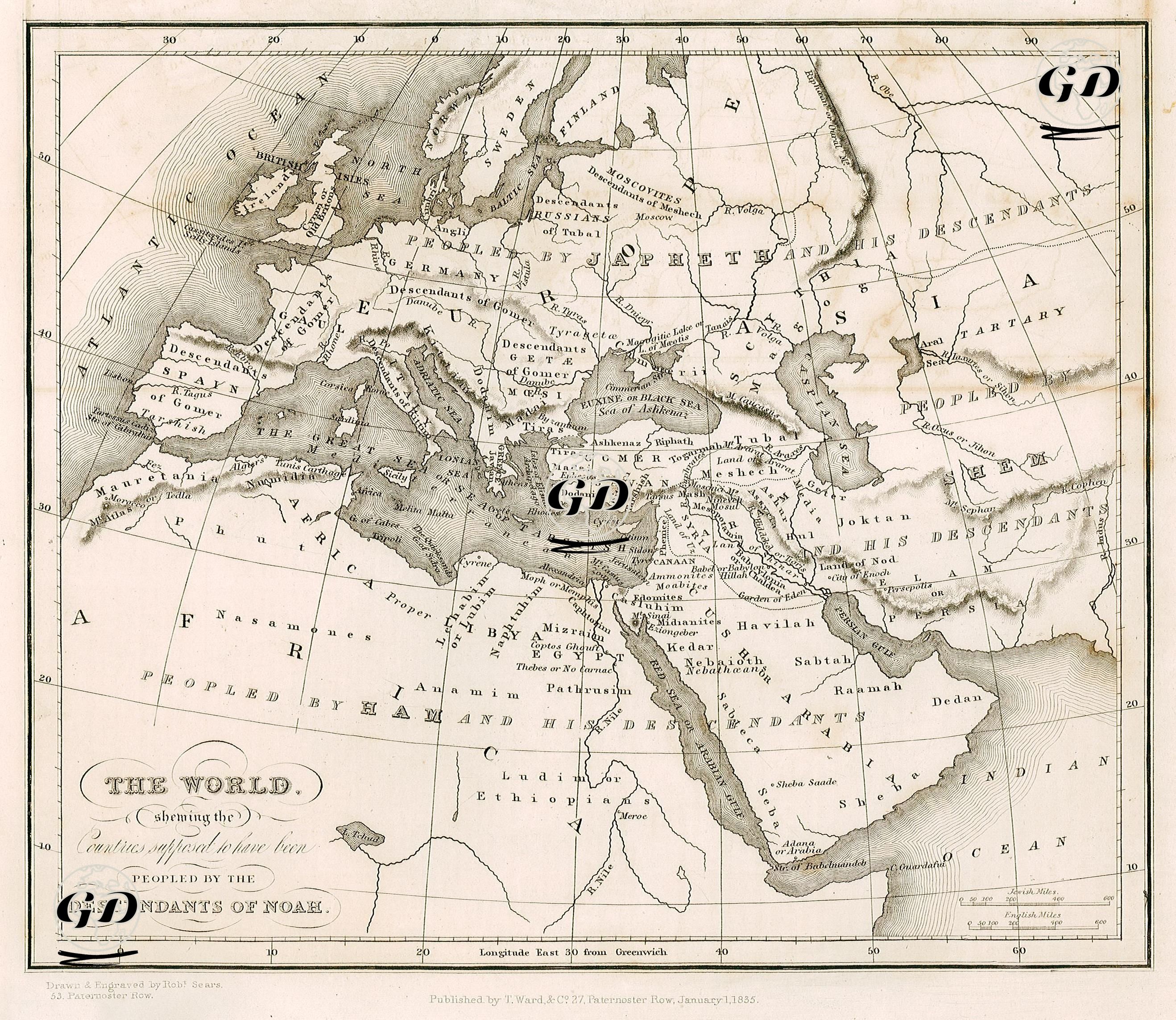
This map, titled “Map of the World Showing Countries Settled by the Descendants of Noah” and dated 1835, depicts how humanity spread after the Flood according to Biblical sources and the religious-cosmological understanding dominant in the West in the 18th and 19th centuries. The map shows how the peoples descended from Noah’s three sons, Japheth (Japheth), Shem (Shem) and Ham, spread throughout the world. Accordingly: The descendants of Japheth (Japheth’s children Tiras, Tubal, Javan, Madai, Magog, Gomer) spread to northern and western Europe, the Caucasus and Central Asia. This group also includes the Scythians, Galatians, Medes and Greeks. The descendants of Shem (Aram, Lud, Arpachshad, Ashur (Astur)) inhabited Mesopotamia, the Arabian Peninsula and the Levant region; that is, it is located in the geography where Semitic tribes such as Hebrews, Arameans and Elamites are represented. The descendants of Ham (Canaan, Fut (Phut), Mizraim, Kush (Cush)) were settled in the southern regions of North Africa, Egypt and Arabia. Place names such as Misraim in Egypt, Phut in Libya and Cush in Ethiopia are linked to this lineage. This map is not only physical but also an ethnographic mapping based on a sacred genealogy. The map includes the four sacred rivers Euphrates, Tigris, Pison and Aras (Gihon) and place names from the Old Testament such as “Havila”, “Sheba” and “Sabtah” on the shores of the Gulf of Aden. There are also references to mythological-religious regions such as “Land of Nod” and “Garden of Eden”, which also makes the map a document of theological geography. Rather than modern cartographic accuracy, this map aims to spatialize the narrative of faith and to concretely place the family lines mentioned in religious texts on the world map.