GRAVÜR DÜNYASI
Digital Engraving Library
| Engraver | J. & C.Walker (Active 1820-1895) |
| Date | 1840's |
| Technique | Steel Engraving-Original Hand Colored |
| Category | Maps |
| Source | London, Edward Stanford 6 Charing Cross |
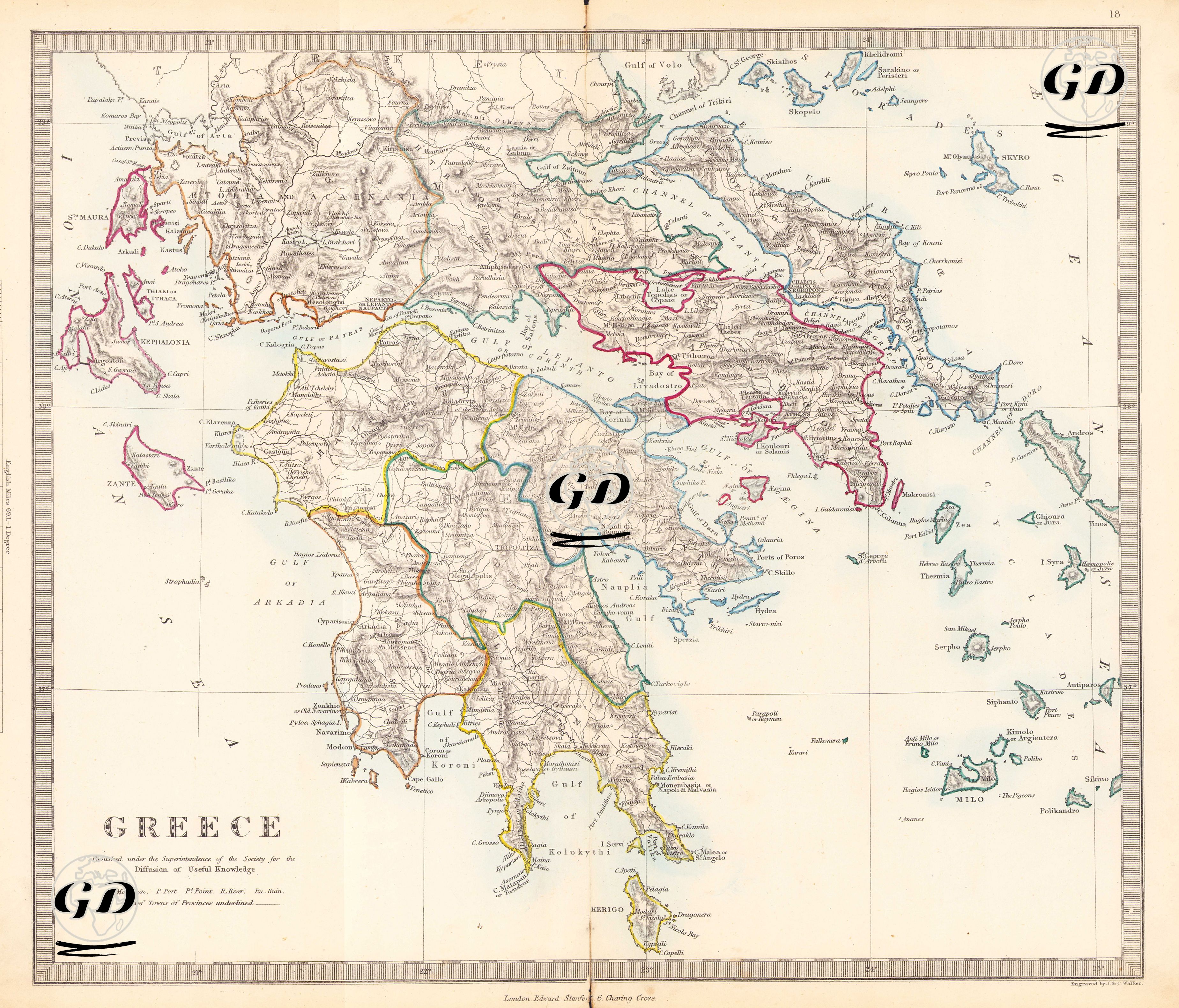
This map is an original hand-colored engraving detailing the historical regions and natural geography of the newly independent kingdom of Greece in the 19th century. The map presents a multilayered structure that overlaps both the regions of ancient Greece and the administrative divisions of the newly established Kingdom of Greece. The Peloponnese, Central Greece, Attica, and the islands are clearly distinguishable, and the regions are delineated by colored borders. The title in the lower left corner of the map states that the map is published by the Society for the Diffusion of Useful Knowledge (SDUK). SDUK was founded in 1826 by the English Lord Henry Peter Brougham. Based in London, the society played a significant role in the history of 19th-century education, publishing inexpensive yet high-quality scientific maps for a rapidly expanding readership. The map's upper section encompasses the northern border points of the Gulf of Volo (today's Gulf of Volos) and Lamia. To the south, it encompasses Cape Matapan (Cape Tenaro), to the west, the Ionian islands of Cephalonia and Zante (Zakynthos), and to the east, the Aegean Sea and the Cyclades archipelago. Classical ancient regions such as Attica, Boeotia, Argolis, Arcadia, Laconia, and Messenia are detailed within their modern borders. Colored lines are used to delineate the boundaries of these regions, representing administrative or historical divisions. Cities that left their mark on ancient Greek history, such as Delphi, Thebes, Corinth, Athens, Sparta, Mycenae, Marathon, and Thermopylae, are meticulously depicted on the map. Mountains, rivers, gulfs, port cities, and ancient roads are depicted, along with detailed coastlines and island groups. This map is also significant for its initial borders, shaped by Greece's independence and separation from the Ottoman Empire. Such maps, printed in Western Europe after the 1830s, both document the founding of the modern Greek state and cartographically reflect Western interest in classical antiquity.