GRAVÜR DÜNYASI
Digital Engraving Library
| Engraver | William Johnston (1802-1888)- Alexander Keith Johnston (1804-1871) |
| Date | 1848 |
| Technique | Steel Engraving |
| Category | Maps |
| Source | Atlas Alison's History Of Europe By Alexander Keith Johnston (William Blackwood & Sons, Edinburgh & London) |
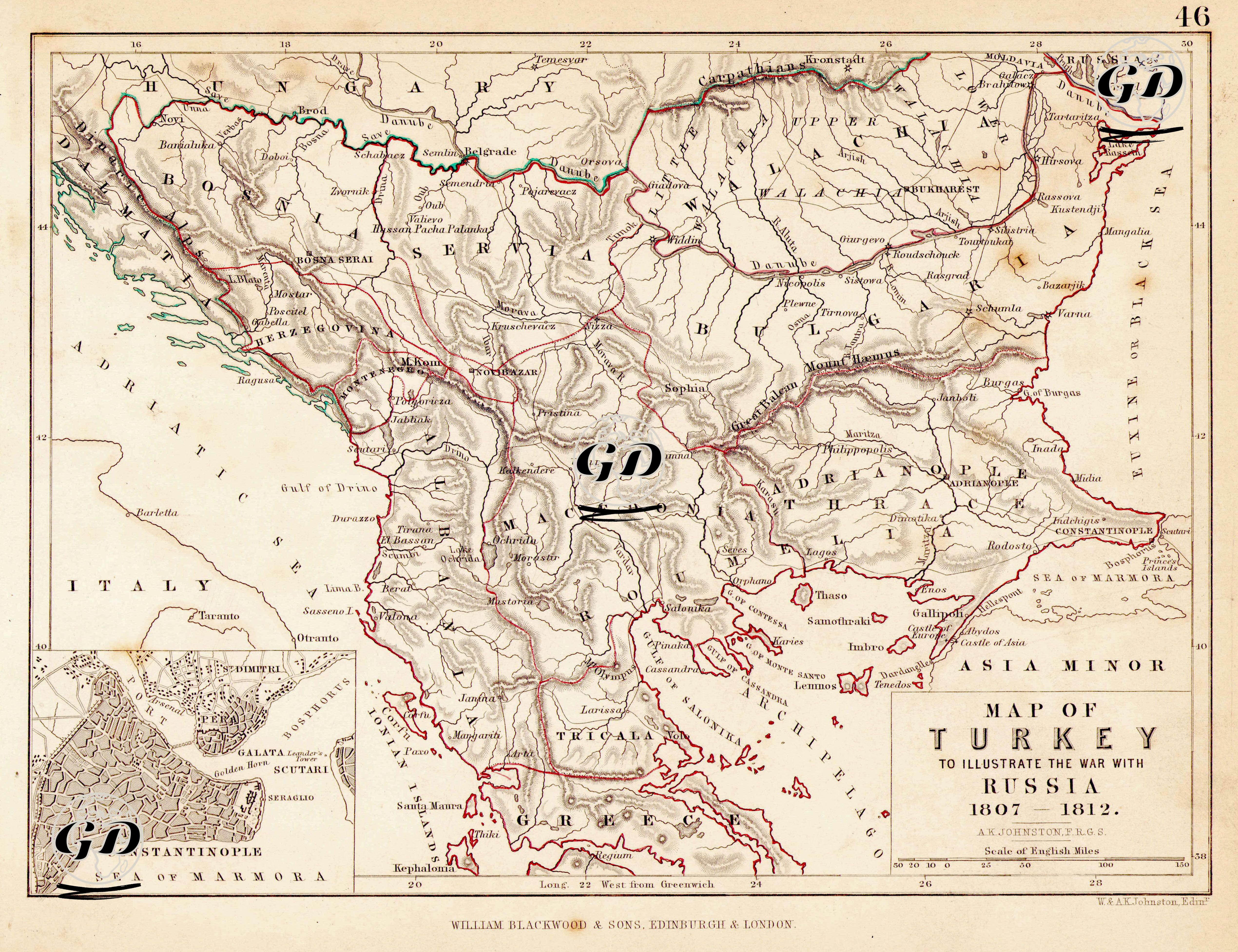
This historical map depicting the 1807–1812 Ottoman-Russian War shows in detail the Ottoman Empire’s battle lines in a vast geography extending from the Balkans to Thrace, from the Black Sea coast to Western Anatolia. In order to highlight the main fronts of the war, the map highlights the fortified cities of Braila, Silistre, Varna, Shumla and Rusçuk along the Danube River, while in Serbia it presents in detail the lines of Semendria, Belgrade and Niš; these areas were of critical importance to both the Ottoman forces and the Serbian rebels led by Kara George. The regions of Wallachia and Moldavia were invaded by the Russians in the early stages of the war, and became the focal point of the Russians’ expansionist goals in the Balkans. At the same time, the detailed plan of Istanbul in the lower left corner of the map points to the strategic importance of the capital with areas such as Galata, Pera, the Golden Horn and Sarayburnu. The map shows the lines along which the Ottoman navy operated, stretching from port cities such as Ragusa (Dubrovnik) on the Adriatic coast to islands such as Lemnos, Tenedos and Lesbos in the Aegean Sea. These islands were also key positions for naval supremacy, open to Russian raids. The thick red border lines on the map highlight Ottoman territory; some borders and mountain passes marked by green lines indicate strategic points of war. With the Treaty of Bucharest of 1812, signed at the end of the Russo-Turkish War, the Ottomans were forced to cede Bessarabia to Russia, but in return made some concessions promising autonomy to Serbia.