GRAVÜR DÜNYASI
Digital Engraving Library
| Date | 1885 |
| Technique | Woodblock Engraving (Newspaper-Text on Reverse) |
| Category | Maps |
| Source | The Graphic (September 26 1885) |
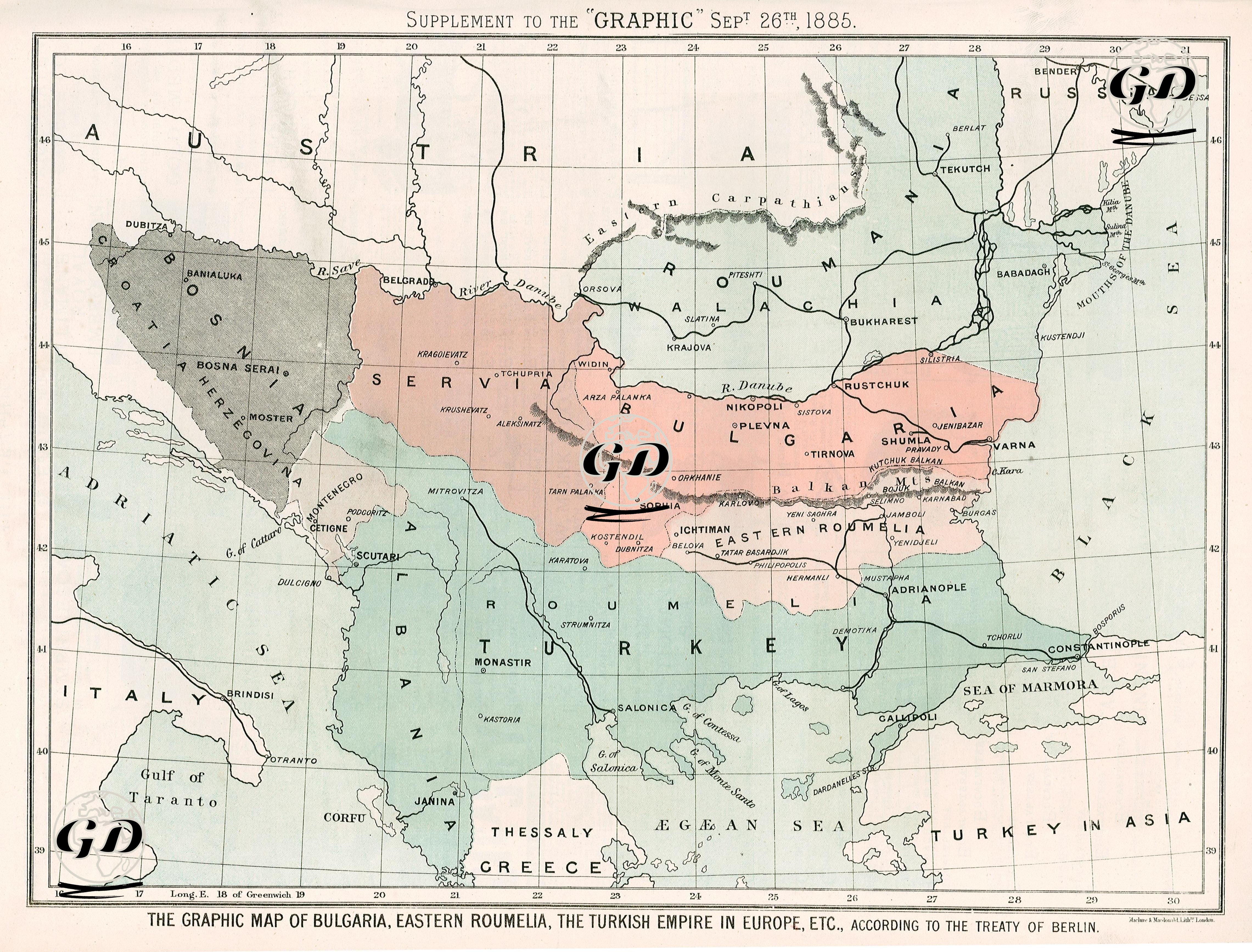
This colored map and the article about it, published in the supplement of The Graphic newspaper on September 6, 1885, examine the de facto unification of Bulgaria and Eastern Rumelia, the fact that this unification was contrary to the Berlin Treaty of July 13, 1878, and evaluate its diplomatic and political repercussions in Europe. The map is explanatory of the new order that emerged after the Berlin Treaty and reflects an important development of the period: the unification of Bulgaria and Eastern Rumelia. This map shows the Principality of Bulgaria (in pink), Eastern Rumelia (dark cream), Serbia (light brown), Montenegro, Bosnia-Herzegovina (grey), Romania and the European lands of the Ottoman Empire (green). According to the Berlin Treaty, Bulgaria became an autonomous principality under the Ottoman Empire, while Eastern Rumelia remained under the Ottoman Empire but was an autonomous province governed by a Christian governor. However, in September 1885, Prince Alexander I of Bulgaria, with the support of the people, seized Eastern Rumelia through a kind of coup and established a unified administration centered in Sofia. The map also visually marks this unification and draws attention to the Ottoman Empire's loss of political ground, prestige and territory in Europe. The newspaper stated that despite the newly united Bulgaria having a population of approximately 5 million and an army of 30,000, the Ottoman Empire did not directly intervene militarily despite this sudden unification, and that the incident was accepted as a de facto reality without creating a situation that would disrupt the status quo. However, the article draws attention to the fact that this situation could lead to similar demands on other peoples in the Balkans. In conclusion, when the news is read together with the map, it is stated that this major change, which occurred only 7 years after the 1878 Berlin Treaty, weakened the Ottoman sovereignty in the Balkans and suggested that a new Balkan crisis could be on the way. The map presented by The Graphic visually fixed this new de facto situation, providing both a warning and an opportunity for analysis to the Western public.