GRAVÜR DÜNYASI
Digital Engraving Library
| Date | 1878 |
| Technique | Lithography-Colored |
| Category | Maps |
| Source | The Collegiate Atlas - William Collins Sons & Co. Limited, Glasgow & London |
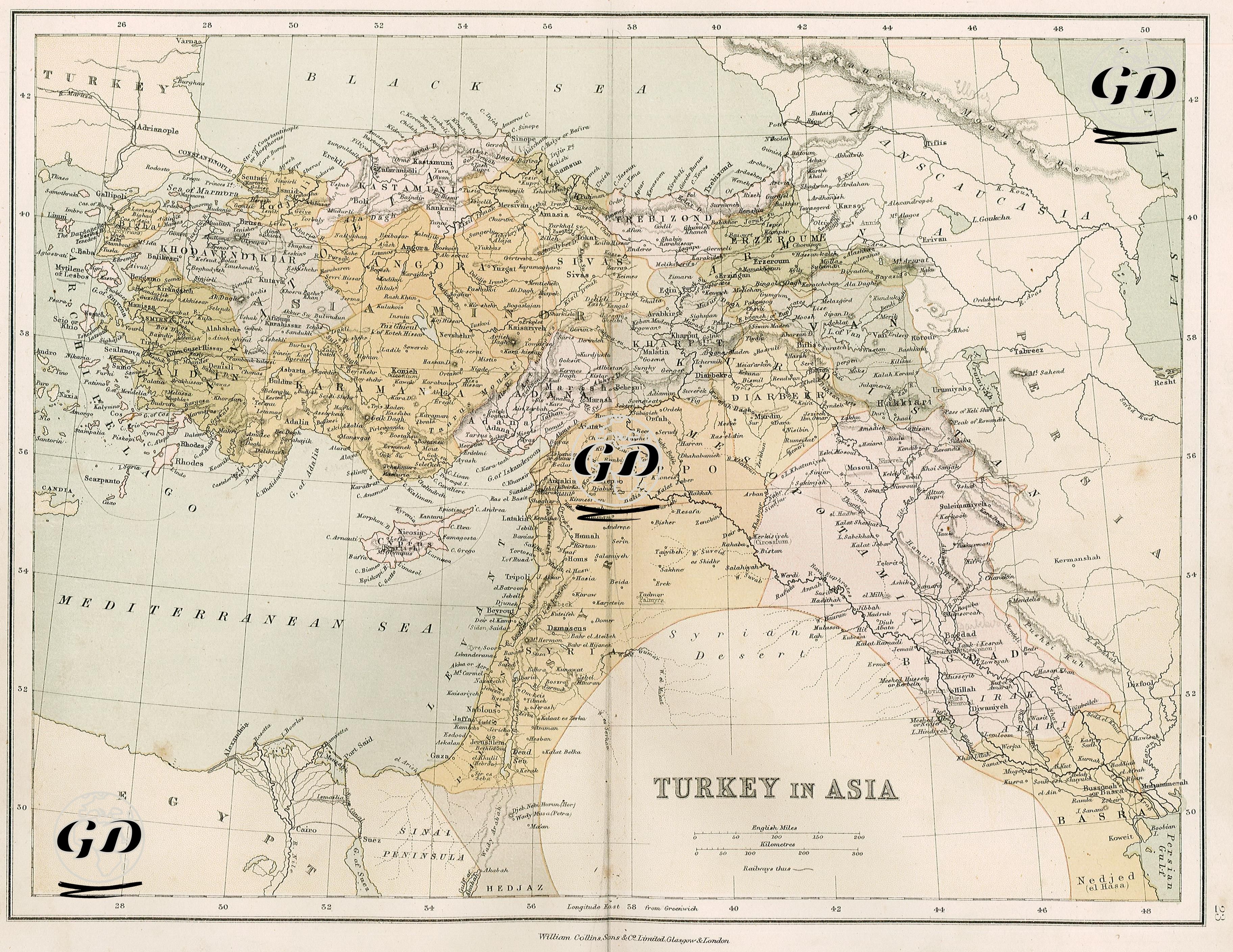
his map, dated from the second half of the 19th century and titled "Turkey in Asia," is a detailed, colorized political and physical map encompassing the Ottoman Empire's Asian territories. The map covers a vast area extending from the Ottoman-administered regions of Anatolia (Asia Minor), Mesopotamia (Iraq), and the Levant (Syria and Lebanon) to the Hejaz and Persian Gulf. Cartographically, both political boundaries and natural geographic elements—mountain ranges, rivers, valleys, and coastlines—are meticulously rendered. Colored areas are used to demarcate provinces or administrative regions; for example, the provinces of Erzurum, Diyarbakır, Baghdad, Aleppo, Syria, Adana, Konya, and Hejaz are shaded in distinctive hues. The center of the map shows the Taurus Mountains and the Eastern Anatolian mountain ranges, and the area where the Tigris and Euphrates Rivers converge and flow into the Persian Gulf is detailed. In Anatolia, central cities such as Izmir, Bursa, Ankara, Sivas, Kayseri, and Adana were shown, while in Mesopotamia, both political and religious centers such as Baghdad, Mosul, Kirkuk, Basra, and Najaf were emphasized. This 1878 map documents the external boundaries of the Ottoman administrative system, which was reshaped after the Treaty of Berlin (1878). The points where the Ottoman-Russian, Ottoman-Iranian, and Ottoman-British borders were drawn on the map, in particular, enable historical readings of the formation of the modern Middle Eastern borders. The map's preparation also reveals how Western powers perceived the Ottoman landscape: the Asian part of the Ottoman Empire was conceptualized as "Turkey in Asia," a definition that implied both a geographical and political exteriority.