GRAVÜR DÜNYASI
Digital Engraving Library
| Artist | John James Dower (1825-1901) |
| Date | 1853 |
| Technique | Woodblock Engraving (Newspaper-Text on Reverse) |
| Category | Maps |
| Source | The İllustrated London News (October 08 1853-Page 310) |
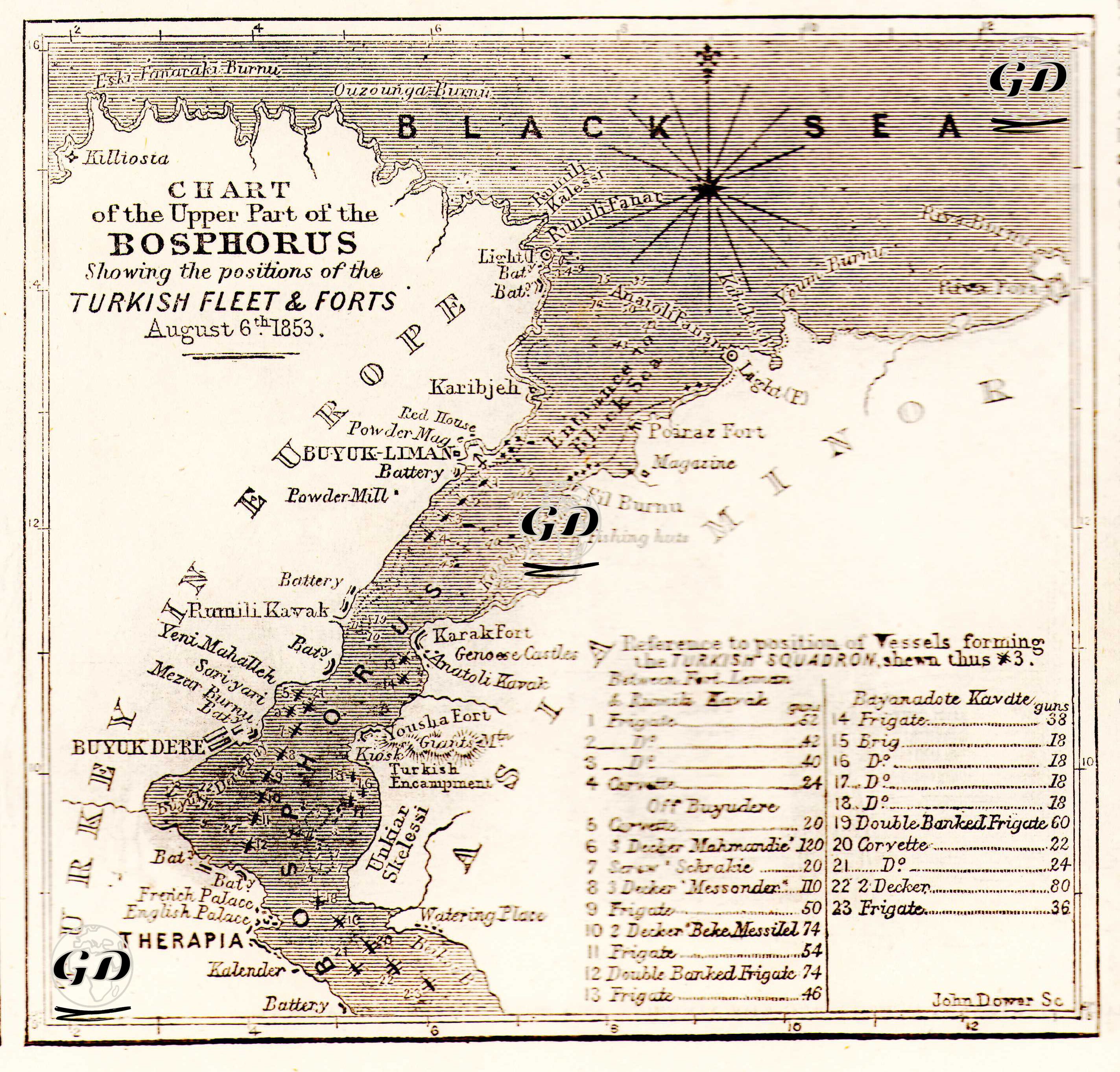
The map and accompanying news item titled “Map of the Northern Side of the Bosphorus with the Turkish Fleet and Forts in the Bosphorus on 6 August 1853” published in The Illustrated London News on 8 October 1853 is a strategic publication that aims to convey to the British public, visually and in writing, the military and geopolitical situation of the Straits region just before the Ottoman-Russian War (Crimean War). The map is based on observations dated 6 August 1853 and shows in detail the locations of 23 warships belonging to the Ottoman Navy (the ships are numbered one by one and the type of ship and the number of guns are given: Frigate, Corvette, Double Banked Frigate, etc.) and the forts and batteries lined up along the coast, positioned in the northern part of the Bosphorus Strait (from Rumelikavağı to the entrance to the Black Sea). While there are batteries and fortifications in strategic locations such as Rumelikavağı, Büyükdere, Kireçburnu, and Kalender on the European side, defensive points such as Poyraz Castle, Fil Burnu, and Anadolu Kavağı stand out on the Anatolian side. The map also draws attention to the diplomatic presence in the region by marking the British and French summer palaces in Tarabya. The newspaper text emphasizes that the map is based on the observations of a British naval officer, and praises the Ottoman navy's defensive capability on the Bosphorus, its force structure and its fortification network; the public is given the message that the Ottoman Empire has the ability to protect the Black Sea. The map is not only a document for military purposes, but is also part of an effort to create public opinion that the Ottomans should be supported as an ally within the framework of the Straits issue.