GRAVÜR DÜNYASI
Digital Engraving Library
| Artist | Ernst George Ravenstein (1834-1913) |
| Engraver | Ernst George Ravenstein (1834-1913) |
| Date | 1877 |
| Technique | Woodblock Engraving (Newspaper-Text on Reverse) |
| Category | Maps |
| Source | The İllustrated London News (August 04 1877-Page 117) |
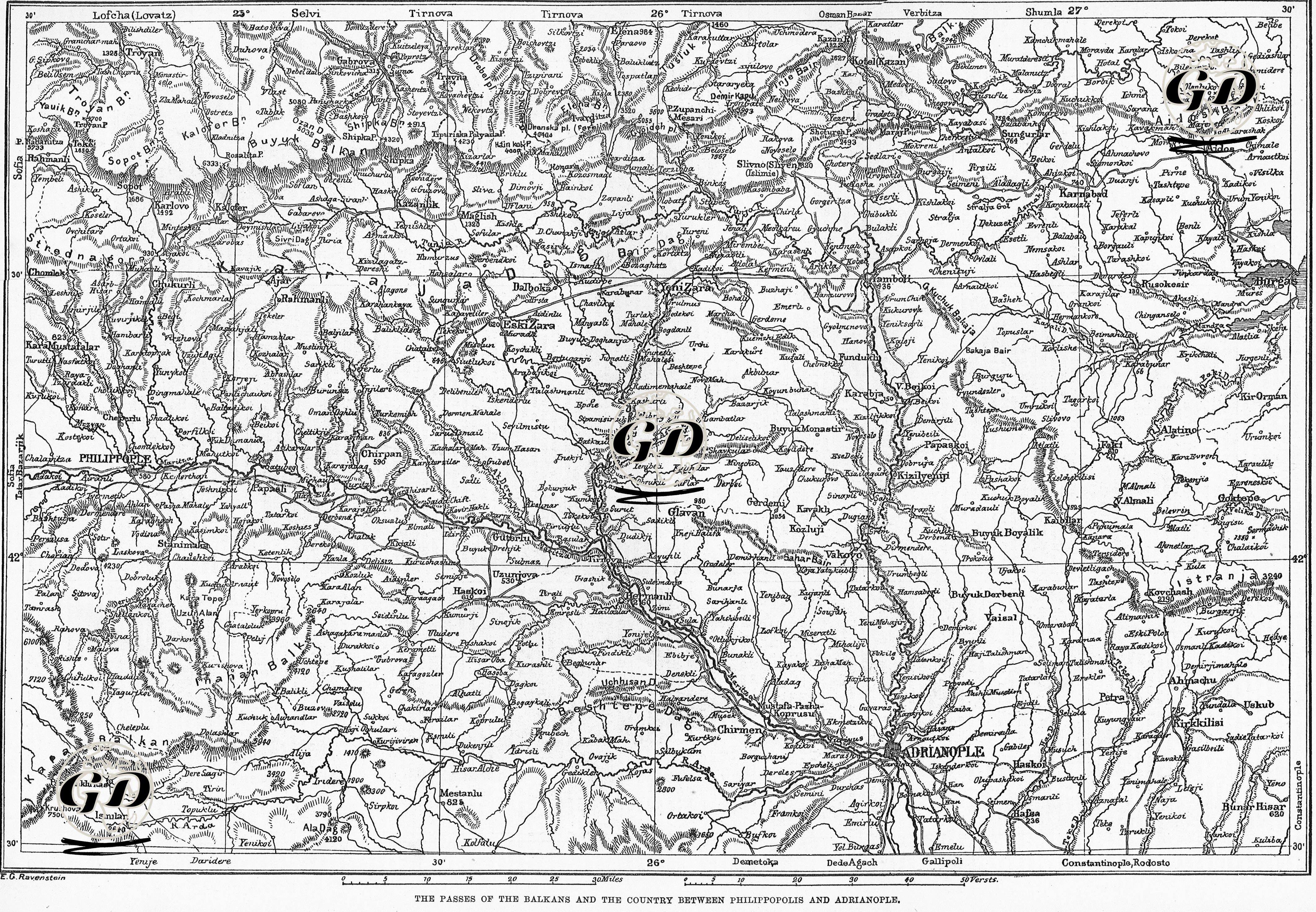
This map and the related newspaper text were published in The Illustrated London News on 4 August 1877 and contain a detailed analysis of the strategic importance of the passes in the Balkans during the 1877-1878 Ottoman-Russian War. The map shows the geography between Philippopolis (Plovdiv) and Adrianople (Edirne) and especially the passes over the Balkan Mountains. The newspaper text presents observations on the geographical structure of these passes between Plovdiv and Edirne, their military usability and the settlement areas where various ethnic communities live. Some of the Balkan passes that are given information about are as follows: Tirnova Pass (5738 ft-connects the Upper Vid River Valley to the Gipsou Valley via Rahmanli), Troyan Pass (4704 ft-reaches from Troyan to Teke, probably only suitable for use as a mule track), Rosalia Pass (6333 ft-one of the highest and most difficult passes), Shipka Pass (the most strategic pass under Russian control and opening to the Kazanlak Valley), Tchurapsla-Payana Pass and Kaluf Deresi Pass. The map was prepared by Ernst George Ravenstein (1834-1913), one of the famous cartographers of the period, and the cartographer's notes on how to pronounce the place names in the region were given in the news text, and a system compatible with the English pronunciation form was suggested. This was a very informative approach for British readers of the period. As a result, both the map and the news text provide invaluable information not only about the course of the war but also about the ethnic makeup, geographical obstacles, strategic routes and military logistics within Ottoman territory.