GRAVÜR DÜNYASI
Digital Engraving Library
| Artist | Alexander Keith Johnston (1804-1871) |
| Engraver | William Johnston (1802-1888)- Alexander Keith Johnston (1804-1871) |
| Date | 1850's |
| Technique | Copper Engraving |
| Category | Maps |
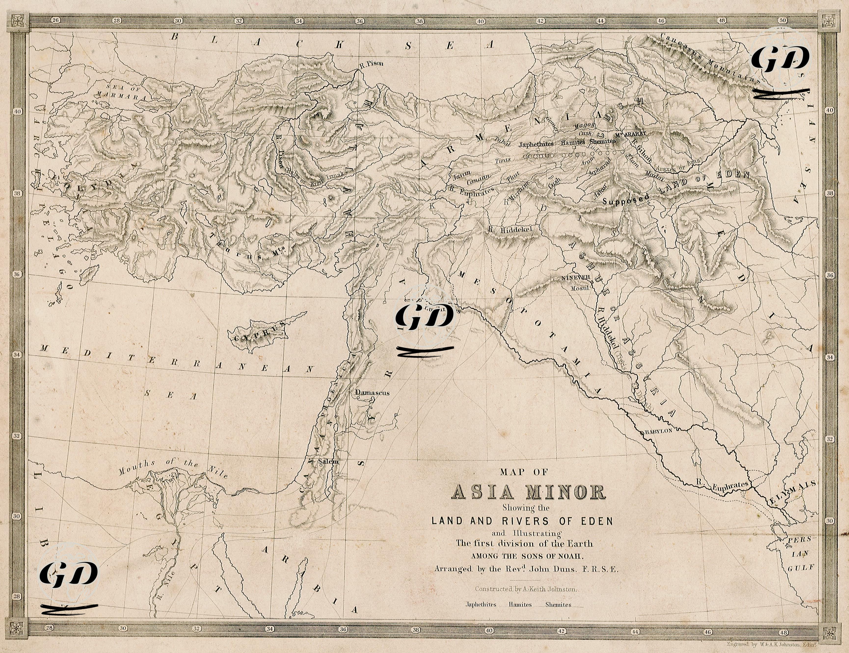
This map, unlike classical geographical and political maps, is a theological depiction shaped around the narrative of the “Garden of Eden” (God’s Garden - the garden of paradise where Adam and Eve lived) in the holy books. At the same time, the map symbolically shows the distribution of the Shemites, Hamites and Japhethites, who were the descendants of Noah’s sons Shem, Ham and Japheth, throughout the world and attempts to model the locations of the four sacred rivers (Euphrates, Tigris, Pison, Gihon) geographically. The map was prepared in line with the understanding of “Biblical Geography”, which was widespread in the West, especially in the 19th century. There are generally two assumptions about the location of the Garden of Eden; either in the region close to where the Euphrates and Tigris Rivers originate in eastern Türkiye or in the region close to the Persian Gulf in southern Iraq, where the Euphrates and Tigris meet. This map was prepared assuming that the Garden of Eden was located in eastern Türkiye and this location is shown on the map as “Supposed LAND OF EDEN”. The symbolic distribution routes and regions for the Semites, Hamites and Japhethites, who are descendants of Noah’s sons, are roughly indicated on the map. On the map, the distribution of the children of Japheth (Japhethians) Tiras, Tubal, Javan, Madai, Magog, and Gomer to Anatolia, Europe, and the northern regions; the children of Ham (Hamis) Canaan, Fut (Phut), Mizraim, and Cush to North Africa and around Egypt; and the children of Shem (Semites) Aram, Lud, Arpachshad, Ashur (Astur), Elam, Mesopotamia, and the Levant (Eastern Mediterranean) regions are shown with red lines. In addition, the Euphrates, Tigris, Pison, and Aras (Gihon) rivers are marked as four sacred rivers on the map. This map aims not only to provide geographical information, but also to spatialize a belief narrative and to place the genealogical branches mentioned in religious texts concretely on the world map.