GRAVÜR DÜNYASI
Digital Engraving Library
| Artist | Thomas Bowen (….-1790) |
| Date | 1780 |
| Technique | Copper Engraving |
| Category | Maps |
| Source | A New And Authentic History of England By William Augustus Russel (Engraved For Russel's History Of England) |
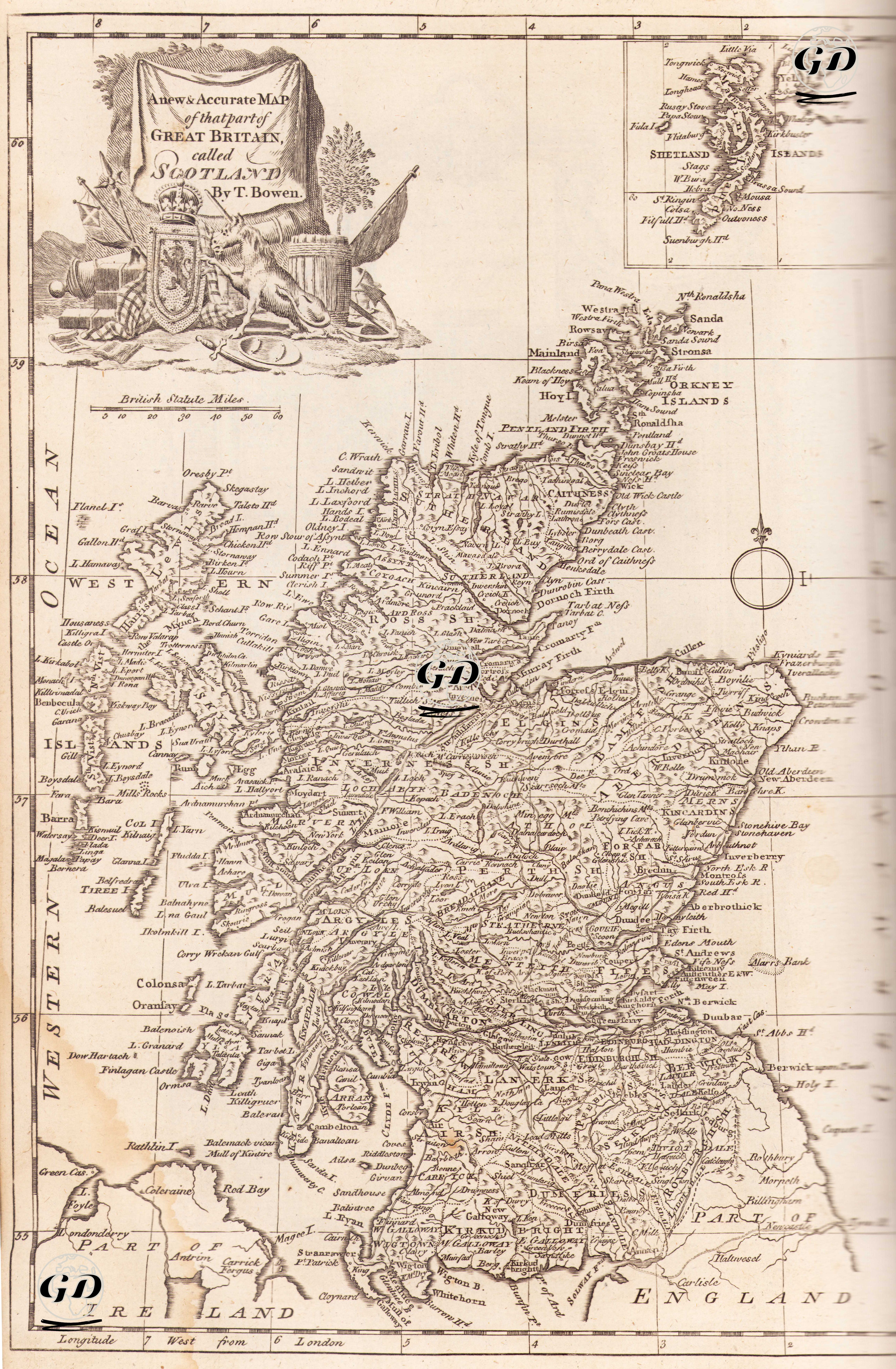
This 1780 map, prepared by English cartographer Thomas Bowen, provides a detailed depiction of the geographic, settlement, and political structure of Scotland, the northern region of Great Britain. The title reads "A New & Accurate Map of that part of GREAT BRITAIN called SCOTLAND. By T. Bowen," emphasizing the map's both innovative and accurate character. Following the Act of Union of 1707, Scotland was united with England to form Great Britain. However, this map depicts Scotland in its entirety, richly illustrated with place names, regions, and rivers. The armorial symbols in the upper left corner—the Union coat of arms, the Scottish one-horned lion, flags, a cannon, and an olive branch—indicate that this map should be read not only geographically but also as a political symbol. Separate insets are provided at the top of the map for the Orkney Islands and the Shetland Islands, located to the northeast. Similarly, "Part of Ireland" appears in the southwest of the map. The map reveals Scotland's complex physical structure in detail. The fjords on the west coast, numerous small islands (the Hebrides / Western Isles), mountain ranges, and river systems are meticulously drawn. The placement of place names directly reflects the topographic density. While the east coast is more regular and sparsely indented, the west coast has a much more complex geography. The settlements and cities on the map (Edinburgh, Glasgow, Aberdeen, Dundee, Stirling, etc.) reflect the settlement density and transportation routes of the period. Natural features (such as Loch Ness and the Firth of Forth) are also rendered with cartographic precision. The geographic coordinate system is based on the London Meridian (Longitude West from London), not Greenwich. The scale used is "British Statute Miles," and this measurement system is clearly indicated at the top of the map.