GRAVÜR DÜNYASI
Digital Engraving Library
| Artist | Alexandre Vuillemin (1812-1880) |
| Date | 1866 |
| Technique | Steel Engraving |
| Category | Maps |
| Source | Atlas Universel D'Histoire et de Geographie (Atlas of Universal History and Geography) - Librairie-Hachette Et Cie A Paris. Imp. E.Dufrenay |
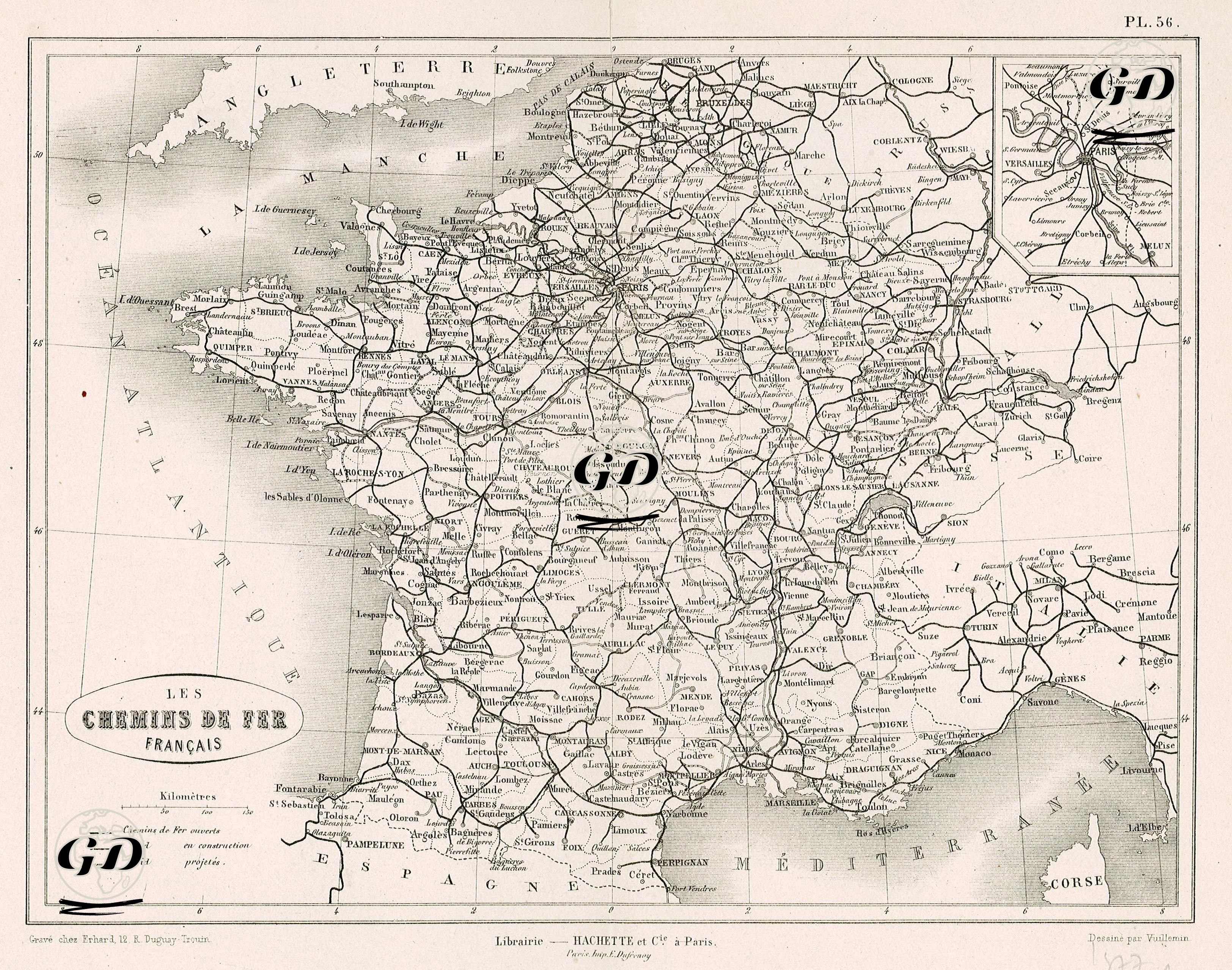
This map dated 1866 shows France's railway network in detail in the second half of the 19th century. The legend in the lower left corner of the map indicates the status of the railway lines using three different line formats: solid lines represent existing lines (Chemins de Fer ouverts), dashed lines represent lines under construction (en construction), and dotted lines represent projects still in the planning phase (projetés). This classification documents the railway planning and development of the period, providing a crucial document not only for transportation but also for economic development and geographical integration. The map shows in detail the railway lines extending throughout all regions of France, with the center being Paris. It also provides a striking visual representation of the country's transportation backbone, with ports connecting to England in the north and lines reaching the Mediterranean and the Spanish border in the south. While France had a railway network exceeding 3,000 km in the 1850s, this figure reached 17,000 km in 1870, and these railway lines were built by the French government in cooperation with private companies with a planned and national strategy.