GRAVÜR DÜNYASI
Digital Engraving Library
| Date | 1870 |
| Technique | Steel Engraving |
| Category | Maps |
| Source | The Self-Interpreting Family Bible, Brown, Rev. John. |
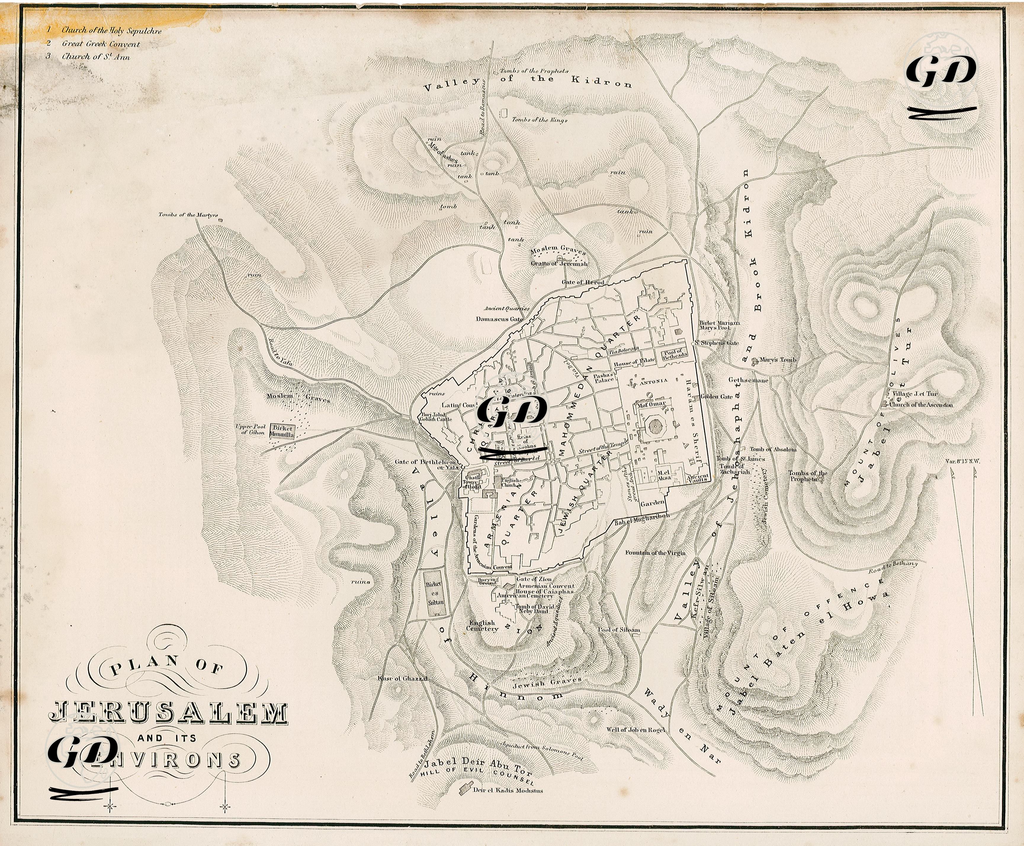
This map, dated 1870, is a detailed plan produced for the understanding of the sacred texts through geographical reality and is titled “Plan of Jerusalem and Its Environs”. While the map depicts the Old City center and its surroundings topographically, it also carefully marks the places that have been the subject of religious narratives. Hills, valleys and elevations are shown with the Hachure technique; a spatial connection is established between the physical structure of Jerusalem and the areas attributed with holiness. The city is surrounded by the Mount of Olives to the east, the Kidron Valley to the north, the Hinnom Valley to the west and the Silvan region to the south. In the center of the map, the Church of the Holy Sepulchre, where it is believed that Jesus was crucified and buried, is in a central position for Christianity as well as for the historical context of the map. In addition, multi-layered sacred sites such as the Dome of the Rock, the Al-Aqsa Mosque, the Pool of Bethesda and Siloam (where Jesus performed his miracles), the Garden of Gethsemane (where Jesus prayed before his crucifixion), the Tomb of Absalom, the Tomb of Zechariah and the Tombs of the Kings are marked as places where Christian, Jewish and Muslim narratives intertwine. The map is designed to include the classical neighborhood structure that divides Jerusalem into four main regions: the Christian Quarter is located in the northwest and is centered around the Holy Sepulchre; the Muslim Quarter is adjacent to the Temple Mount to the northeast and is the largest neighborhood; the Armenian Quarter spreads around the Mount of Zion to the southwest; and the Jewish Quarter covers the western slopes of the Temple Mount, where the Western Wall is located, to the southeast. This four-neighborhood system was institutionalized during the Ottoman period and represented a sustainable urban order in terms of both administrative and religious affiliations. The map can be considered not only as a topographic plan, but also as a theological memory space where the sacred narratives of the three heavenly religions are processed layer by layer. This spatial structure, which is largely valid even today, continues to carry both religious and political meanings.