GRAVÜR DÜNYASI
Digital Engraving Library
| Date | 1836 |
| Technique | Steel Engraving |
| Category | Maps |
| Source | London, Samuel Holdsworth Amen Corner Paternoster Row 1836 |
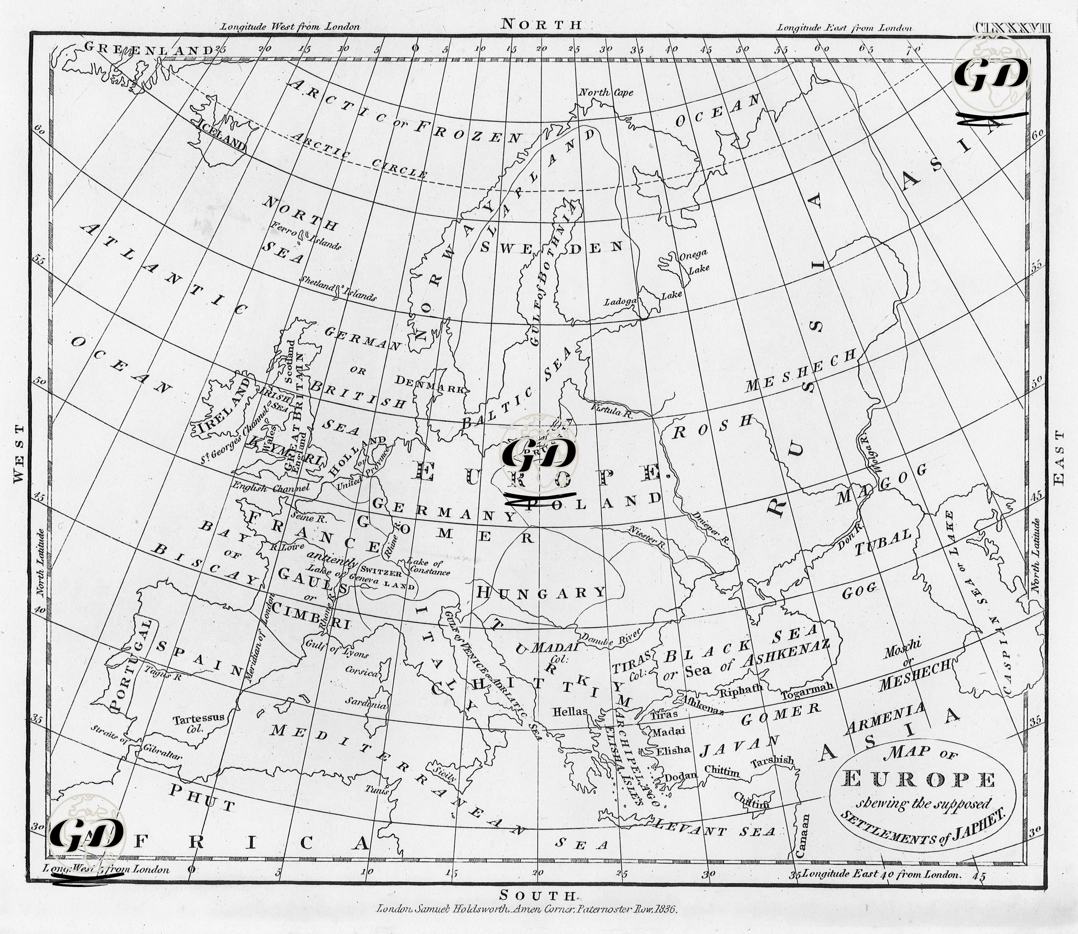
The 1836 map titled “Map of Europe Showing the Settlements of Peoples Assumed to Be Descendants of Japheth” is an example of a theological-ethnographic cartographic study that aims to show the settlements of peoples assumed to be descended from Noah’s son Japheth in Europe, the Caucasus and Western Asia. On the map, the names of communities mentioned in ancient and sacred texts appear placed in modern geography: For example, “Gomer”, “Magog”, “Meshech”, “Tubal”, “Togarmah”, “Ashkenaz”, “Riphath”, “Javan”. These names are matched to various modern regions. While the name “Ashkenaz” describes today’s Central European Jews, here it is placed in Central Europe and north of the Black Sea; “Gomer” is associated with the Celtic peoples of Western Europe; and “Magog” refers to the Russian steppes in the north. In addition to the European continent, the western part of Asia, the Caucasus, Anatolia, the Middle East, the northern part of Africa and the Black Sea, Aegean and Mediterranean basins are also shown on the map and are associated with the settlement areas of the sacred lineages. There are references to historical civilizations such as Rome, Greece and Phoenicia, but the central purpose of the map is to visualize the supposed settlements of the tribes mentioned in ancient Jewish sacred texts. This map should be considered a product of the understanding of sacred history that was prevalent in England in the 1830s. This understanding, while trying to explain the peoples of the world through the lineages of Noah's three sons, was also intertwined with the effort to derive Western civilization from a sacred lineage. Rather than modern cartographic accuracy, this map aims to spatialize the narrative of faith and to concretely place the lineages mentioned in religious texts on the world map.