GRAVÜR DÜNYASI
Digital Engraving Library
| Date | 1724 |
| Technique | Copper engraving |
| Category | Maps |
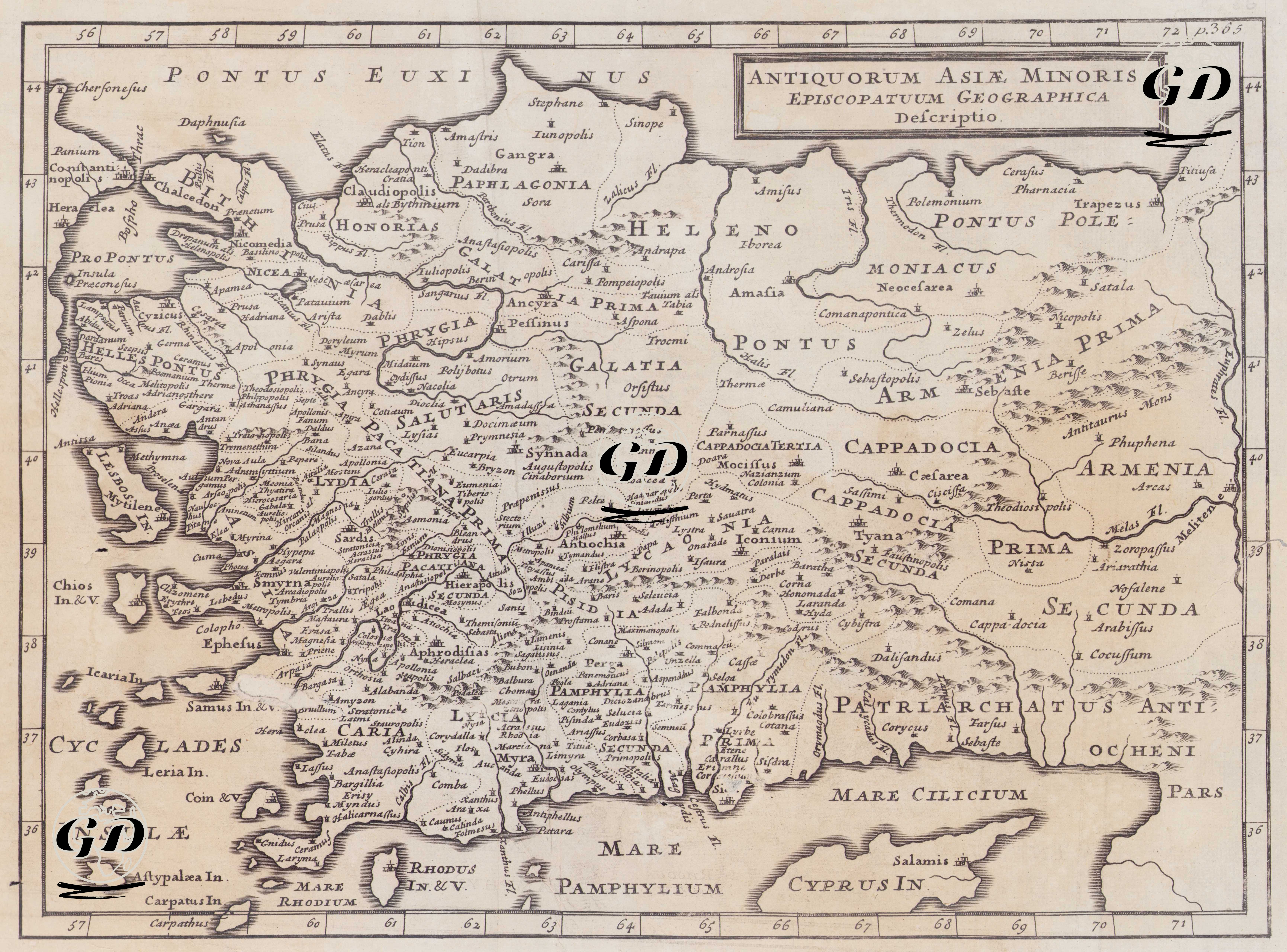
The 1724 “Antiquorum Asiae Minoris Episcopatuum Geographica Descriptio” is a historical-religious map that views Anatolia not as a political geography, but through the lens of the church administration (episcopal organization) of the early Christian and Byzantine world. The map adheres to the tradition of ancient-classical geography with Latin place and region names (e.g., Bithynia, Galatia, Cappadocia, Phrygia, Pamphylia, Cilicia, etc.). Furthermore, through dotted boundaries and divisions, the map makes visible the historical distribution of episcopal centers (episcopatus) and the broader church areas to which they belonged. Notes such as the phrase “Patriarchatus Antiocheni” in the southeast indicate the map's connection to church hierarchies and patriarchal spheres of influence. The coastlines, islands (e.g., Aegean islands and Cyprus), sea designations (Pontus Euxinus, Mare Pamphylium, Mare Cilicum, etc.), degree scales, and the hatching-shading language that provides relief make the map also a form of didactic-reference cartography that was widespread in early 18th-century Europe. Therefore, the main purpose of the map is not so much to provide the current borders of the Ottoman period, but rather to present the late antiquity-medieval church geography of Anatolia in an organized scheme, producing a "spatial guide" for readings based on history, theology, and classical philology.