GRAVÜR DÜNYASI
Digital Engraving Library
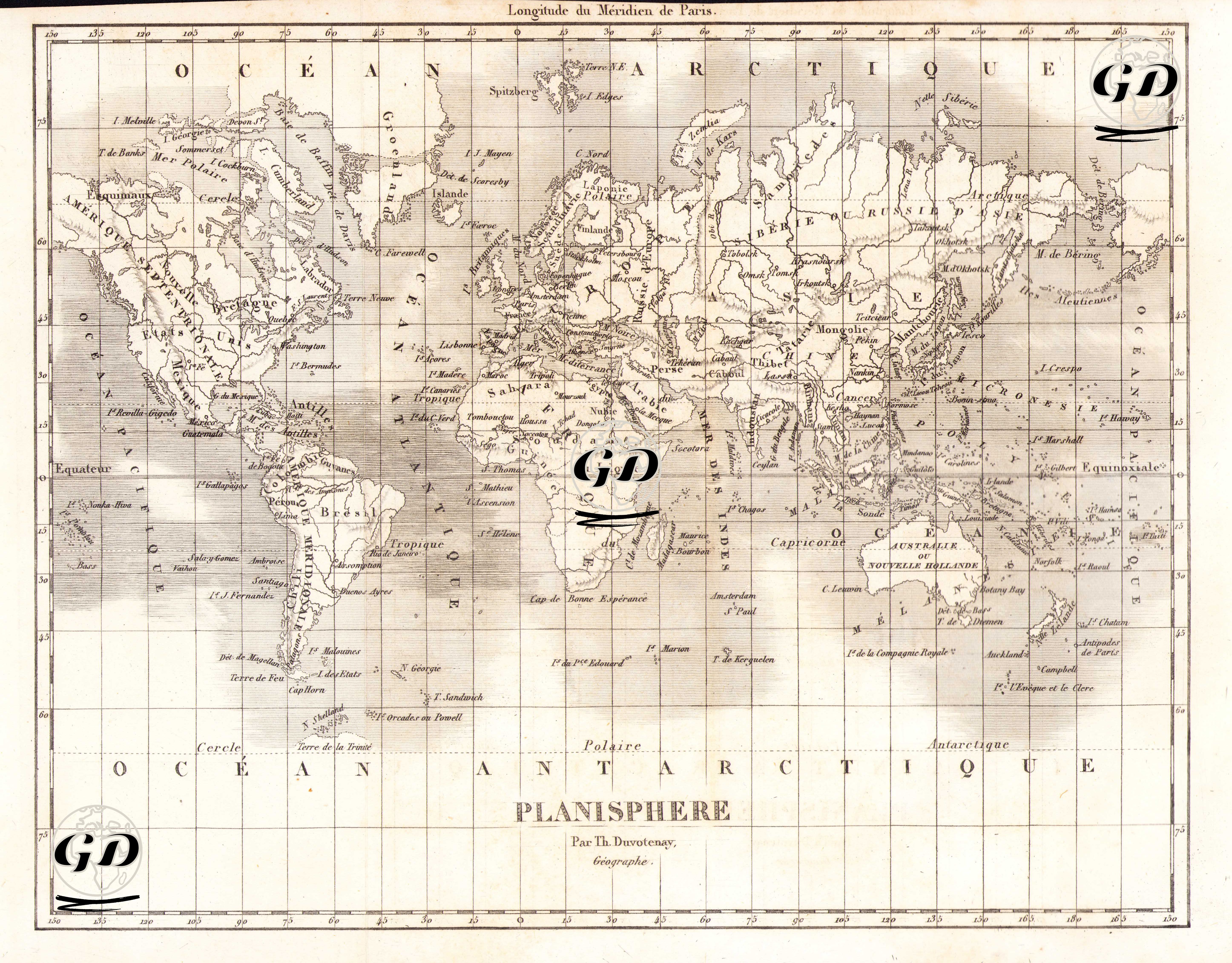
| Artist | Thunot Duvotenay (1796-1875) |
| Date | 1840 |
| Technique | Steel Engraving |
| Category | Maps |
This 1840 world map was prepared by the French geographer Thunot Duvotenay and titled "Planisphere" (world projection). The map, drawn with reference to the Paris Meridian, is a significant example of the mid-19th-century Western European perspective in terms of conveying both geographical and geopolitical knowledge. The map was drawn using a method similar to a cylindrical projection, presenting the Earth's surface as an elongated east-west axis—a visualization technique particularly suited to the maritime and global domination strategies of the colonial era. The continents are largely depicted accurately on the map, but the geographical names are based on the French terminology of the time: for example, Australia is called "Nouvelle Hollande" (New Netherlands), the Indonesian Archipelago "Iles de la Sonde," and Central Asia is broadly called "Tartarie" (Tatarstan). The northern part of Asia is designated "Sibérie," and the inland regions are marked with "Mongolie." The North Pole and South Pole regions are divided into "Océan Arctique" and "Océan Antarctique," and the equator is clearly marked as "Équateur." Similarly, the Tropics of Cancer and Capricorn (Tropique du Capricorne) and the Polar Circles (Cercle Arctique, Cercle Antarctique) are also shown on the map.