GRAVÜR DÜNYASI
Digital Engraving Library
| Date | 1880's |
| Technique | Steel Engraving |
| Category | Maps |
| Source | The National Encyclopaedia, A Dictionary of Universal Knowledge |
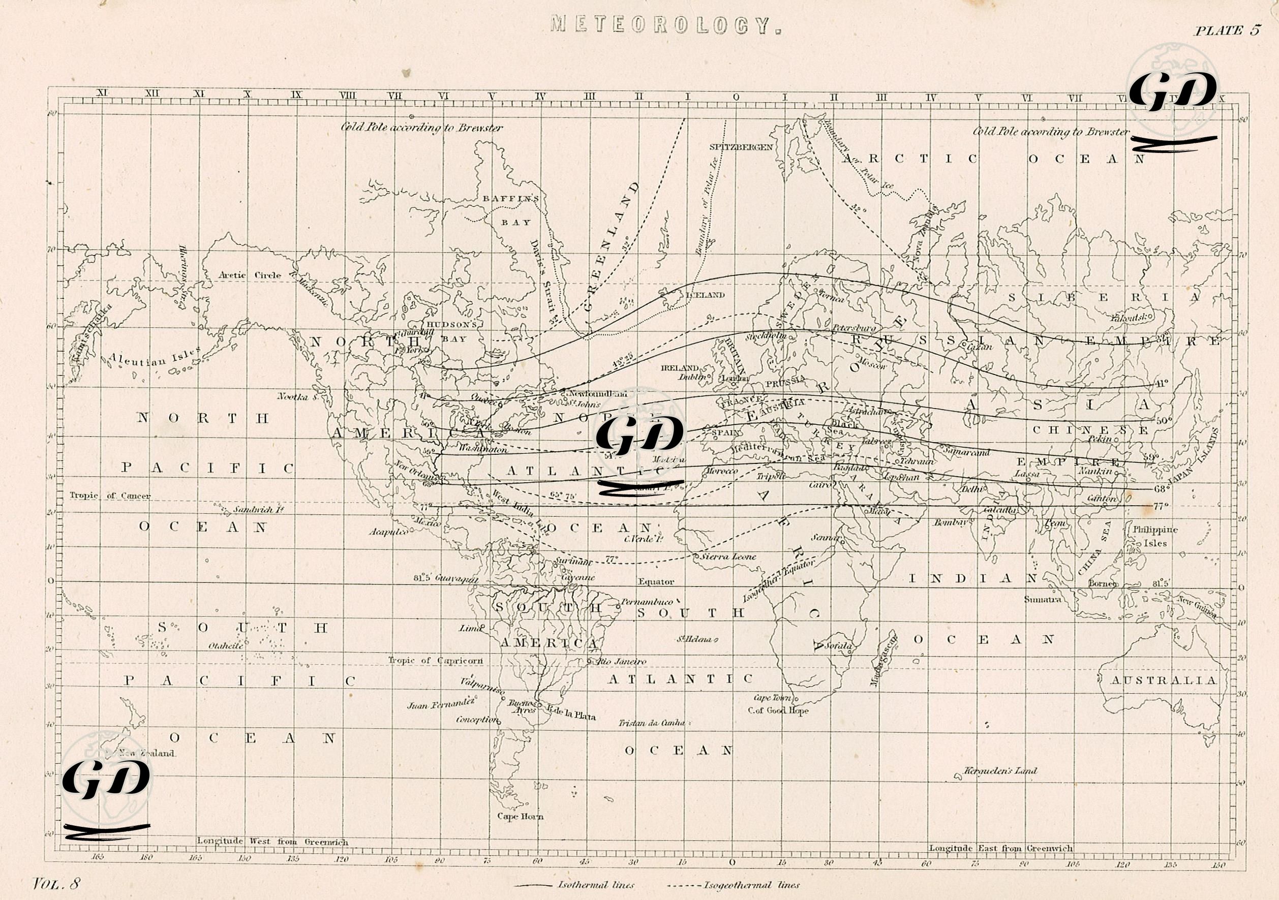
This map was produced in the 19th century, when meteorology was beginning to become a systematic branch of science, and it was specifically aimed at visualizing the distribution of global heat. Two basic types of lines stand out on the map: "Isothermal Lines" (solid lines) and "Isogeothermal Lines" (broken lines). Isothermal lines represent curves connecting regions where average temperatures on the earth's surface are the same; isogeothermal lines are theoretical lines reflecting the distribution of heat underground. Thanks to these lines, the map provides information not only about air temperature, but also about heat distribution within the earth. Unlike classical geographical maps, the map is structured to indicate climate zones, ocean currents, sea winds, and temperature thresholds. For example, isothermal lines passing over the North Atlantic try to explain why regions like England have a milder climate. Similarly, lines in India, China, Central Africa, and parts of South America represent the tropical zone. The upper part of the map is marked with phrases such as “Cold Pole according to Brewster”, which are based on the theoretical assumptions of 19th century scientists. Lines extending from the equator to the poles allow the tracing of climatic zones and temperature gradients. Basic geographical references such as the equator, tropics and polar circles are placed on the map to better understand the global distribution of heat. In addition, the map allows temperature comparisons by reference to specific points such as the Aleutian Islands, Siberia, Brazil, Spain, Siberia, Cape Horn and Cape of Good Hope. This map is a pioneering cartographic document not only for meteorology but also for different fields such as geothermal energy, climate zoning and agricultural planning. Such maps, which are the product of the desire of 19th century scientists to model natural events with quantitative data, formed the basis of disciplines such as climatology, geophysics and environmental geography that would later develop.