GRAVÜR DÜNYASI
Digital Engraving Library
| Artist | Augustus Heinrich Petermann (1822-1878) |
| Engraver | John James Dower (1825-1901) |
| Date | 1850 |
| Technique | Copper Engraving-Original Hand Colored |
| Category | Maps |
| Source | A Descriptive Atlas of Astronomy, and of Physical and Political Geography by Thomas Milner - London, Published By Orr And Comp. Amen Corner Paternoster Row |
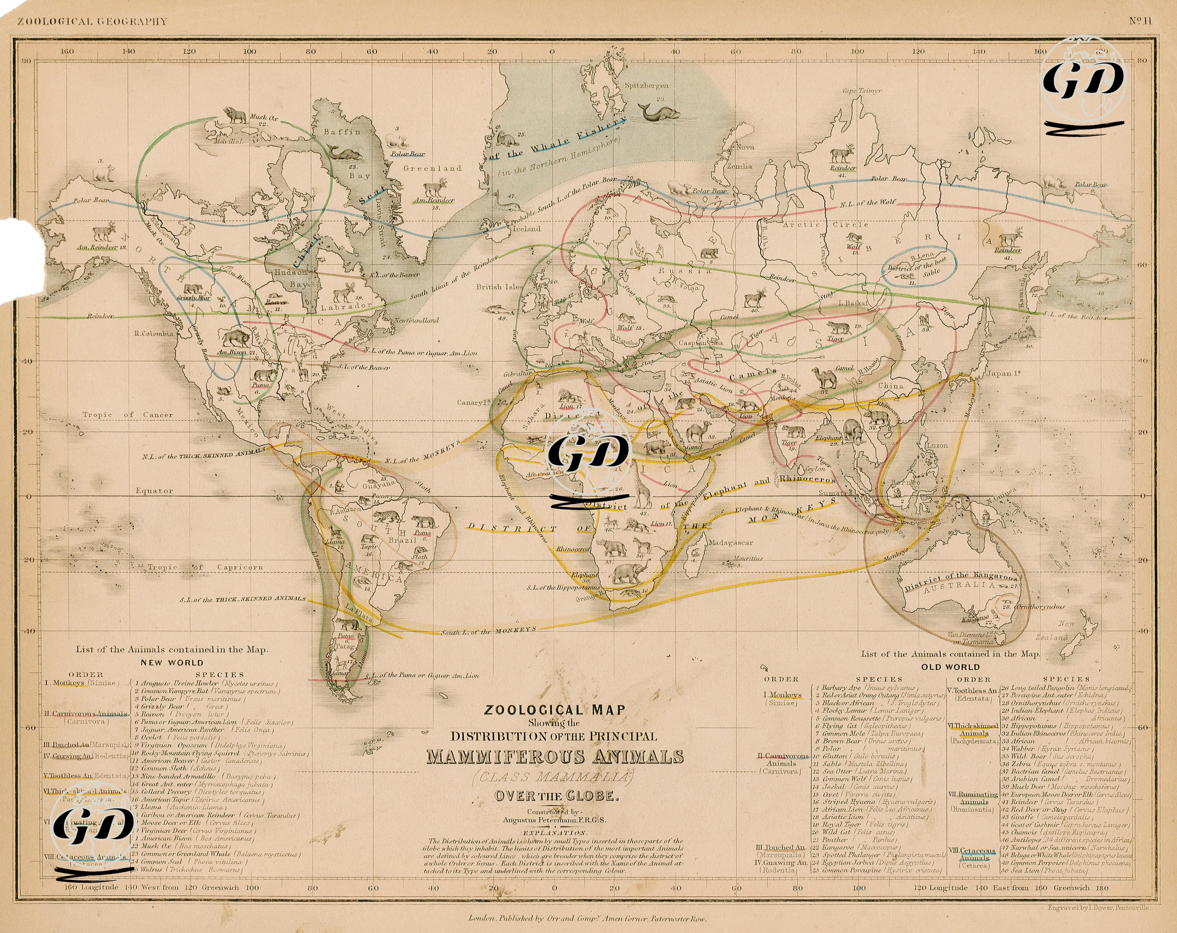
The map titled “Zoological Map of the Distribution of the Principal Mammals on Earth” and dated 1850 is one of the early examples of biogeography (zoological geography) that visualizes the geographical distribution of mammals on Earth. Prepared by Augustus Petermann, a German cartographer and member of the Royal Geographical Society, this map shows the regions where animal species live with colored border lines and symbolic animal icons. In two main areas divided into the New World (American continent) and the Old World (Eurasia and Africa continents), species are systematically classified (class, order, species) and listed at the bottom of the map in accordance with scientific taxonomy. While species such as spider monkey (Simia Paniscus), Virginia opossum (Didelphis Virginiana), armadillo and llama (Camelus Llama) stand out in North and South America, the distribution areas of species such as Indian elephant (Elephas Indicus), one-humped camel (Camelus Dromedarius), lion (Panthera Leo), brown bear (Ursus Arctos), Asiatic monkeys (Macaca Silenus) and wombat (Phascolomys) in the Old World are shown in detail. The geographical boundaries of certain animal groups were specified with explanations such as “District of Monkeys” and “Range of the Elephant and Rhinoceros”; in addition, the effects of environmental factors on distribution were emphasized with geographical reference lines such as climate zones, tropics and equator. The map is located at the intersection of natural history and geography and presents observational information about the natural habitats of species in a systematic manner. Petermann’s map is a visual and scientific document reflecting the understanding of animal geography in the period before modern ecology and evolutionary biology.