GRAVÜR DÜNYASI
Digital Engraving Library
| Date | 1903 |
| Technique | Lithography-Colored |
| Category | Maps |
| Source | Encyclopaedia Britannica |
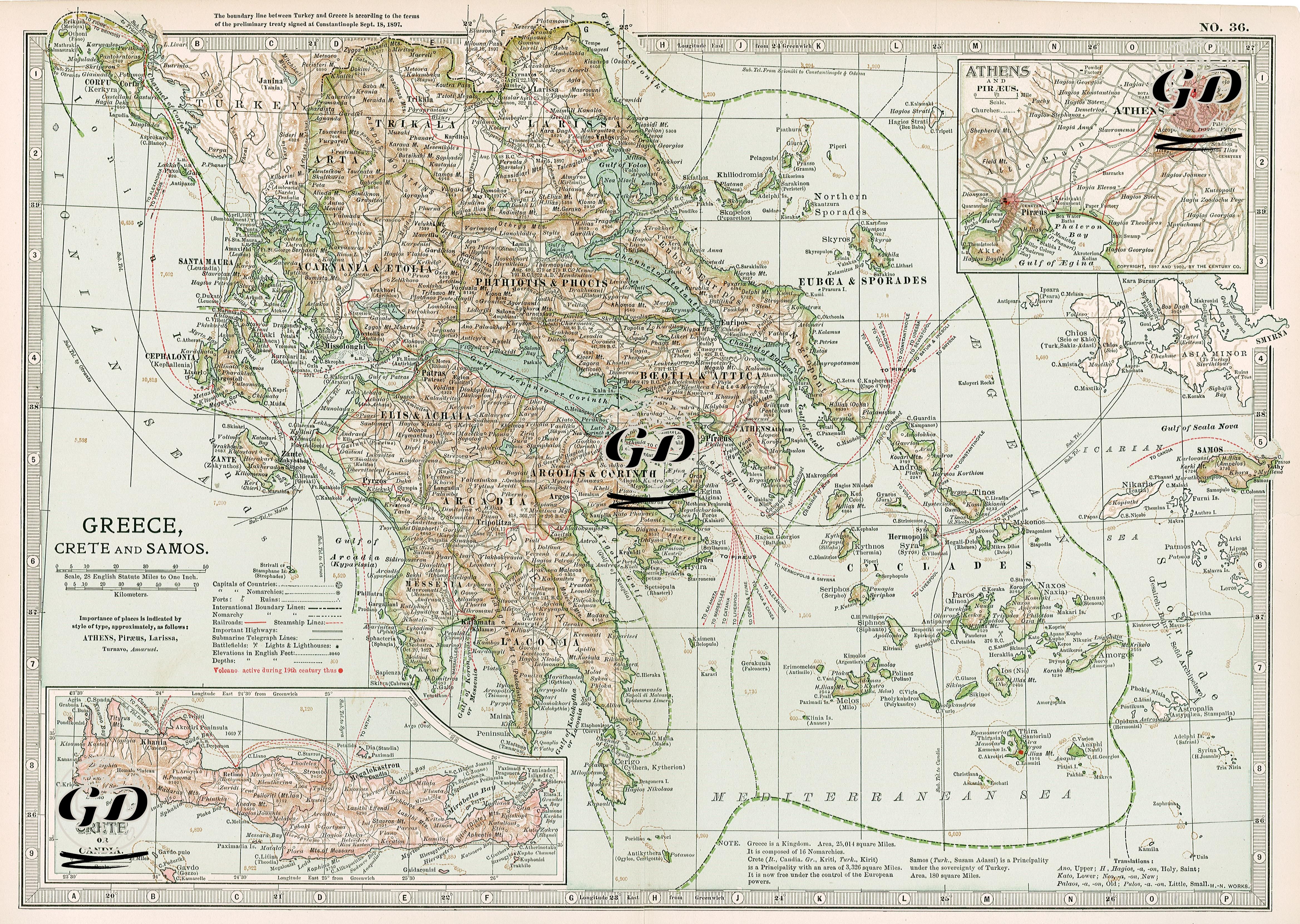
This map reflects the Ottoman-Greek borders redefined in accordance with the Treaty of Istanbul signed on September 18, 1897 after the 1897 Ottoman-Greek War, and the geopolitical situation of the period. The main map shows the Greek regions of Thessaly, Epirus, Mora and Attica in detail; while a detailed plan of Athens is in the upper right corner, the island of Crete (Candia) is in the lower left and the island of Samos is on the right. The dashed lines represent the new Ottoman-Greek border determined by the 1897 treaty. The Ottomans captured Thessaly during the war, but despite the Ottoman victory on the battlefield, they were forced to withdraw from Thessaly as a result of the intervention of the great European powers (England, France, Russia, Germany, Austria-Hungary and Italy) and minor changes were made to the border line in favor of the Ottomans. Although the island of Crete appears as Ottoman territory on the map, it symbolizes the period when the island was granted autonomy and a Christian prince was appointed as governor, symbolizing the period when de facto control was removed from the Ottomans. The island of Samos also maintains its autonomy under the Ottoman Empire and is detailed in a separate frame on the map. This map is a visual resource that shows the process of Greece expanding its territory in line with the Megali Idea, the Ottoman Empire's loss of influence in the Balkans, and the influence of European powers in directing regional politics through diplomatic pressure. It also reflects the sea routes, telegraph lines, and administrative structure of the period, making it possible to track not only political but also strategic and communicational dimensions.