GRAVÜR DÜNYASI
Digital Engraving Library
| Engraver | J. & C.Walker (Active 1820-1895) |
| Date | 1853 |
| Technique | Steel Engraving-Original Hand Colored |
| Category | Maps |
| Source | London George Cox, Jan 1 1853 |
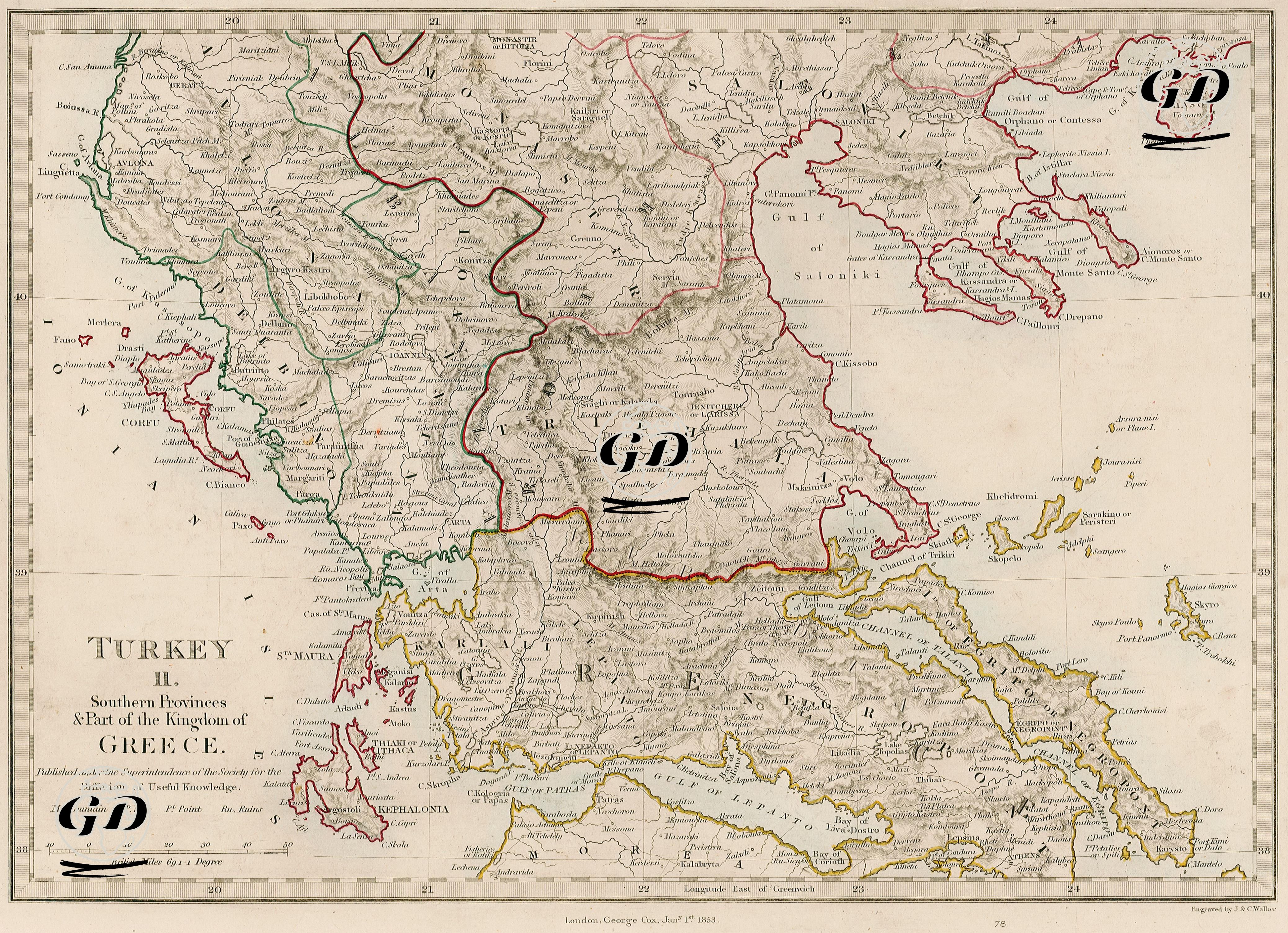
The map shows the southern provinces of the Ottoman Empire in Europe and the northern borders of the Kingdom of Greece. It also includes detailed settlement areas belonging to Ottoman geography such as Albania (Albania), Thessaly, Macedonia (Macedonia), Epirus, Ioannina, Trikala, Thessaloniki, and the northern regions of the Peloponnese Peninsula. Regions separated by different colored borders on the map are marked to define both administrative borders and ethnic and political regions. For example, green borders define the regions of Albania, red lines show the Ottoman borders in Macedonia and Thrace, and yellow lines show the borders of the Kingdom of Greece. Since 1853 coincides with the time just before the Crimean War, maps prepared during this period are also important in terms of showing the Ottoman control in the Balkans and its border relations with Greece. Rising nationalist movements in Europe began to threaten the Ottoman position in the Balkan provinces; The independence of the Morea Peninsula, especially after the Greek Revolt (1821-1830), made the Ottomans more sensitive in this region. In these regions, ethnic tensions, potential for rebellion, and diplomatic interventions by major powers (especially England, France, and Russia) increased intensely, and the Balkans became a geopolitical chessboard that not only Ottoman-Russian rivalry but also Austria and England coveted. The fact that the map was published by the Society for the Diffusion of Useful Knowledge (SDUK) in London shows that the map was used not only as an academic tool but also as an educational and ideological tool. SDUK was an important institution that published maps and encyclopedic publications in order to spread access to information throughout the 19th century. The maps prepared by this institution were widely used as course material in secondary schools in both England and Europe.