GRAVÜR DÜNYASI
Digital Engraving Library
| Artist | John James Dower (1825-1901) |
| Engraver | John James Dower (1825-1901) |
| Date | 1853 |
| Technique | Woodblock Engraving (Newspaper-Text on Reverse) |
| Category | Maps |
| Source | The İllustrated London News (November 05 1853-Page 385) |
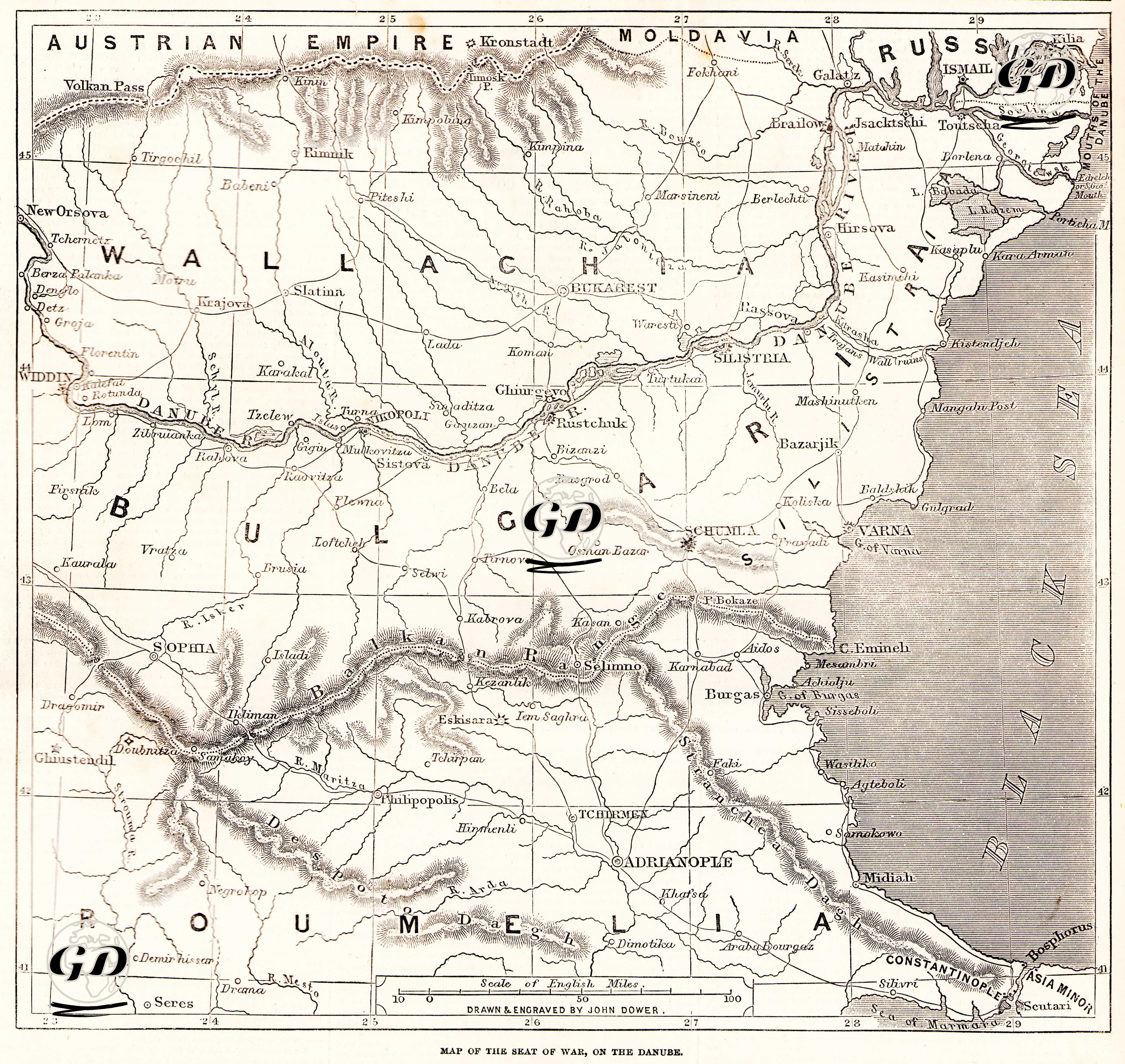
The map and accompanying newspaper article published in The Illustrated London News on 5 November 1853 focus on the European front of the Russo-Turkish War (1853–1856), particularly the Danube River region. The map shows a wide area from the Austrian border to Bulgaria, Wallachia (Wallachia), Moldavia (Moldavia) and the Black Sea coast. Strategic points, forts and crossing lines along the Danube River are marked, and Ottoman strongholds of military importance such as Vidin, Kalafat, Silistre, Ruscuk, Varna, Burgas and Shumen are highlighted. The article provides information on the Ottoman defensive order on the Danube, the condition of the forts and temporary fortifications, and particularly emphasizes the military importance of the Vidin–Shumen–Varna line. The criticality of Shumen as a junction point preventing the Russians from reaching the Black Sea directly is emphasized. In addition, the text accompanying the map explains that the defensive strategy implemented by the Ottoman army on this line was based on geographical advantages, that the passes and transportation routes were protected by castles, that the terrain was suitable for defense, and that the Russian advance was limited. Bu harita ve açıklama, Kırım Savaşı'nın henüz patlak verdiği dönemde, Avrupa’daki savaşın sahneleneceği Tuna hattına dair kamuoyuna bilgi sunmak üzere hazırlanmıştır.