GRAVÜR DÜNYASI
Digital Engraving Library
| Date | 1856 |
| Technique | Steel Engraving (Text on Reverse) |
| Category | Maps |
| Source | Pictorial History Of The Russian War 1854-5-6 - W.R.Chambers London & Edinburgh |
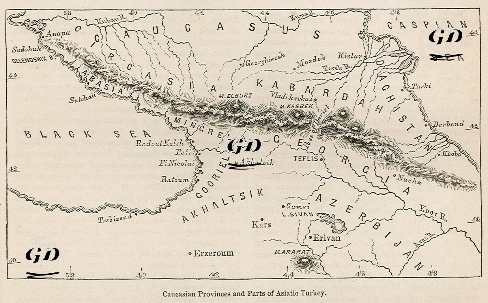
This map, dated 1856, is a war geography map covering the Caucasus region and the eastern parts of Anatolia during the Crimean War (1853–1856). During this period, the Caucasus was the scene of intense conflicts between Russia and the Ottoman Empire, and this map was prepared to present the geographical dimension of these struggles to the viewer. It includes today's Georgia, Armenia, Azerbaijan, the Southern Federation of Russia, and the eastern provinces of Turkey (especially Erzurum, Kars, Trabzon). Starting from the Black Sea in the north and extending to the Aras River in the south, this map covers a wide geography from Trabzon and Erzurum in the west to Derbent and Baku on the Caspian Sea coast in the east. The Caucasus Mountain Range in particular is shown in detail, and the mountain ranges form the main geographical backbone of the map. Ethnic and administrative regions such as Mingrelia, Abkhazia, Circassia, Gurya, Kabarda, and Dagestan are highlighted on the map. Mingrelia was recognized as an autonomous region among the Georgian Kingdoms and took its place on the map as an important cultural area with a coastline on the Black Sea. Similarly, regions such as Abkhazia and Dagestan are prominent places within the framework of the military expansion of the Russian Tsardom in the Caucasus. In addition, cities of great military importance such as Kars, Erzurum, Tiflis (Tbilisi), Batumi, Yerevan are carefully marked on the map.