GRAVÜR DÜNYASI
Digital Engraving Library
| Date | 1877 |
| Technique | Woodblock Engraving (Newspaper-Text on Reverse) |
| Category | Maps |
| Source | The İllustrated London News (July 14 1877-Page 42) |
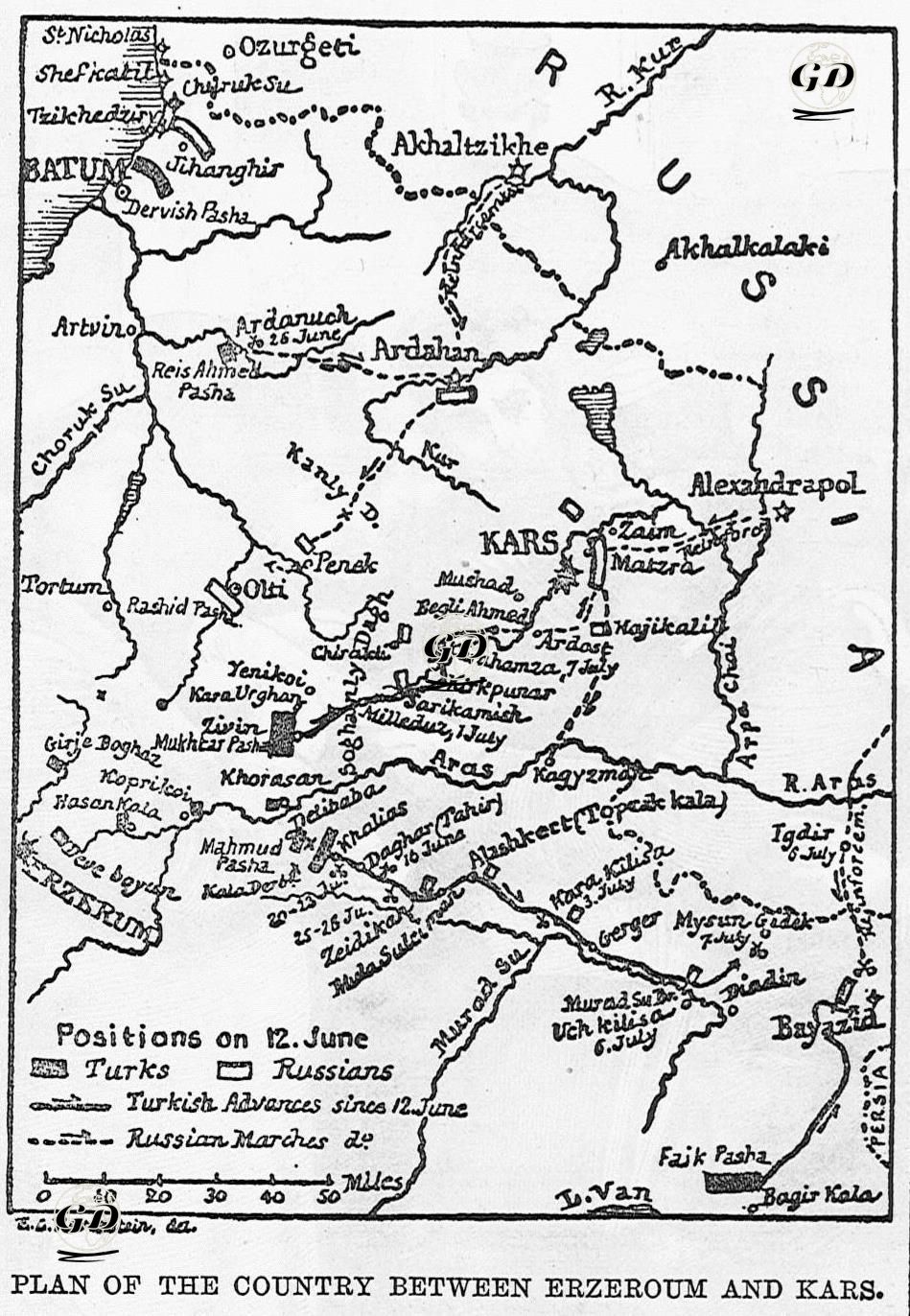
This map details the military movements and fighting positions between Erzurum and Kars during the Ottoman-Russian War of 1877-1878. The map specifically shows the deployments of Ottoman and Russian forces on 12 June 1877. At the same time, the forward and backward movements made by the two sides since this date are indicated with arrows. Erzurum and Kars were the largest and most important defense centers on the Ottoman eastern front and the main targets of the advancing Russian army. Towns and passes such as Oltu, Ardahan, Penek, Beyazıt, Iğdır, Arpaçay were critical passageways on this route. The locations of the Ottoman commanders: Rashid Pasha, Mukhtar Pasha in Ziivin, Reis Ahmed Pasha, Mahmud Pasha, Faik Pasha, Derviş Pasha, Veli Pasha, Ferik Süleyman Pasha are marked on the map. The squares on the map indicate the positions of the Turkish troops (as of 12 June), rectangles indicate the positions of the Russian troops (as of 12 June), and dashed lines indicate the positions of the Russian troops (as of 12 June); The dotted lines show the forward movements of the Turkish forces after June 12, and the dotted lines show the advance routes of the Russians after June 12. In the newspaper article about this map, it was stated that the prepared map aimed to show the movements of Turkish and Russian troops since June 12, and detailed information was given about the location and strength of the Turkish army forces under the command of Muhtar Pasha, and then information was given about the history, location and results of the clashes between Turkish and Russian troops in this region.