GRAVÜR DÜNYASI
Digital Engraving Library
| Date | 1877 |
| Technique | Woodblock Engraving (Newspaper-Text on Reverse) |
| Category | Maps |
| Source | The İllustrated London News (November 24 1877-Page 50) |
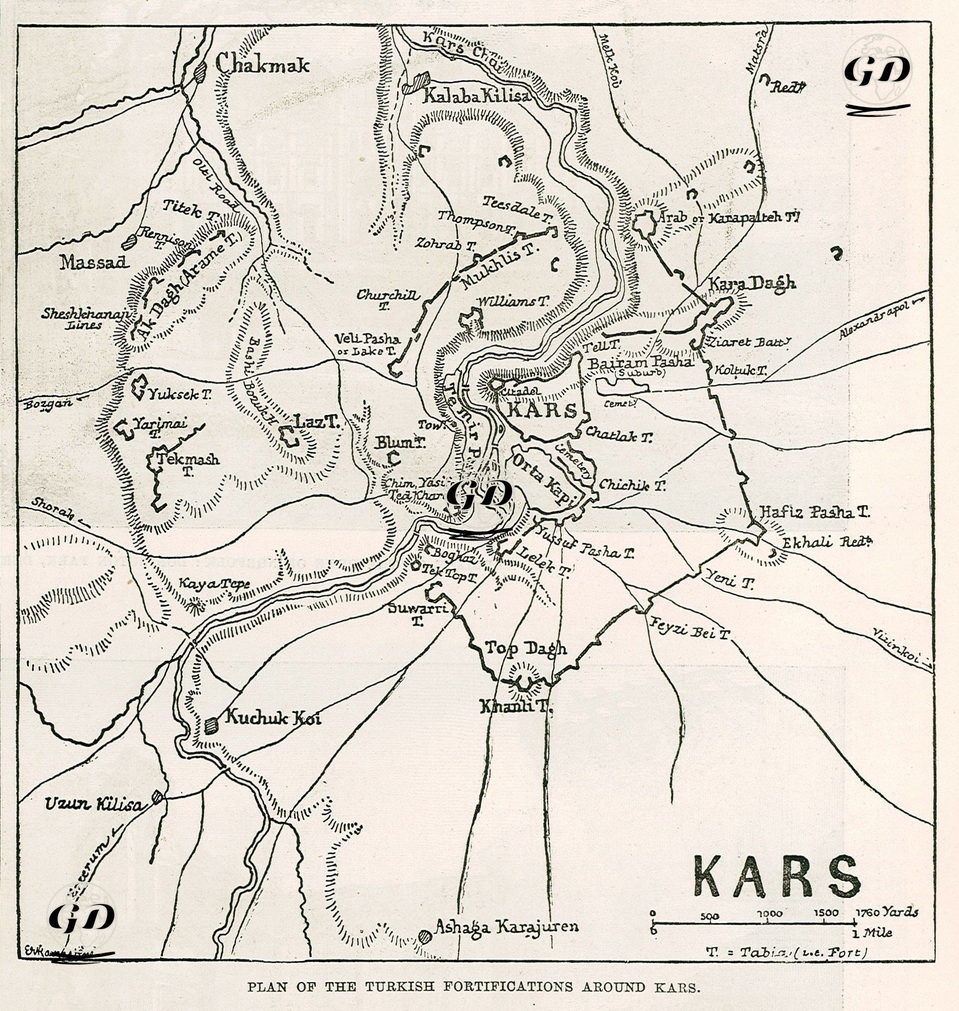
This map shows in detail the Ottoman defensive positions around the city of Kars during the 1877-1878 Ottoman-Russian War (93 War). The focal point of the map is the city of Kars and its inner castle. The city is located at the center of all the surrounding defense lines, with the castle positioned as the last point of defense. Numerous fortification points (redif forts) are indicated on the map with the abbreviation "T." These forts are fortified positions for artillery units and were established to provide all-round defense against attacks from different directions. Prominent forts: Hafız Paşa T., Top Dağı T., Suwarti T., Veli Paşa T., Williams T., Churchill T., Müslü T., Kalaba Kilisia and forts concentrated on the skirts of Kara Dağ. In addition, rivers, hills (such as Kaya Tepe, Yüksek Tepe, Kara Dağ, Top Dağ) and passes on the map are elements that affect strategic positioning. The newspaper article provides information about the fall of the city of Kars and the military and strategic importance of this event. The map shows the fortification system built by the Ottoman army around Kars, while the article explains how this defense line was overcome and how the city fell into Russian hands.