GRAVÜR DÜNYASI
Digital Engraving Library
| Date | 1877 |
| Technique | Woodblock Engraving (Newspaper-Text on Reverse) |
| Category | Maps |
| Source | The İllustrated London News (November 10 1877-Page 459) |
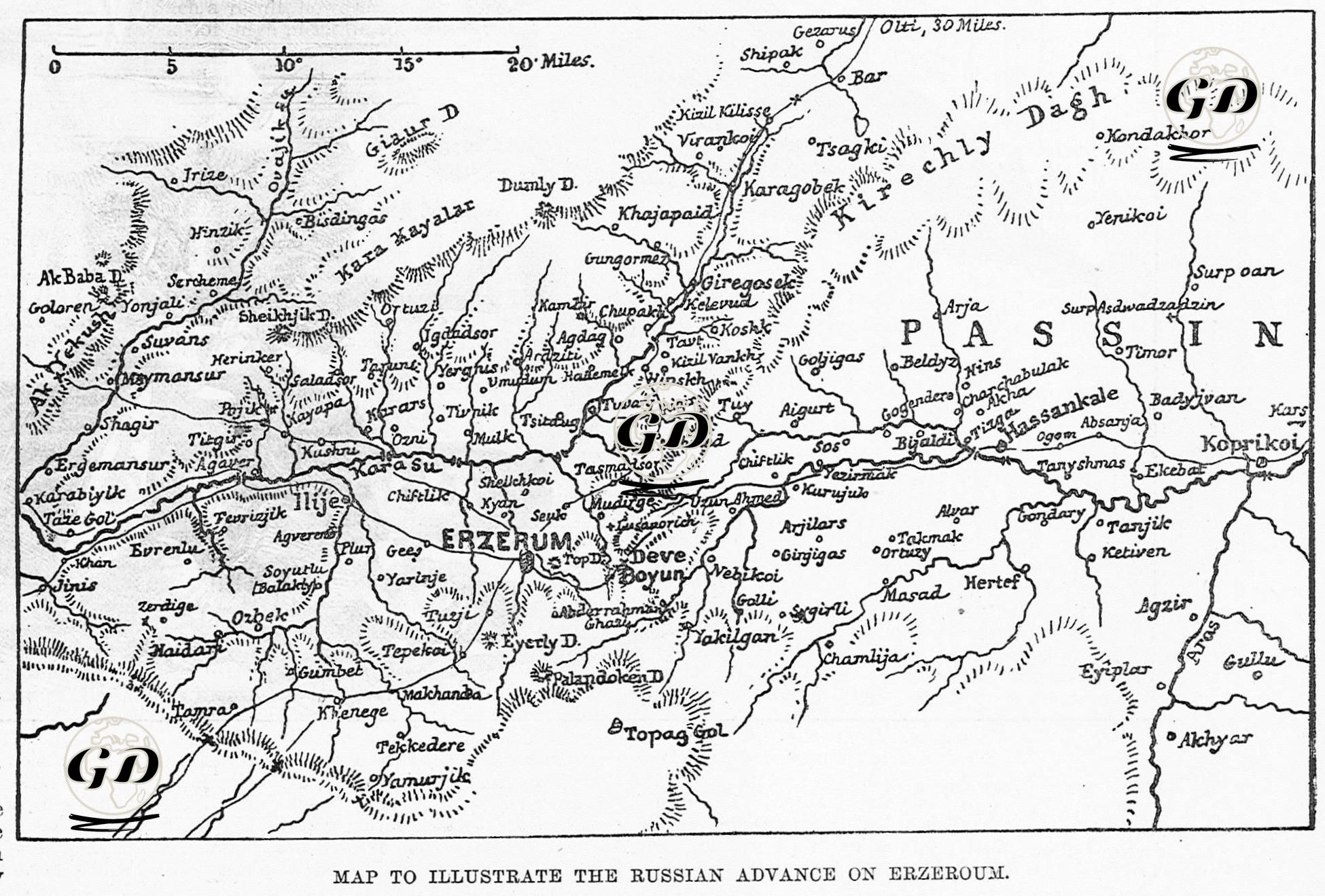
This map was published together with the news item titled “The Russian Advance on Erzeroum” published in The Illustrated London News on November 10, 1877, and shows the Russian advance on the Eastern Anatolian Front during the 1877-1878 Ottoman-Russian War (93 War). In the news item and the map, the strategic location of Erzurum, the route of the Russian army, and the state of the Ottoman defense are discussed in detail. The map clarifies the route of advance of the Russian troops by showing the mountainous geography of Erzurum and its surroundings in detail. Erzurum is positioned as the center on the map. The Pasin Plain and Köprüköy line are the main lines of the Russian advance. The mountain ranges, passes, and rivers on the map are detailed as elements that directly affect the maneuvers and supply movements of the armies. The Turkish translation of the newspaper article reads, “Mukhtar Pasha has lost the city of Erzurum. It seems that when his position at Deveboynu was seriously endangered, Muhtar Pasha abandoned this position and left Erzurum to the Russians. The Russians are now in control of the Armenian capital (i.e. Erzurum). Muhtar Pasha is retreating to Trabzon, where he is sure of the supply of food, and is waiting for large reinforcements.” This does not reflect the real situation. On November 8-9, 1877, Russian forces attacked Erzurum, but with the help of the people, the Russian army was repelled and this event went down in Turkish history as the defense of Aziziye Tabya.