GRAVÜR DÜNYASI
Digital Engraving Library
| Engraver | Sidney Hall (1788-1831) |
| Date | 1820's |
| Technique | Copper Engraving |
| Category | Maps |
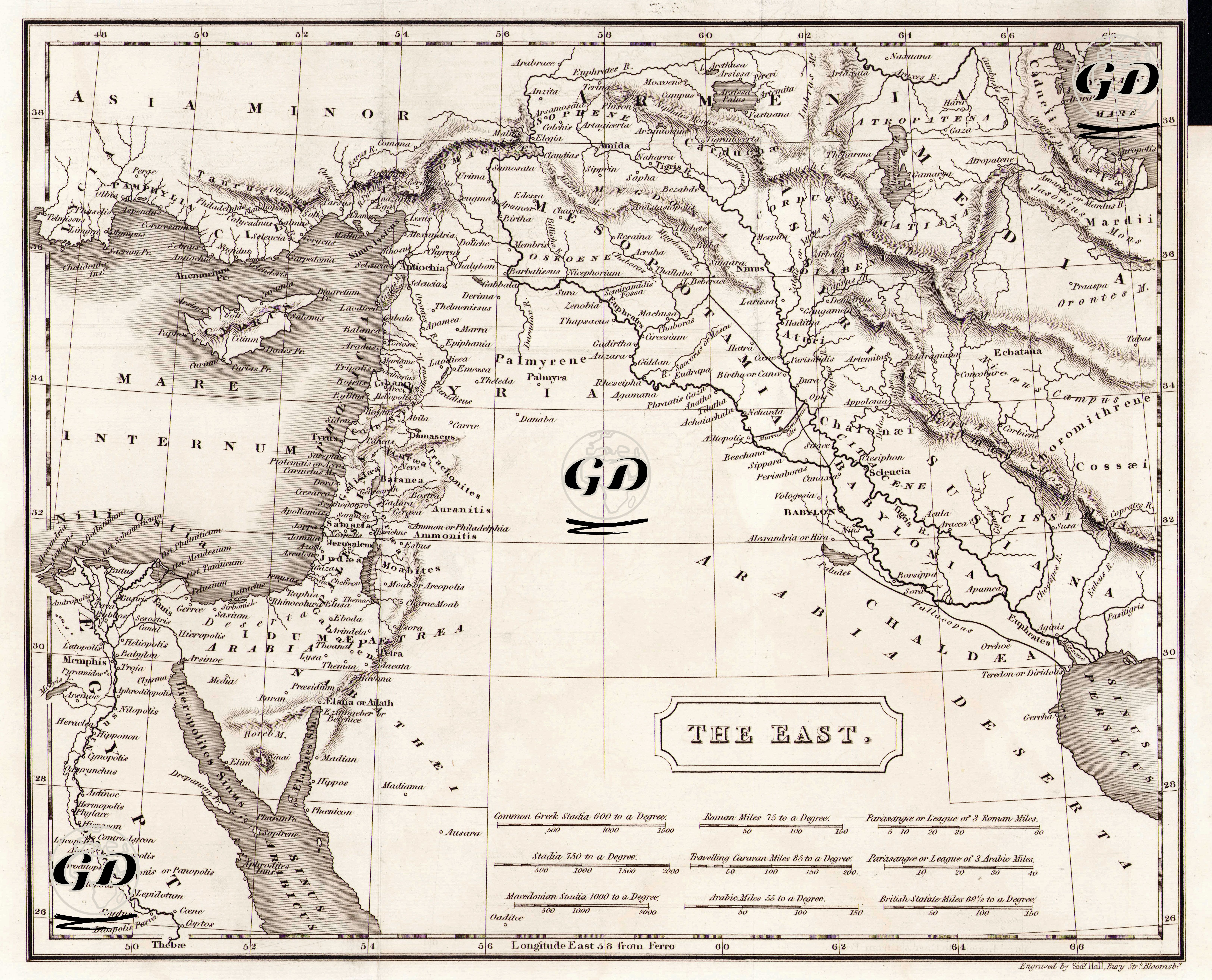
This historical map titled “East” is a cartographic study that describes in detail the important regions of the Ancient Near East based on the geographical information of the classical age and is particularly based on ancient settlements based on Biblical geography and Greco-Roman sources. The map starts from the Nile River delta and the Thebais region in Egypt in the west and extends to present-day Iran in the east, bordered by Anatolia in the north and the desert regions of the Arabian Peninsula in the south. In this vast geography, the lands of Mesopotamia are centrally located and the fertile crescent region between the Euphrates and Tigris rivers, along with ancient cities such as Babylon (Babylon), Nineveh (Nineveh), Seleukeia, Ctesiphon (Ctesiphon), Susa, are detailed. On the western side of the map, especially in the lands of Palestine, Lebanon and Syria, the holy cities mentioned in the Bible such as Jerusalem (Jerusalem), Bethlehem (Bethlehem), Gaza, Jericho (Jericho), Tyre and Sidon stand out, and these settlements form a spiritual line with Petra (Selah) and the Sinai region in the northwest of the Arabian Peninsula. In addition, Arabia is divided into three sub-regions on the map (Arabia Deserta, Arabia Petraea, Arabia Felix) and classified in accordance with the widespread geographical understanding of the period. At the eastern end of the map, ancient cities such as Persopolis, Ekbatan (Ecbatana), Susa and Elymais on the Iranian plateau bear the traces of ancient Persian and Median civilizations. The distance measurement unit comparison table in the lower section relates different ancient measurement systems such as Common Greek Stadia, Roman Miles, Persian Parasangs and Arabian Miles to the present-day English mile, making this map an educational tool as well. Mountain ranges, riverbeds and coastlines are depicted in depth and realistically on the map using shading.