GRAVÜR DÜNYASI
Digital Engraving Library
| Date | 1853 |
| Technique | Woodblock Engraving (Newspaper-Text on Reverse) |
| Category | Maps |
| Source | The İllustrated London News (July 16 1853-Page 32) |
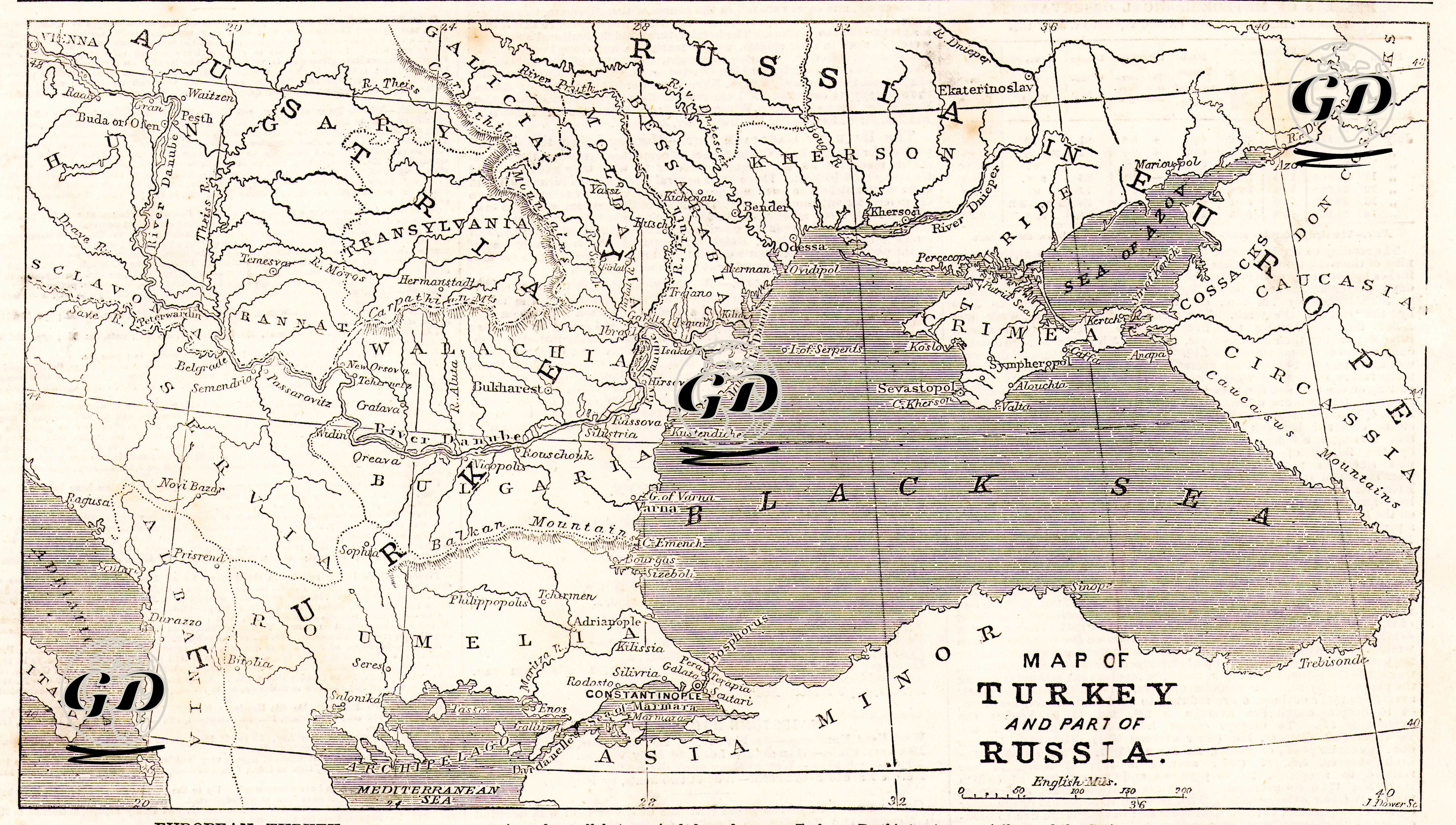
Published in The Illustrated London News on July 16, 1853, just weeks before the outbreak of the Crimean War (1853-1856), this map and accompanying news item were intended to present Russia’s intention to expand into Ottoman territory to the Western public, both visually and in writing. The map focuses on the line of tension between European Turkey, the Balkan lands of the Ottoman Empire, and Bessarabia, a territory of Russia located north of the Black Sea.