GRAVÜR DÜNYASI
Digital Engraving Library
| Date | 1903 |
| Technique | Lithography-Colored |
| Category | Maps |
| Source | Encyclopaedia Britannica |
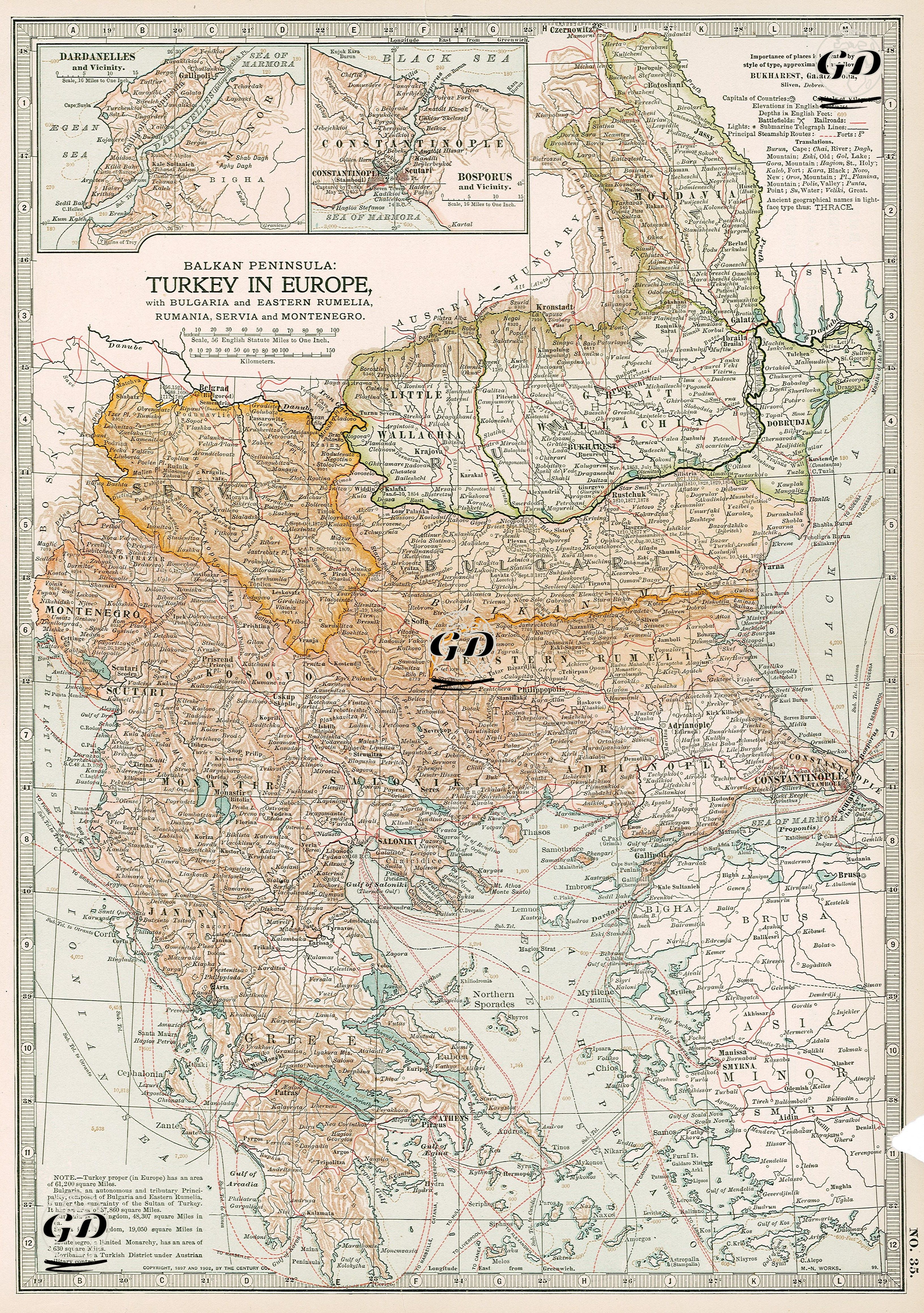
This detailed political map from 1903 depicts the Ottoman Empire’s European territories, namely the Rumelian provinces and the neighboring Balkan states, in the context of the political divisions following the Treaty of Berlin (1878). The map documents the narrowing geography of Ottoman rule in Europe at the beginning of the 20th century, both politically and administratively. The Ottoman territories are distinguished on the map by color tones, with Eastern Rumelia in particular prominently marked; although still shown as Ottoman territory, it had been de facto annexed by Bulgaria since 1885. Similarly, Serbia, Romania, and Montenegro are drawn as politically independent states on the map, indicating that Ottoman authority in the region had ended de facto, if not de jure. The two detail boxes in the upper left corner of the map, titled “Dardanelles and Vicinity” and “Bosporus and Vicinity,” emphasize the strategic importance of the Dardanelles and Bosphorus Straits. While Istanbul (Constantinople) is located near the center of the map, Balkan provincial centers such as Thessaloniki, Monastir, Skopje, and Ioannina continue to remain under Ottoman rule. The map also shows in detail the railway lines, postal routes and maritime trade routes, thus visually connecting the remaining lands of the Ottoman Empire. Note in the lower left corner of the map; The area of the actual Turkey in Europe is 61,200 square miles. - Bulgaria is an autonomous and tributary principality consisting of Bulgaria and Eastern Rumelia, under the rule of the Sultan of Turkey. Its area is 37,860 square miles. - Romania is a Kingdom, 48,307 square miles. - Serbia is a Kingdom, 19,050 square miles. - Montenegro is a limited Monarchy, 3,630 square miles. - Novibazar is a Turkish region under Austrian military control.