GRAVÜR DÜNYASI
Digital Engraving Library
| Engraver | Ormando Wyllis Gray (1829–1912) & Son |
| Date | 1860's-1870's |
| Technique | Steel Engraving |
| Category | Maps |
| Source | Published By Arch & Fullarton & Co. Glasgow |
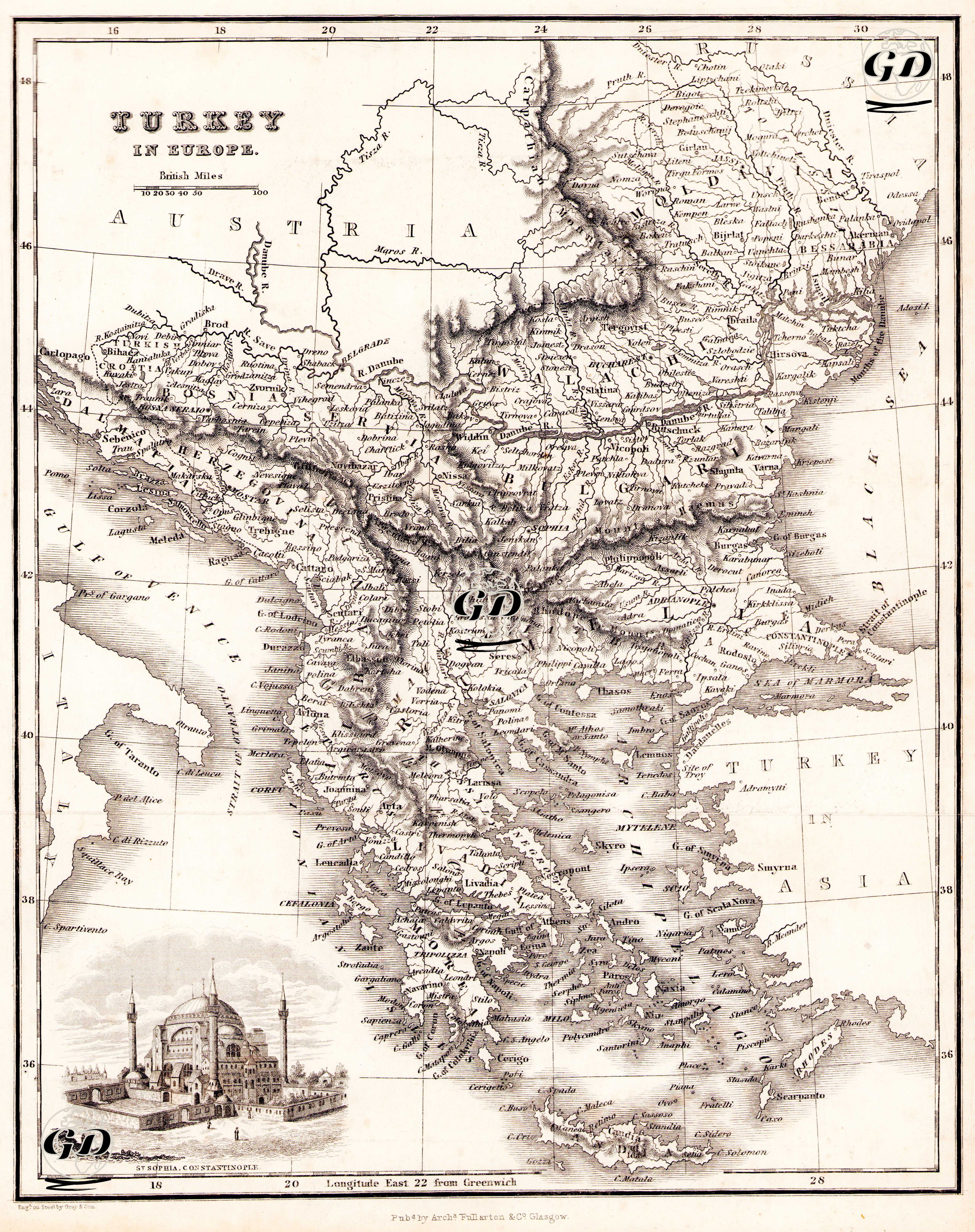
This engraving map was published in the second half of the 19th century and shows the Ottoman Empire’s European territories (Rumelia), especially the Balkan Peninsula, in detail. The illustration of Hagia Sophia (St. Sophia, Constantinople) in the lower corner of the map emphasizes Istanbul’s role as both a geographical and cultural center. The engraving covers a vast area defined as the Balkans in the modern sense: the Danube River to the north, the Adriatic coast to the west, the Black Sea to the east and the Aegean Sea to the south. This map includes former Ottoman provinces, including today’s Bulgaria, Greece, Serbia, Albania, Macedonia, Kosovo, Montenegro and Bosnia-Herzegovina. The city names on the map are written in their English adaptations; settlements such as Philippopolis (Plovdiv), Adrianople (Edirne), Thessalonica (Thessaloniki), Scutari (Üsküdar), Bucharest (Bucharest) and Belgrade (Belgrade) are clearly visible. The city lines that developed along the Danube River also formed the basis of the Ottoman-Russian and Ottoman-Austrian border disputes. The relief representation of mountainous areas and strategic passes and river valleys are carefully processed. In this respect, the map has not only a geographical function but also a military and political function. The visual contribution under the engraving is a common presentation style of the period; because it has aesthetic and ideological functions such as adding a cultural dimension to the map information, increasing the interest of the viewer and at the same time ensuring that the region is presented with the image of the "Exotic East".