GRAVÜR DÜNYASI
Digital Engraving Library
| Artist | James Playfair (1738-1819) |
| Engraver | H.Cooper |
| Date | 1814 |
| Technique | Copper engraving |
| Category | Maps |
| Source | A New General Atlas, Ancient and Modern by James Playfair |
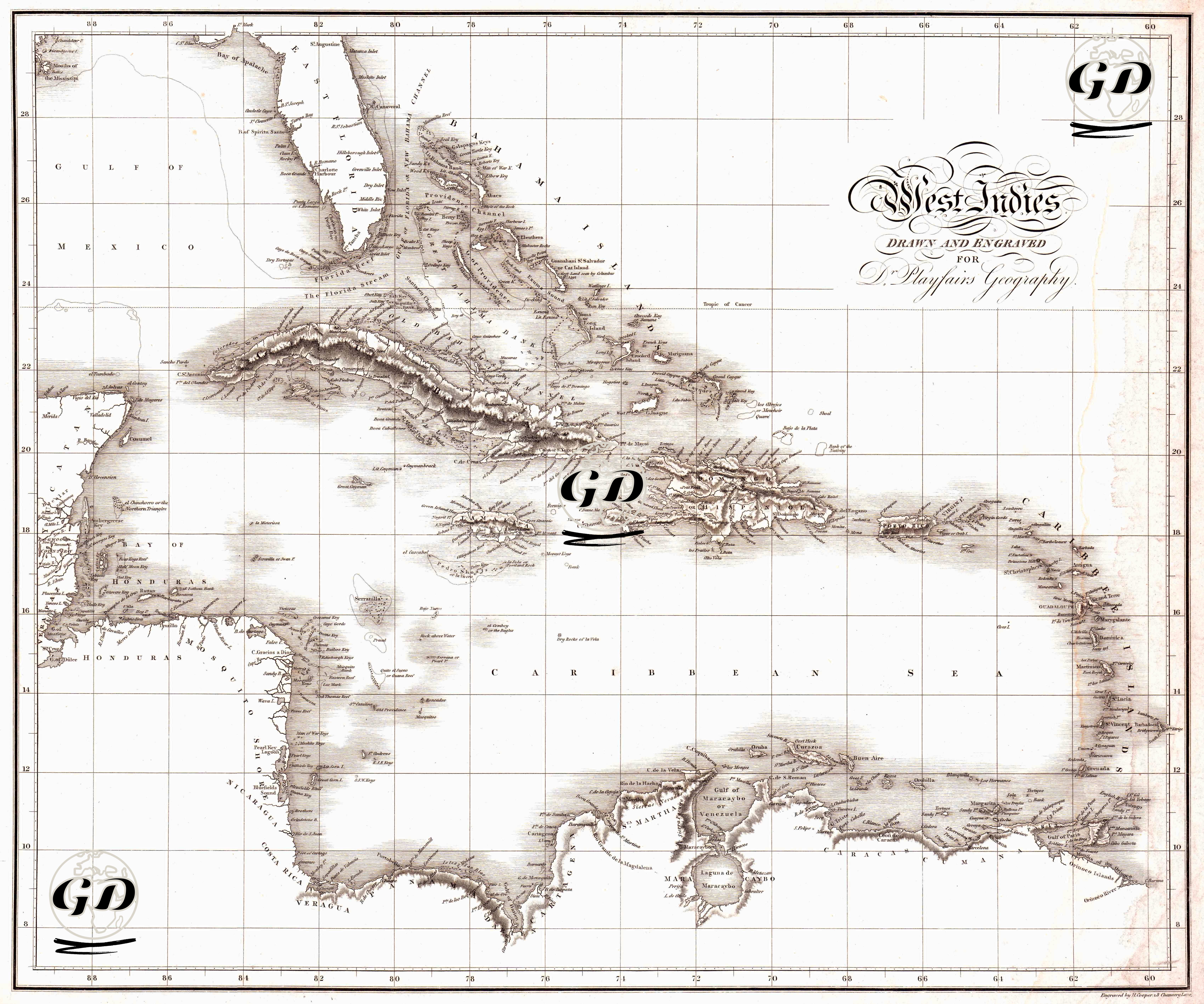
This engraved map, measuring 54 × 46 cm, is a geopolitical and physical map of the Caribbean prepared in 1814 for Dr. Playfair’s Geography. The map shows the Greater Antilles and Lesser Antilles in detail. Centered on the Caribbean Sea, it depicts the line encompassing Cuba, Hispaniola (Santo Domingo), Jamaica, Puerto Rico, the Lesser Antilles chain, and, with an emphasis on “adjacent countries,” the Central American coast (particularly the Honduras-Veragua area) and the North-South American coastline (Venezuela–Guiana line). The map is a rich and aesthetically pleasing document reflecting the geographical and political structure of the Caribbean during the colonial era. The map's language, through the balanced use of latitude-longitude grids and terrestrial-marine spaces, creates a “measurable” spatial composition, while the hachure and coastal hatching techniques, which highlight the island spines and coastal forms, make the elevation zones, especially in Cuba and Hispaniola, legible.