GRAVÜR DÜNYASI
Digital Engraving Library
| Artist | James Playfair (1738-1819) |
| Engraver | Samuel John Neele (1758-1824) |
| Date | 1814 |
| Technique | Copper engraving |
| Category | Maps |
| Source | A New General Atlas, Ancient and Modern by James Playfair |
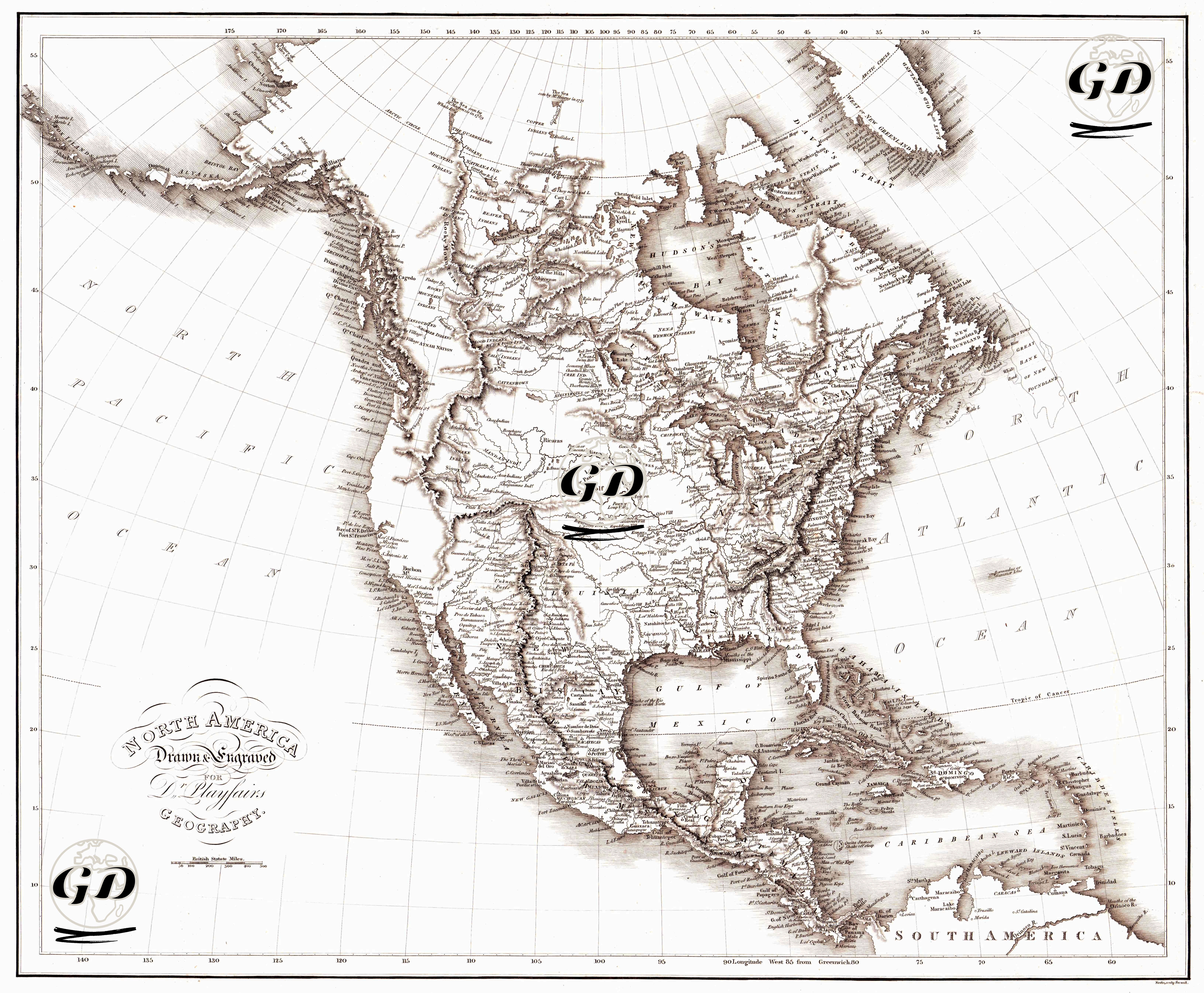
This engraved map, measuring 54 × 46 cm, is a geopolitical and physical map prepared in 1814 for Dr. Playfair’s Geography. The engraving illustrates the Eurocentric geographical knowledge and political boundary perceptions of the North American continent in the early 19th century. The map presents the reshaped borders of the American continent after the Revolutionary War (1776) and the Louisiana Purchase (1803) from a European colonial perspective. Canada was still a British colony, Mexico had not yet gained independence, and the western borders of the United States were still being defined by expeditions (particularly the Lewis-Clark expeditions, 1804-1806). Therefore, the western regions of the continent are sparsely marked with place names and densely represented by hachures. The map was prepared using the hachure technique, which was widely used in scientific cartography of that period. This method allows mountainous areas to be shaded, creating a three-dimensional effect of elevation differences. The map is prepared according to the Greenwich meridian, with location references determined by both longitude and latitude lines. River systems, mountain ranges, and coastlines are particularly highlighted. Hudson Bay in the north of the continent, the Rocky Mountains in the west, and the Gulf of Mexico in the south are depicted in detail. Place names and boundaries represent a "post-discovery" geography for European cartographers of the time. Therefore, the lands of indigenous peoples were left as "empty spaces" or "undefined areas."