GRAVÜR DÜNYASI
Digital Engraving Library
| Artist | James Playfair (1738-1819) |
| Engraver | Samuel John Neele (1758-1824) |
| Date | 1814 |
| Technique | Copper engraving |
| Category | Maps |
| Source | A New General Atlas, Ancient and Modern by James Playfair |
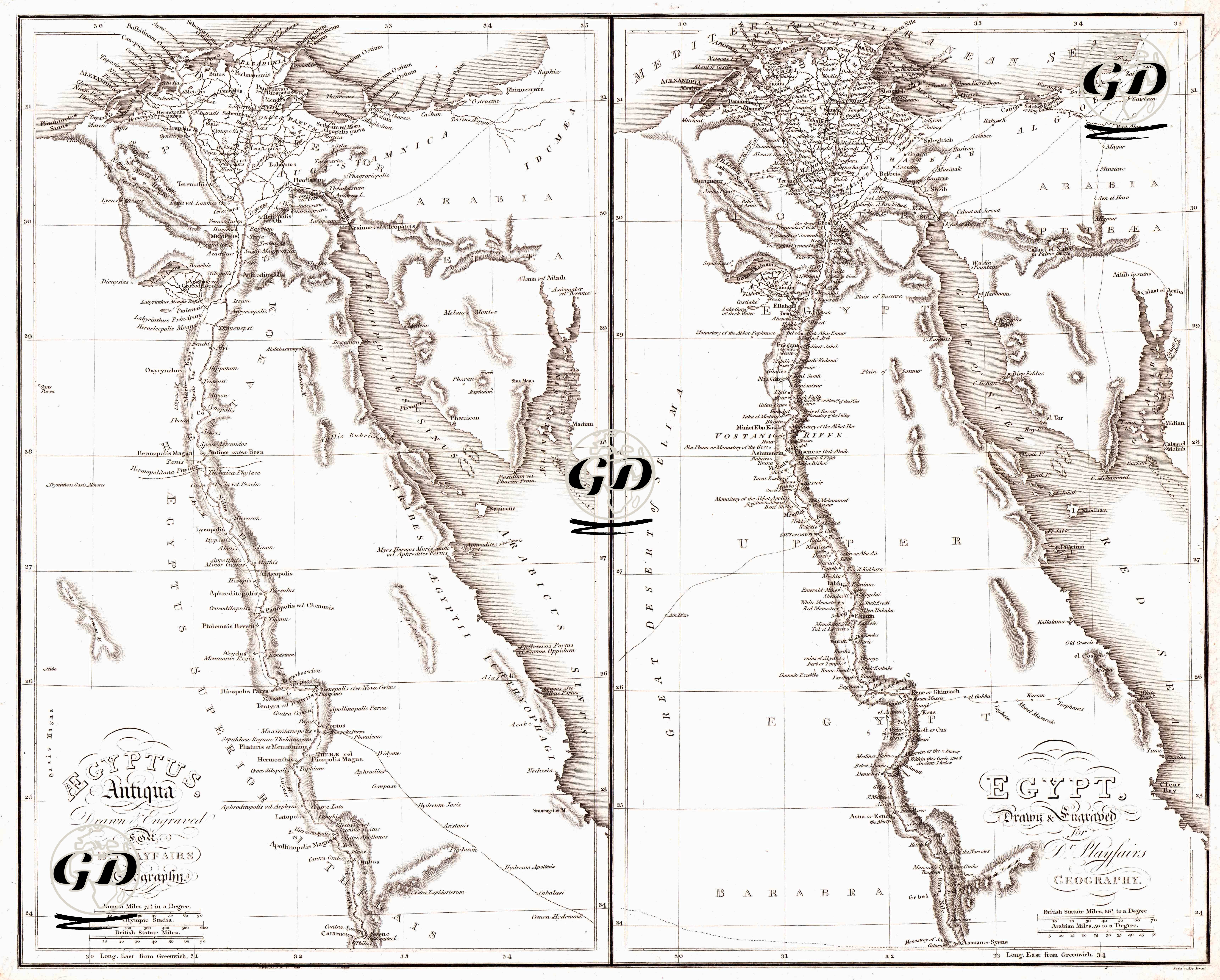
This two-part map, measuring 54 × 46 cm, is a historical and physical comparison map prepared for Dr. Playfair’s Geography in 1814. The left panel, titled “Aegyptus Antiqua,” depicts Ancient Egypt, while the right panel, titled “Egypt,” presents Egypt (along with its immediate surroundings) side-by-side within the same geographical framework. Both maps feature the Nile River and its delta as the main backbone. Natural boundaries such as the Mediterranean coast, the Sinai Pass, and the Red Sea line are used as key reference points for understanding settlements and potential transit routes on the map. These two maps show the historical development of Egypt in a comparative manner, side-by-side, in both ancient and modern contexts. The left panel (Aegyptus Antiqua) reflects the geography of Ancient Egypt. Here, classical cities such as Thebes, Hermopolis, and Memphis, as well as pyramid areas along the Nile Valley, are depicted in detail. Place names are given according to ancient Greco-Roman sources, and the units of measurement used are "Roman Miles" and "Olympic Stadia". This highlights the ancient settlement patterns, temple centers, and prehistoric routes of Egypt. The right panel (Egypt) represents contemporary Egypt in the early 19th century. The Nile Delta and its surroundings are redrawn according to the urbanization and transportation networks of that period. Here, the "British Miles" scale is used, marking a transition to modern geographical terminology. The sacred centers of antiquity have been replaced by the commercial and administrative centers of the era (e.g., Cairo, Alexandria, Asyut). Therefore, the fundamental historical difference between the two panels is the transition from the religiously and symbolically centered settlement structure of the ancient world to the measurable, administratively and transportation-oriented spatial organization of the modern era. The map, in keeping with the style of early 19th-century atlases, uses a coordinate-grid system and longitude information relative to Greenwich to make the space "measurable" and comparable. Mountainous areas and coastlines are indicated using the hachure technique. This makes the character of the terrain, especially in desert regions and valleys, easier to understand.