GRAVÜR DÜNYASI
Digital Engraving Library
| Artist | James Playfair (1738-1819) |
| Engraver | Samuel John Neele (1758-1824) |
| Date | 1814 |
| Technique | Copper engraving |
| Category | Maps |
| Source | A New General Atlas, Ancient and Modern by James Playfair |
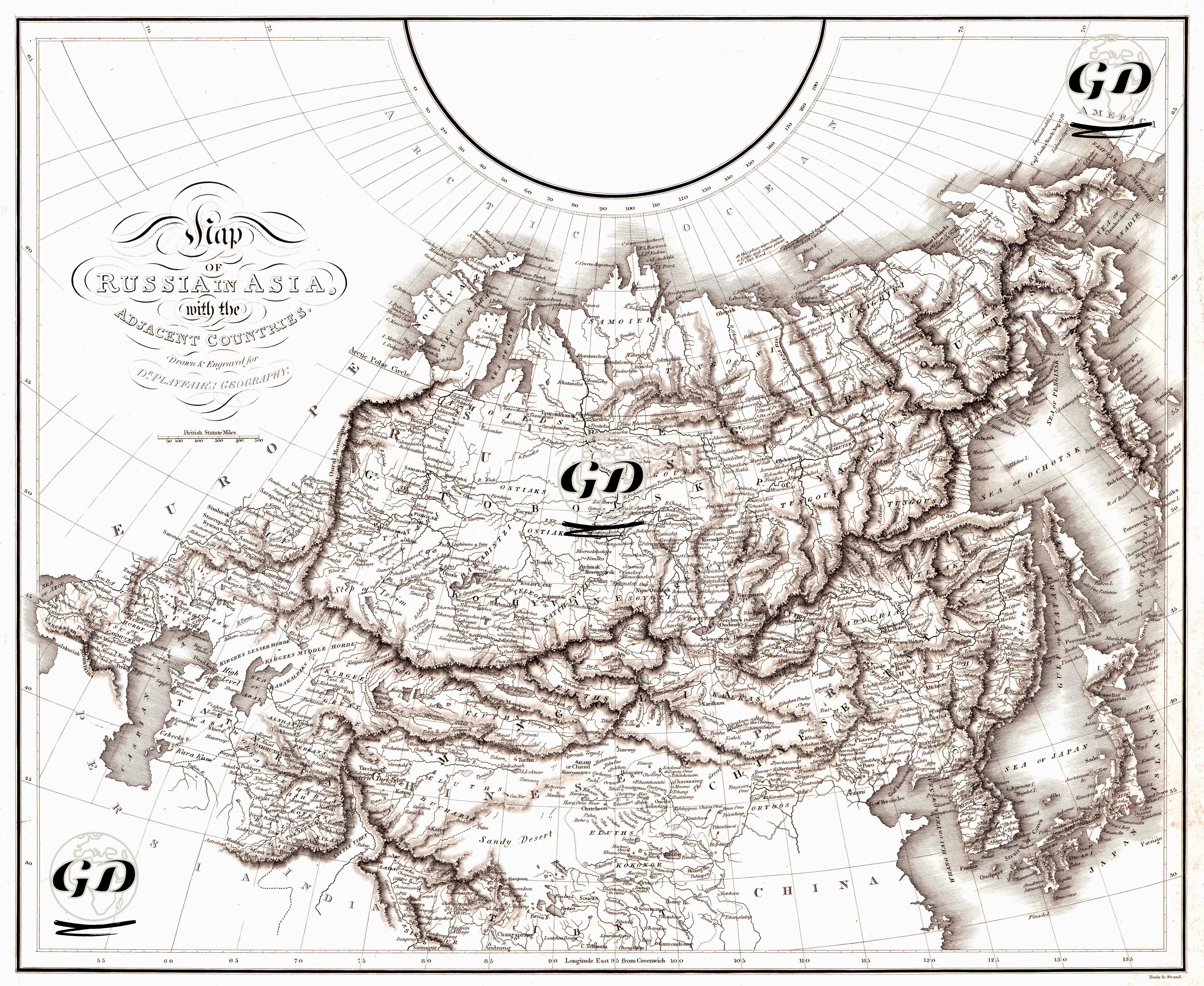
This engraving is a 54 × 46 cm geopolitical and physical map drawn and etched by Samuel John Neele in 1814 for Dr. Playfair’s Geography. It is part of a series of atlases published by P. Hill and T. Underwood. The engraving comprehensively depicts the Asian territories of Imperial Russia (including Siberia, Central Asia, the Caspian region, the Caucasus, and the Far East). It also shows its borders with the Ottoman Empire to the west, Iran to the south, and China and the Sea of Japan to the east. The map was produced in the early 19th century, a period of rapid Russian expansion into Central Asia. This coincides with the beginning of the Great Game, a rivalry between Britain and Russia for dominance in Central Asia. Therefore, such maps not only provided geographical information but also served as a means of gathering information for imperial exploration, trade routes, and military strategy. The map depicts mountainous areas and elevations using the hachure (hatching) method, which became widespread in the early 19th century. This allows the topography, from the Urals to the Altai Mountains, from the Pamir Plateau to the mountain ranges on the Chinese border, to be rendered with an almost three-dimensional effect. River systems (Ob, Yenisei, Lena, Amur) and lakes (Baikal, Aral, Balkhash) are clearly shown. The inclusion of the polar projection in regions near the North Pole makes the map meaningful not only within a regional but also within a global coordinate system. The use of both British Statute Miles and Russian Versts as scales demonstrates its appeal to a multifaceted target audience, both scientific and political.