GRAVÜR DÜNYASI
Digital Engraving Library
| Artist | Ernst Georg Ravenstein (1834-1913) |
| Date | 1877 |
| Technique | Woodblock Engraving (Newspaper-Text on Reverse) |
| Category | Maps |
| Source | The Illustrated London News (May 5 1877-Page 429) |
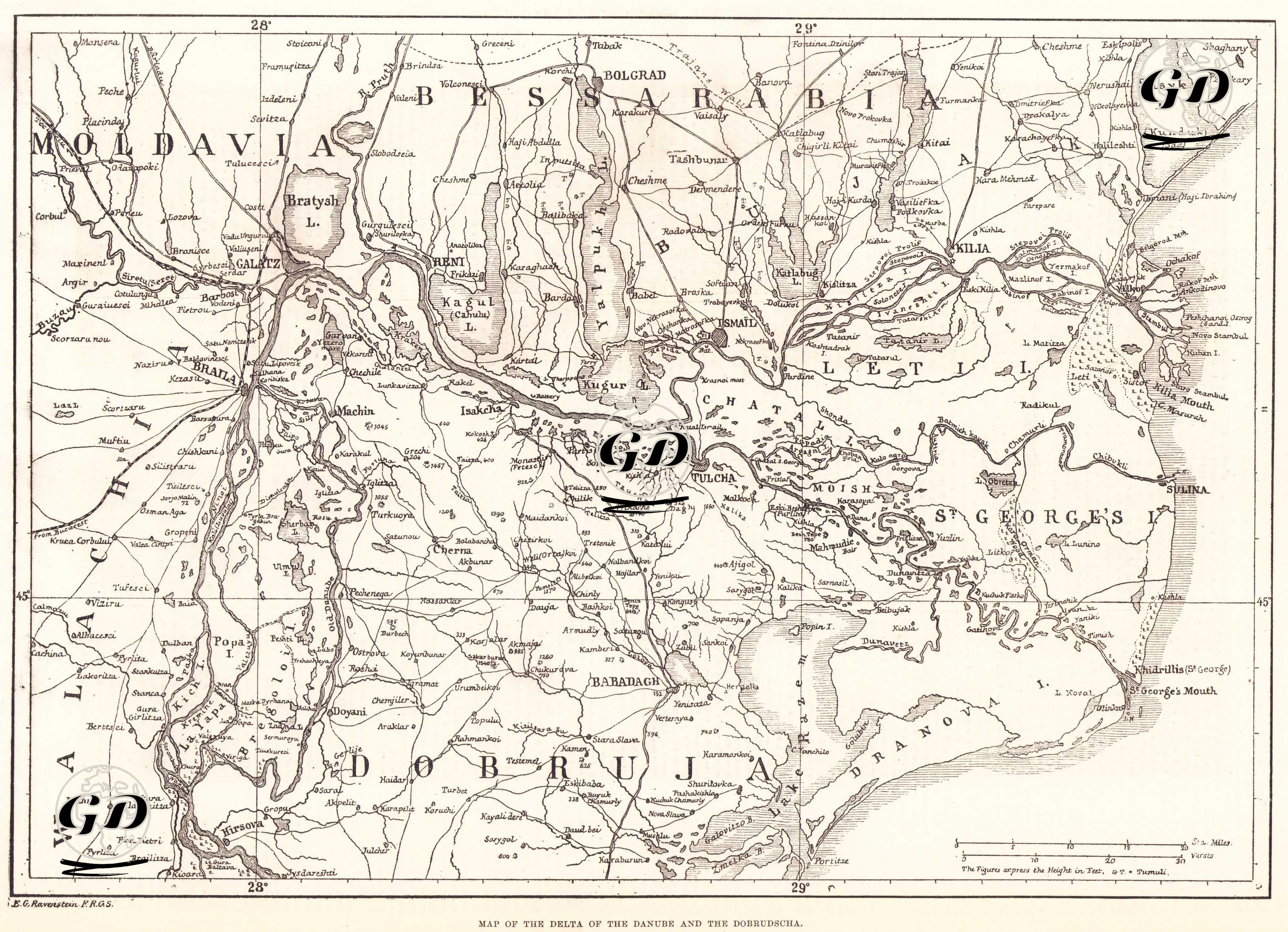
This map engraving, published in The Illustrated London News on May 5, 1877, depicts in detail the Danube River Delta and the Dobruja region, one of the most critical geographies of the 1877-1878 Russo-Turkish War. The map is a strategic cartographic study prepared to inform European public opinion at the outset of the war, detailing military elements such as the Russian army's potential crossing of the Danube, Ottoman defensive lines, river mouths, marshes, logistics routes, and garrison towns. The engraving depicts the Danube's three main tributaries, the Kilia (Kilya), St. George's (Sfantu Gheorghe), and Sulina, in all their intricate detail, clearly reflecting the strategic challenges of this multi-branch delta system, which played a crucial role in naval movements and supply lines during the war. The border regions of Bessarabia, Moldavia, Wallachia, and Ottoman-ruled Dobruja are depicted in accordance with the political geography of the period. Furthermore, military centers such as Galați, Braila, Ismail, Tulcea, Machin, Babadağ, Constanta, and Sulina are also located.