GRAVÜR DÜNYASI
Digital Engraving Library
| Date | 1877 |
| Technique | Lithography-Colored |
| Category | Maps |
| Source | The Mediterranean Illustrated, Picturesque Views and Descriptions of its Cities, Shores and Islands - London, T.Nelson and Sons, Paternoster Row, Edinburgh and Newyork |
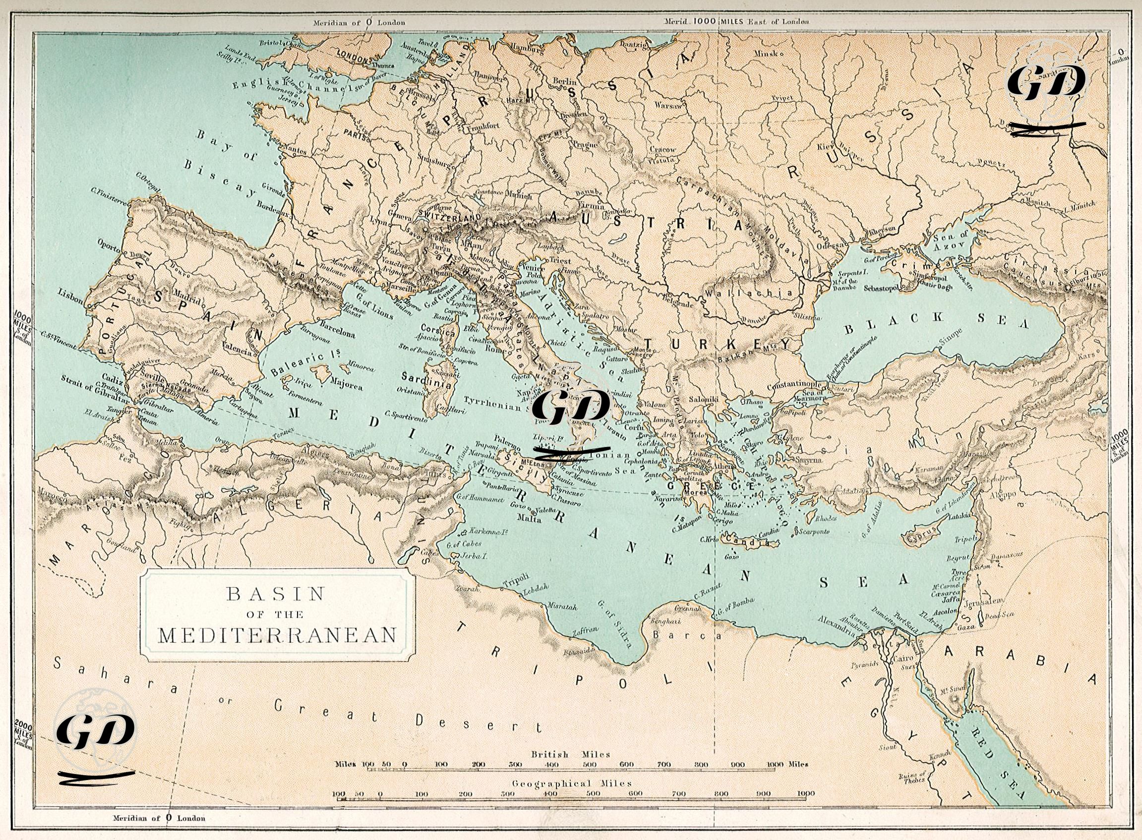
This map, printed in 1877 using the color lithography technique, reveals the natural unity and strategic importance of the Mediterranean Basin. This area, which is the meeting point of three continents (Europe, Africa, Asia), has been the scene of trade, cultural interaction, war, and the birth of civilizations throughout history. The Mediterranean’s feature of being an inland sea and the fact that many states are coastal are embodied in the dense markings of ports and cities on the map. This map, which shows the borders and major cities of the states surrounding the Mediterranean, also presents the names of the seas, ports on the coastline, and geographical formations in detail. The map is a product of the British cartographic tradition, and Greenwich is taken as the meridian. Historically, this map points to a period when the Ottoman Empire still ruled vast lands, but the balance of power in Europe was changing.