GRAVÜR DÜNYASI
Digital Engraving Library
| Date | 1857 |
| Technique | Woodblock Engraving (Newspaper-Text on Reverse) |
| Category | Maps |
| Source | The İllustrated London News (June 6 1857) |
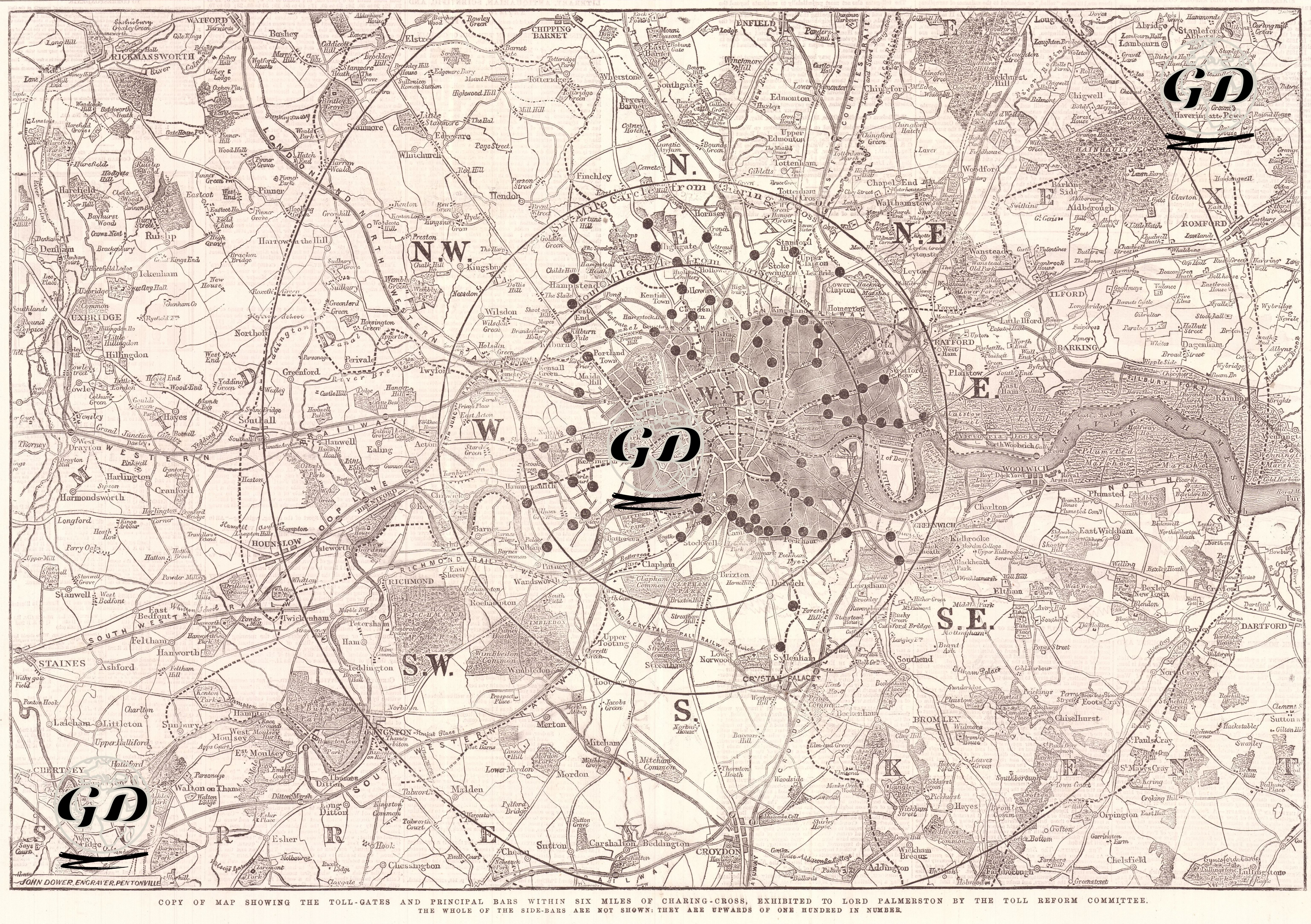
This map shows toll gates and barricades on main roads in a six-mile radius from Charing Cross, centered on 19th-century London. As stated in the note at the bottom of the map, this visual material was prepared by the Toll Reform Committee to be presented to Lord Palmerston, the British Home Secretary at the time. The black dots on the map represent toll gates, and are divided into eight zones in different directions (N, NE, E, SE, S, SW, W, NW), highlighting how traffic was cut off from the main directions. The regional markings in the center, such as “W.E.C” and “C.E.C”, represent the central areas of London (West End, City, etc.). The aim of the map is to demonstrate that there were many toll gates on the roads extending from the city center to the outskirts, and that this situation posed a serious economic burden to the public. This type of intensive toll system was a major problem, especially for the working class and those involved in transportation. In terms of historical context, this map is an important document in the critique of transport policies in Victorian London. At that time, as the city grew, such roadblocks and toll systems were common to maintain the roads. However, over time, demands for reform of this system increased because it both hindered commercial activity and created public dissatisfaction. The map is valuable in shedding light on both the history of urban planning and social reform movements. These early critiques of urban transport later influenced the development of rail systems and the expansion of municipal services in London.