GRAVÜR DÜNYASI
Digital Engraving Library
| Date | 1848 |
| Technique | Copper Engraving |
| Category | Maps |
| Source | Tartarie, Beloutchistan Boutan et Nepal par M.Dubeux - Afghanistan, par M.Xavier Raymond - Firmin Didot Freres (Paris) |
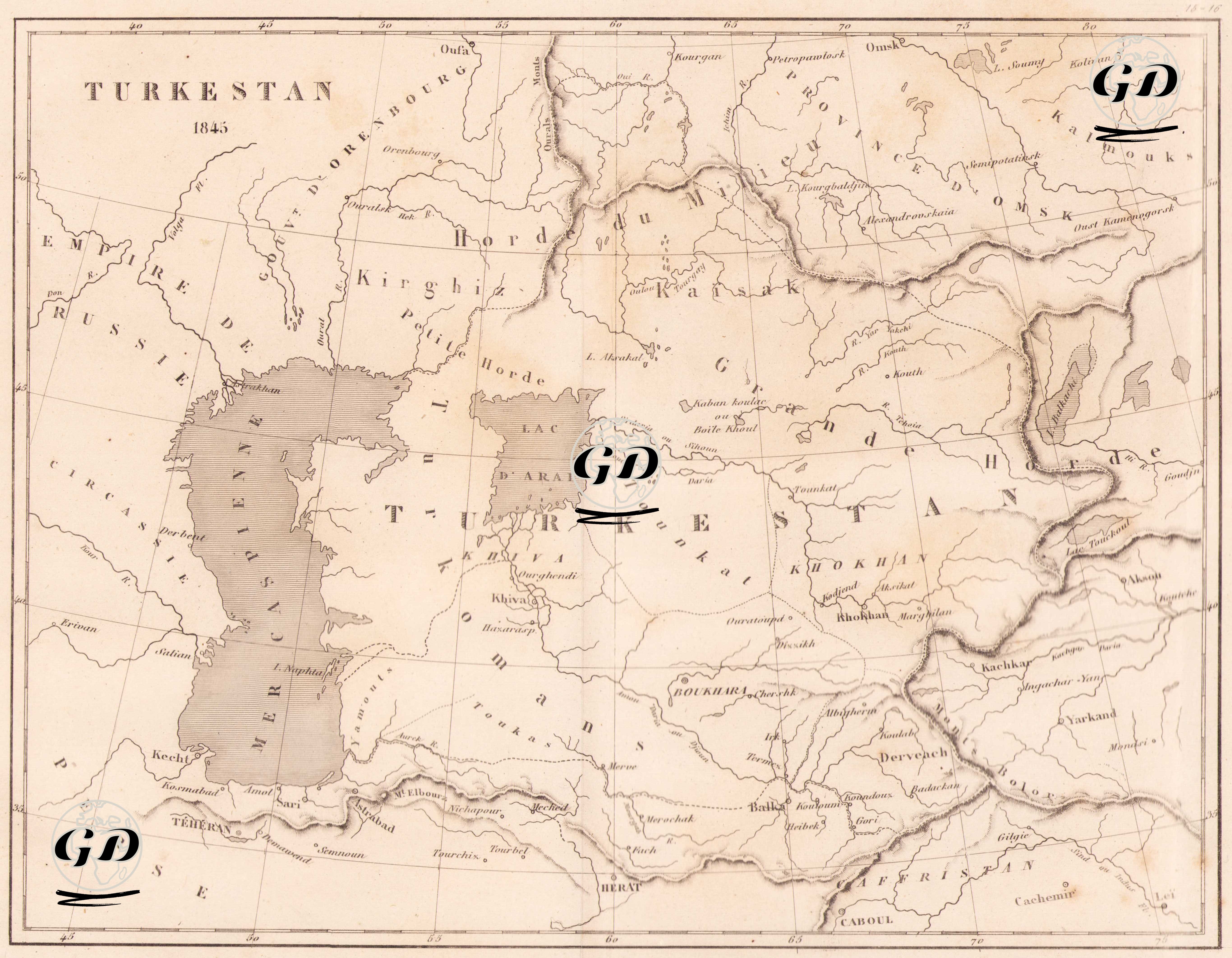
This map is a rare engraving from 1845 titled "Turkestan" and reflects the political and geographical appearance of Central Asia in the 19th century. The map shows the Caspian Sea (Mer Caspienne) to the west, the borders of the Russian Empire to the northwest, and the East Turkestan region close to the Chinese borders to the east; and Iran (Perse) and Afghanistan (with settlements such as Herat and Caboul) to the south. In the center of the map, many regions and ethnic groups are shown under the general name "Turkestan": "Kirghiz Horde" (Kyrgyz communities), "Karakalpak", "Khokhan" (Kokand), "Kashgar" (Kashgar), "Yarkand" (Yarkand), "Bokhara" (Bukhara), "Khiva" (Khiva) are notable for important khanates and cities. Important water sources such as the Aral Sea (Lac d’Aral), the Caspian Sea, the Sir Darya and the Amu Darya (ancient Oxus) were included on the map as basic elements in determining both borders and settlements. The map was prepared by French or Western cartographers of the period and shows the living spaces of nomadic communities and the areas of influence of the khanates, along with the lines separating the ethnographic groups in the region (e.g. Uzbeks, Turkmens, Kazakhs, Kyrgyz). In addition, the geographical locations and political borders of the Bukhara, Khiva and Kokand khanates provide a historical background for understanding Russia's imperial expansion in these regions in the following years.