GRAVÜR DÜNYASI
Digital Engraving Library
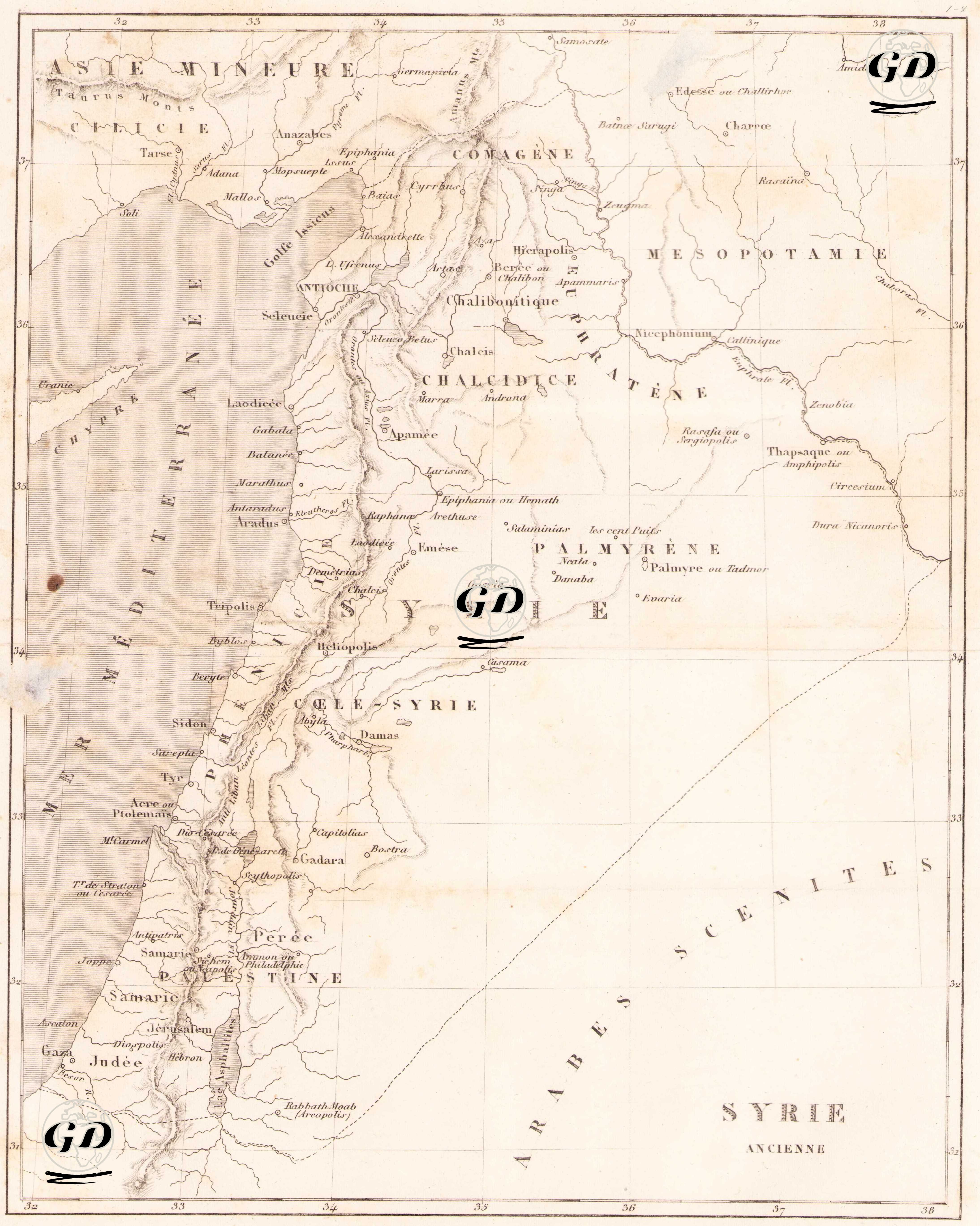
| Date | 1848 |
| Technique | Copper Engraving |
| Category | Maps |
| Source | Syrie Ancienne et Moderne, par M.Jean Yanoski - Firmin Didot Freres (Paris) |
This map is titled “Ancienne Syria” or “Ancient Syria” and is a historical geographic map depicting the Levant region and its surroundings in ancient times. The map extends from the Mediterranean coast to Mesopotamia in the east, and to the south of Asia Minor (Asie Mineure) in the north; and includes Palestine, Judea (Yehuda) and its surroundings in the south. The ancient city names on the map—such as Antioch, Damas, Palmyre, Hierapolis, Laodicea and Héliopolis—indicate Roman and Hellenistic settlements. Also marked on the map are ancient provinces and ethnic regions such as Commagene, Chalcidice, Galilee, Idumee, Judaea, Commagene and Syrie Seconde, which were shaped under Seleucid and Roman rule. In the east, cities such as Osroene, Charræ (Harran) and Nisibis (Nusaybin) around the Euphrates provide access to the Mesopotamian region. The map also includes important ancient trade and cult centers such as Tarse (Tarsus), Zeugma, Apamee (Afamia), and Emèse (Humus). The island of Kypros (Cyprus) on the Mediterranean Sea is also drawn on the left side of the map. Cartographic signs, along with ancient river courses and mountain ranges, reveal the importance of settlements and the natural barriers of the region. This map is a resource especially for the Roman Empire and Hellenistic Period research and contributes to the understanding of the political geography of that period. Compared to modern countries, it shows an area covering today's Lebanon, Syria, Jordan, Israel and southeastern Turkey.