GRAVÜR DÜNYASI
Digital Engraving Library
| Date | 1882 |
| Technique | Woodblock Engraving-Colored (Newspaper-No Text on Reverse) |
| Category | Maps |
| Source | The Graphic (September 23 1882) |
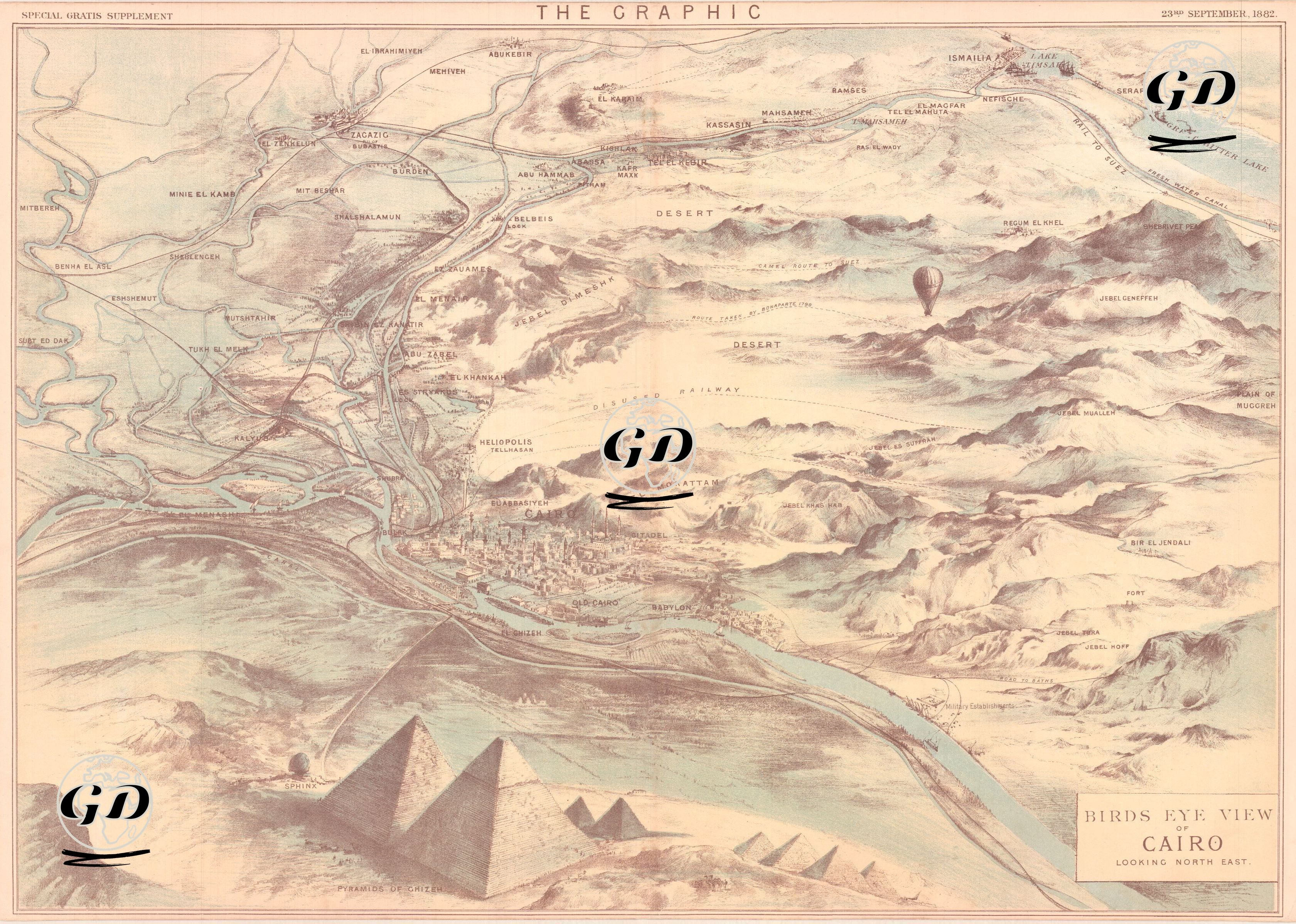
This impressive bird's eye view map was published as a supplement to The Graphic newspaper on September 23, 1882, and presents a visual panorama of Cairo, the capital of Egypt, from the northeast. The Anglo-Egyptian War was a short-lived but far-reaching war between England and Egypt, which took place between July and September 1882. In this war, England effectively occupied Egypt, thus taking control of the Suez Canal and the Nile Delta, thus consolidating its influence over Egypt. The map depicts the detailed topography of Cairo, the Nile River, the pyramids, railway lines and British military movements, along with a balloon observation scene. This bird's eye view engraving, drawn with high art technique, was prepared to make strategic areas understandable to the public and readers during the period of British intervention in Egypt. Areas such as the Giza Pyramids, the Sphinx, Old Cairo, Heliopolis (el-Matariyye), Bab el-Luk and Abbassiye are detailed, and important military routes in the Egyptian desert geography are highlighted. The canal zone, Ismailia and the route of the Suez Canal were also shown at the top of the map, drawing attention to this region, which was important for Britain's strategic interests.