GRAVÜR DÜNYASI
Digital Engraving Library
| Date | 1884 |
| Technique | Woodblock Engraving-Colored (Newspaper-No Text on Reverse) |
| Category | Maps |
| Source | The İllustrated London News, Supplement (July 12 1884) |
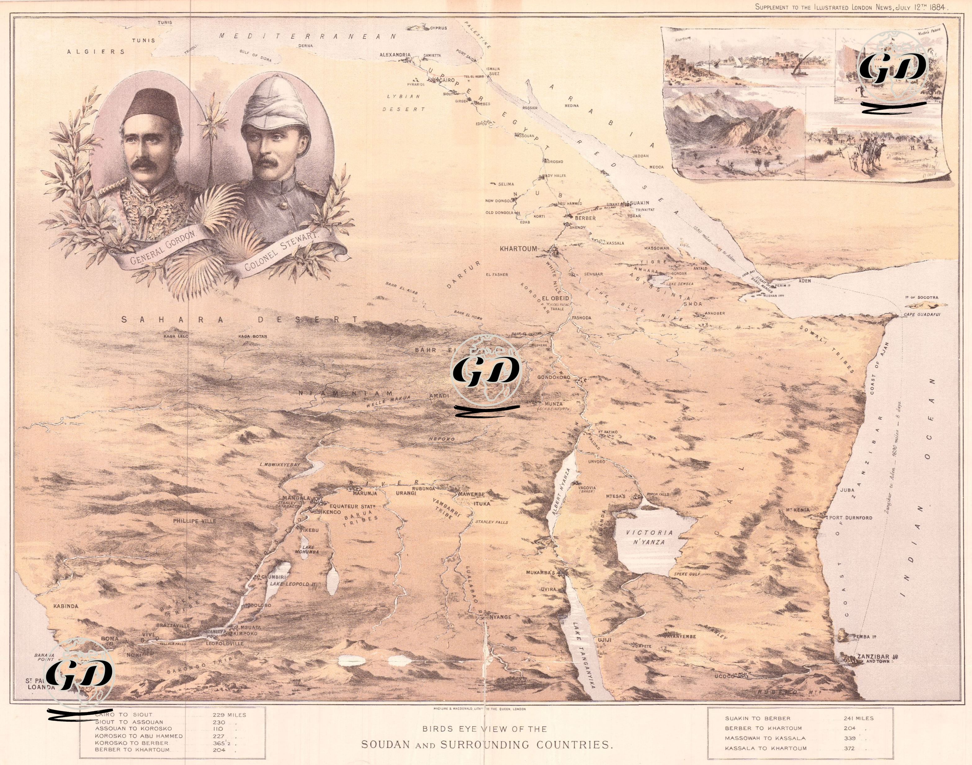
This bird's eye map was published as a supplement to The Illustrated London News on 12 July 1884 and provides a detailed description of Sudan and its surrounding areas. The map is a visual representation of the military and political presence of the British Empire in Africa in the last quarter of the 19th century and the British military intervention during the Mahdi uprising. In the upper left corner are portraits of General Charles Gordon and Colonel Herbert Stewart. Both officers were tasked with maintaining Egyptian rule in the Sudan on behalf of the British administration and suppressing the Mahdi uprising initiated by Muhammad Ahmed al-Mahdi. They were killed by Mahdist forces in the early months of 1885; this event had a great impact on the British public. The map covers the Nile River line from Egypt to Khartoum and a wide area from the Sahara Desert in the west to the Red Sea coast in the east. The geographical details are richly described in terms of both topographical features and strategic roads, and important cities, military passes and river routes are meticulously shown. There are also four small illustrations in the upper right corner of the map. These are the Capital of Sudan, Khartoum, the Administration and Military Headquarters Building in Khartoum, the Karaza Pass in the Kordofan Region, and El Obeid City. The map, which uses colored lithography techniques, lists the distances from Egypt to the interior of Sudan in miles at the bottom, which shows that the map was used both in military operation planning and public information.