GRAVÜR DÜNYASI
Digital Engraving Library
| Artist | John Tallis (1817-1876) |
| Engraver | John Rapkin (1815-1876) |
| Date | 1862 |
| Technique | Lithography-Original Hand Colored |
| Category | Maps |
| Source | The London Printing and Publishing Company Limited |
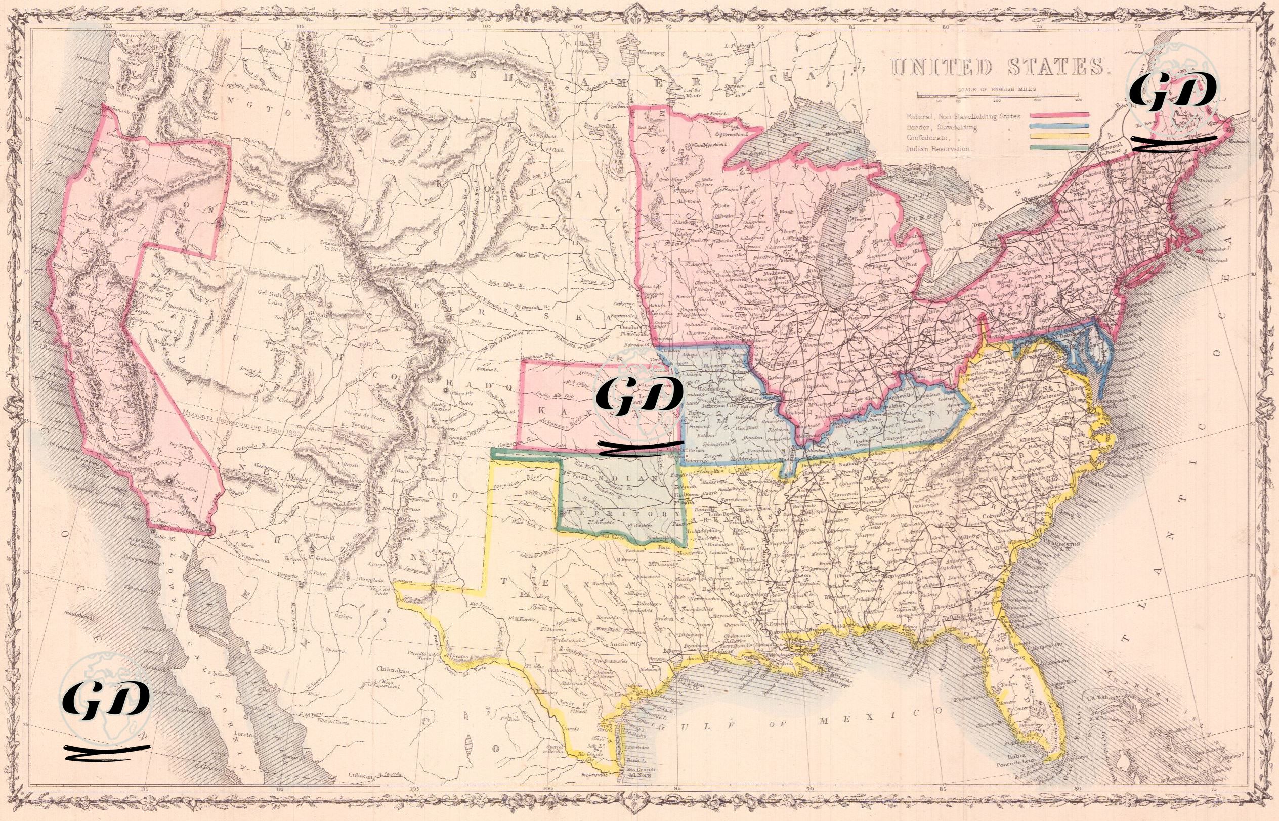
This map is from the American Civil War, and geographically reflects the political and social divisions of the United States at that time. The map shows the complex political structure of the period by separating the states and territories with various colors. The pink states in the north were federal states that banned slavery; these regions were more industrialized, developed with trade, and consisted of societies that were more open to modernization. The blue states were federally governed but allowed slavery. The yellow states in the south were pro-slavery regions of the Confederate States of America and were largely dependent on agricultural production based on slave labor. The map also shows lands reserved for indigenous peoples (especially the present-day Oklahoma region) marked with green borders; these regions are notable as lands to which Native American tribes were forcibly displaced. Western regions, such as states such as California and Oregon, had definite borders but were not yet densely populated; while regions such as Kansas, Nebraska, Utah and New Mexico were not yet states and were shown as federally controlled lands expanding westward in line with the doctrine of “Manifest Destiny”, which was American expansionism. The map is a document that visualizes not only geographical borders but also ideological conflicts such as slavery, states’ rights and federal authority. In this respect, it is extremely valuable in understanding the causes of the American Civil War, the parties and the areas in which the war took place.