GRAVÜR DÜNYASI
Digital Engraving Library
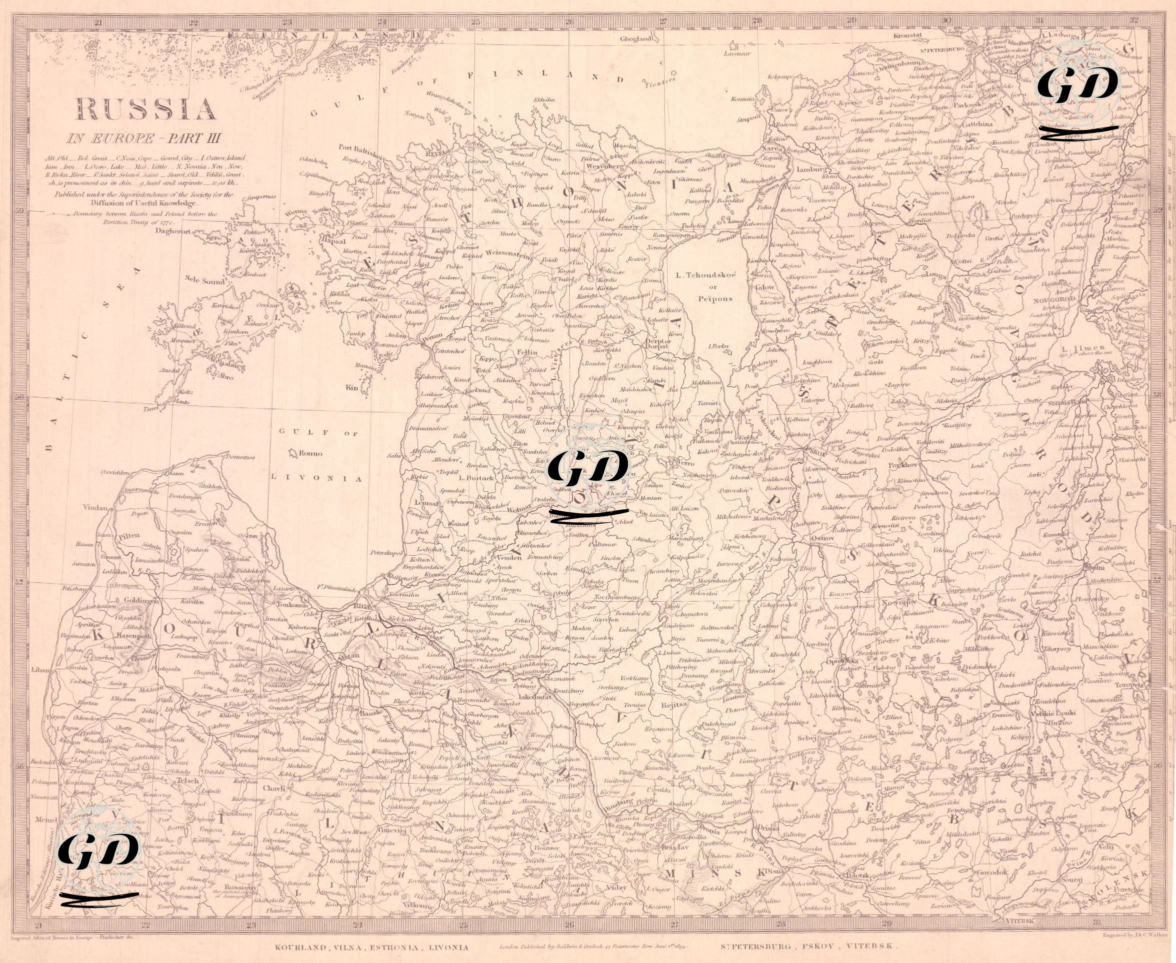
| Engraver | J. & C.Walker (Active 1820-1895) |
| Date | 1834 |
| Technique | Copper Engraving |
| Category | Maps |
| Source | Published Under the Supervision of the Society for the Diffusion of Useful Knowledge (SDUK)-London, Published by Baldwin & Cradock 47 Paternoster Row, June 1 1834 |
This map is a detailed geographical document published in 1834 under the title "Russia in Europe - Part III". The map focuses on the northwestern borderlands of the Russian Empire, showing in detail the Baltic region, the Gulf of Finland, Estonia, Latvia, Livonia, Pskov, Vitebsk and the surrounding area of St. Petersburg. The Baltic Sea (Gulf of Livonia) and the Gulf of Riga are on the left side of the map, while the Gulf of Finland and the southern coast of Finland are in the northwest. Important cities and ports of the period, such as Reval (Tallinn), Riga, Dorpat (Tartu), Pskov, Narva, Wenden, Mitau, Wesenberg, Kronstadt and St. Petersburg are clearly marked. The old German or Latinized forms of the cities seen on the map are in accordance with the Eurocentric cartographic tradition of the period. This map details the political, administrative and geographical situation of the Estonian and Latvian regions, namely the duchies of Estonia, Livonia and Courland, where the Baltic Germans were dominant. These regions were the gateway to the Russian Empire to the West and were of great economic, cultural and military importance. In addition, Russia's northwestern hinterland, centered in Petersburg, was of strategic importance to the Baltic Navy. The map presents geographical details such as rivers (e.g. Narva River), lakes (Chud Lake - Peipus), forested and mountainous areas, with cities marked according to their density of population, making it an important document not only in terms of politics but also natural geography.