GRAVÜR DÜNYASI
Digital Engraving Library
| Engraver | J. & C.Walker (Active 1820-1895) |
| Date | 1835 |
| Technique | Copper Engraving |
| Category | Maps |
| Source | Published Under the Supervision of the Society for the Diffusion of Useful Knowledge (SDUK)-London, Published by Baldwin & Cradock 47 Paternoster Row, July 1 1835 |
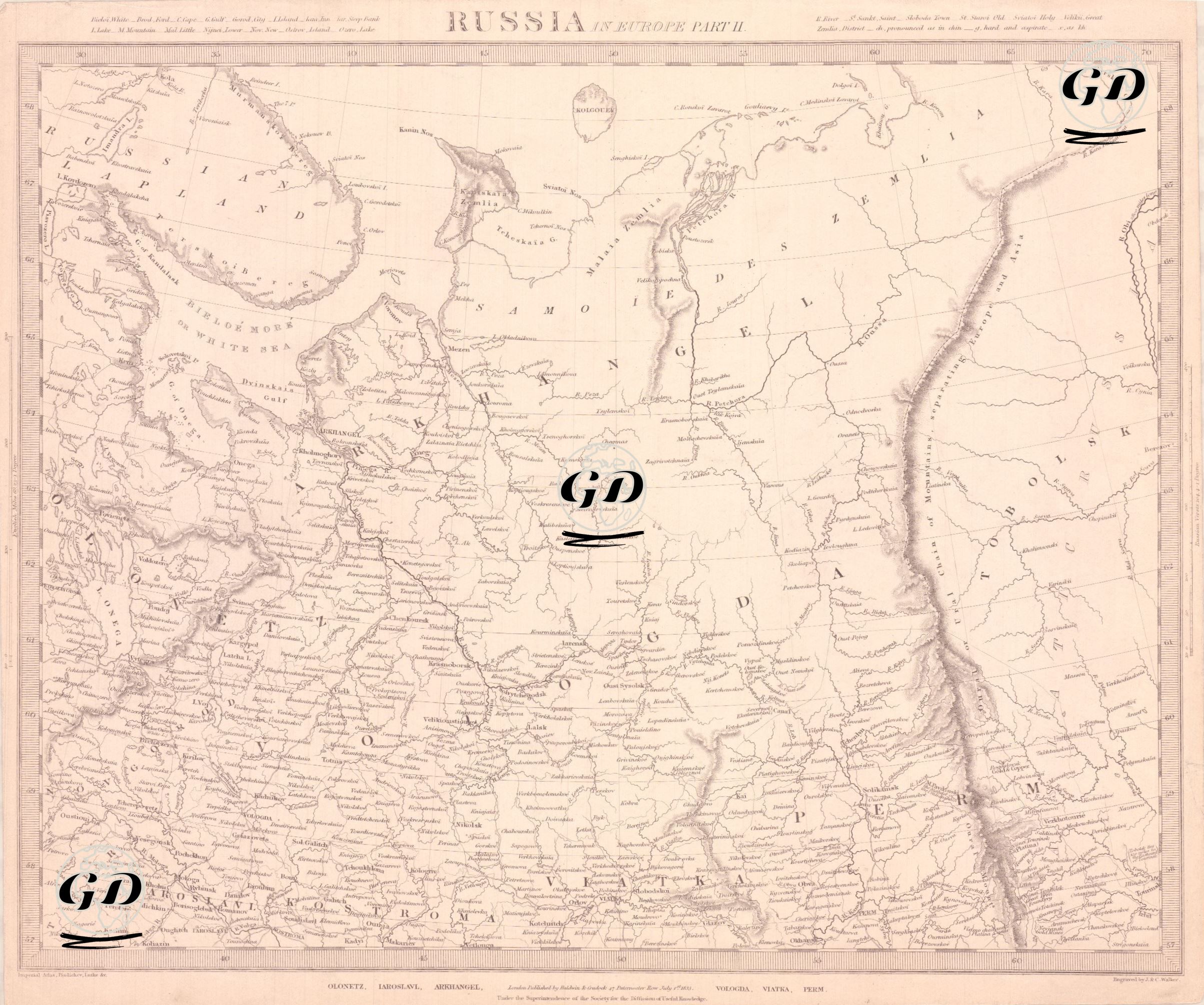
This map is a detailed geographical document published in 1835 under the title “Russia in Europe – Part II”. The map covers the northeastern and eastern parts of the Russian Empire in Europe. The map shows the White Sea in the north, the Gulf of Finland in the northwest, the Ural Mountains in the east, and the middle and lower reaches of the Volga River in the south. Major Russian provinces such as Arkhangelsk, Vologda, Novgorod, Tver, Kostroma, Yaroslavl, Vladimir, Nizhny Novgorod, Kazan, Viatka, and Perm are shown in detail. These regions reflect both the administrative structure and the ethnographic diversity of the 19th century Russian Empire. The Ural Mountains mark the eastern border of the map, and these mountains are considered the natural border between Europe and Asia. The cities along the Volga River are shown to emphasize the importance of this region in terms of trade, transportation, and population density. Also on the map are visible the Komi region, the Udmurt lands and areas inhabited by other Finno-Ugric peoples, which gives the map not only a geographical, but also an ethnographic dimension. Topographic details include mountain ranges, river networks, and forest areas; population centers are marked by size. The map is historically valuable because it provides detailed information about the Russian interior that is rare in Western European sources.