GRAVÜR DÜNYASI
Digital Engraving Library
| Engraver | J. & C.Walker (Active 1820-1895) |
| Date | 1832 |
| Technique | Copper Engraving |
| Category | Maps |
| Source | Published Under the Supervision of the Society for the Diffusion of Useful Knowledge (SDUK)-London, Published by Baldwin & Cradock 47 Paternoster Row, Dec. 15 1832 |
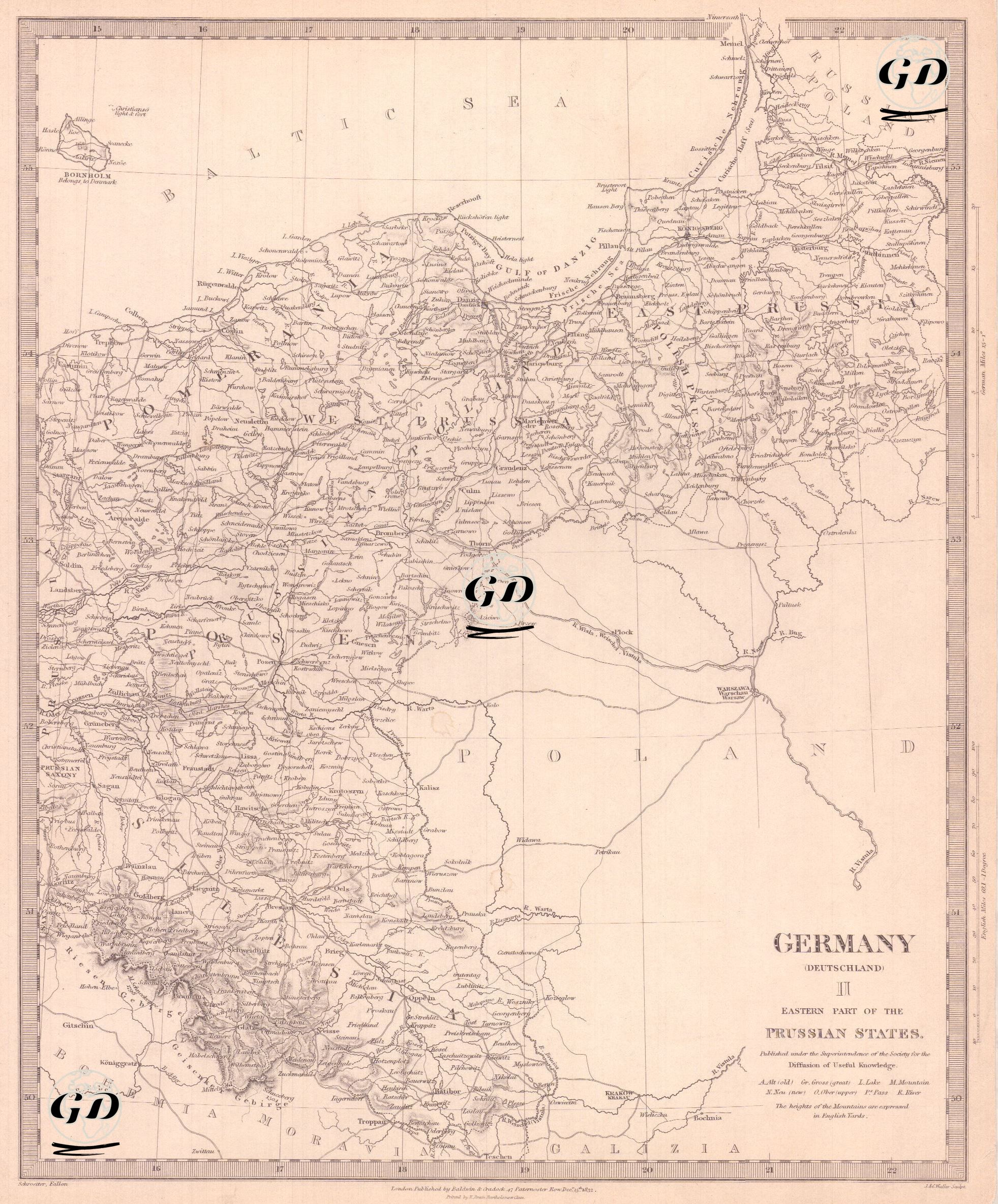
This map, dated 1832 and published by the Society for the Diffusion of Useful Knowledge (SDUK), was prepared with the title "Germany (Deutschland) II – Eastern Part of the Prussian States" to reflect the detailed geographical structure of the eastern provinces of Prussia. It is a continuation of the other map in the same series covering western Germany. Key Prussian regions such as East Prussia, West Prussia, Posen, and Silesia are clearly shown on the map. In addition, lands overlapping with the northern and western parts of today's Poland are within the borders of Prussia at the time, revealing the border confusion in Central Europe before the German Empire. Important cities such as Danzig (Gdańsk), Königsberg (Kaliningrad), Thorn (Toruń), and Breslau (Wrocław) are clearly marked on the map. The Baltic Sea is outlined on the map to the north, the border of the Russian Empire to the east, Galicia and the Austrian Empire to the south, and the western provinces of Prussia to the west. The routes of major rivers, especially the Vistula (Weichsel) River, and railway lines are also carefully worked out. The region seen on the map is important both in terms of the reshaping of the European map after the Napoleonic Wars and in terms of the key role that Prussia played in the unification of Germany.