GRAVÜR DÜNYASI
Digital Engraving Library
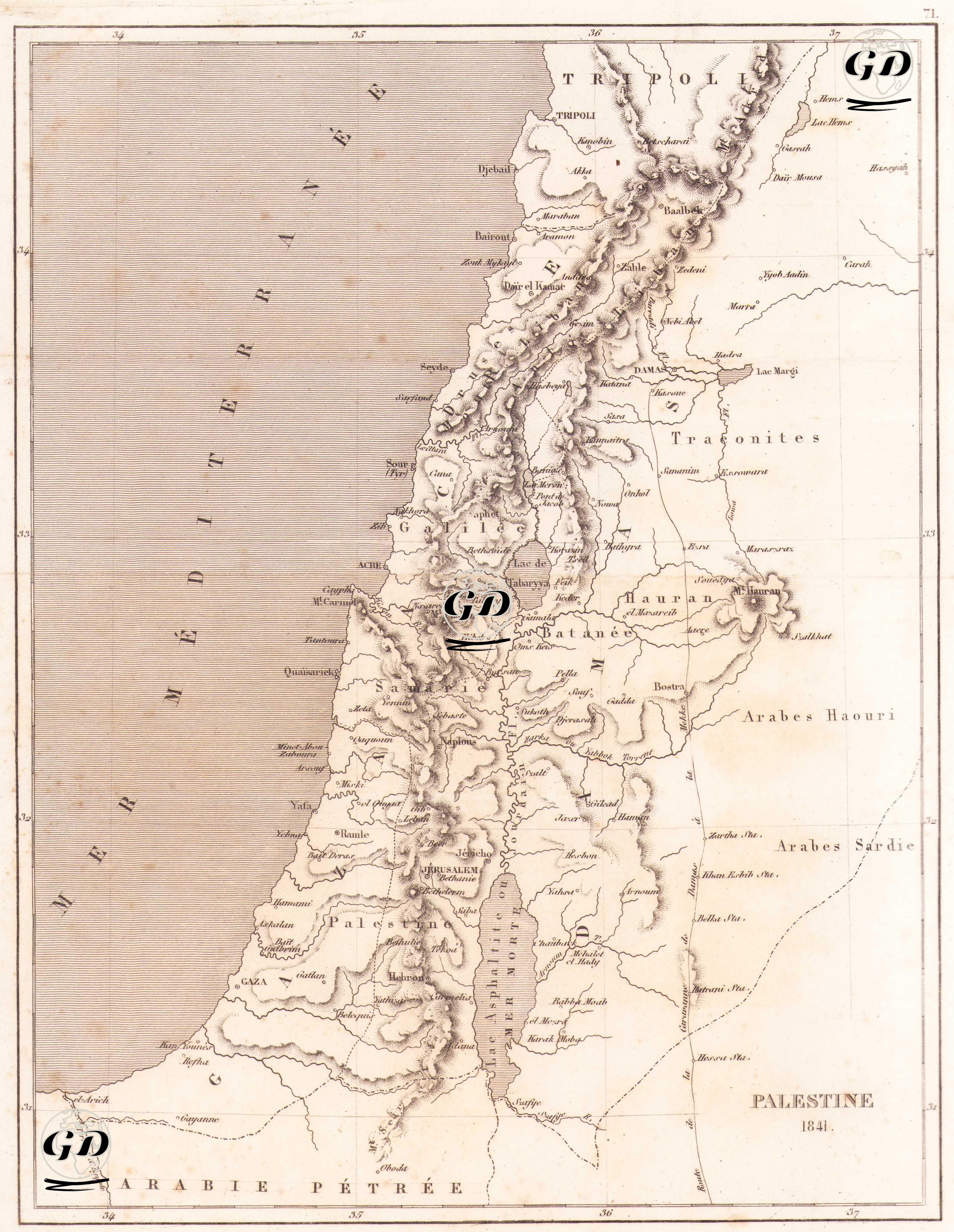
| Artist | Salomon Munk (1803-1867) |
| Date | 1845 |
| Technique | Copper Engraving |
| Category | Maps |
| Source | Palestine, Description Geographique, Historique et Archeologique par Salomon Munk - Firmin Didot Freres (Paris) |
This map shows the geographical and historical structure of the Holy Land under the title of “Palestine 1841" in detail. The map, prepared in French, depicts the region of Palestine in the context of ancient times, and offers a topography that highlights important religious and historical cities as well as natural elements. The western border of the map is drawn by the Mediterranean Sea (Mer Méditerranée), while the eastern border indicates regions where Arab tribes such as Arabes Haouri and Arabes Sardie lived. The region known as “Arabie Pétrée” (Rock Arabia) is located in the south, while Tripoli and the Antilibano Mountains are seen in the north. The cities featured on the map include Jerusalem, Gaza, Jaffa, Naplouse, Nazareth, Acre, Safed, Tiberias, Jericho, and Ramla. In addition, the Dead Sea (Mer Morte) along the Jordan River is clearly shown; the western shore of the lake extends to the Judean Mountains, while the eastern shore features Arab settlements and desert areas. Ancient tribal areas, mountain ranges, rivers and valleys are also depicted topographically in relief. The map is important for biblical geography and 19th-century Christian theology because it shows detailed place names and geographic reference points from both the Old and New Testaments. The stylistic and visual language of the map reflects the engraving techniques typical of the period, while the lined borders and shaded topographic features make it easy to distinguish both political and natural boundaries.