GRAVÜR DÜNYASI
Digital Engraving Library
| Artist | Salomon Munk (1803-1867) |
| Date | 1845 |
| Technique | Copper Engraving |
| Category | Maps |
| Source | Palestine, Description Geographique, Historique et Archeologique par Salomon Munk - Firmin Didot Freres (Paris) |
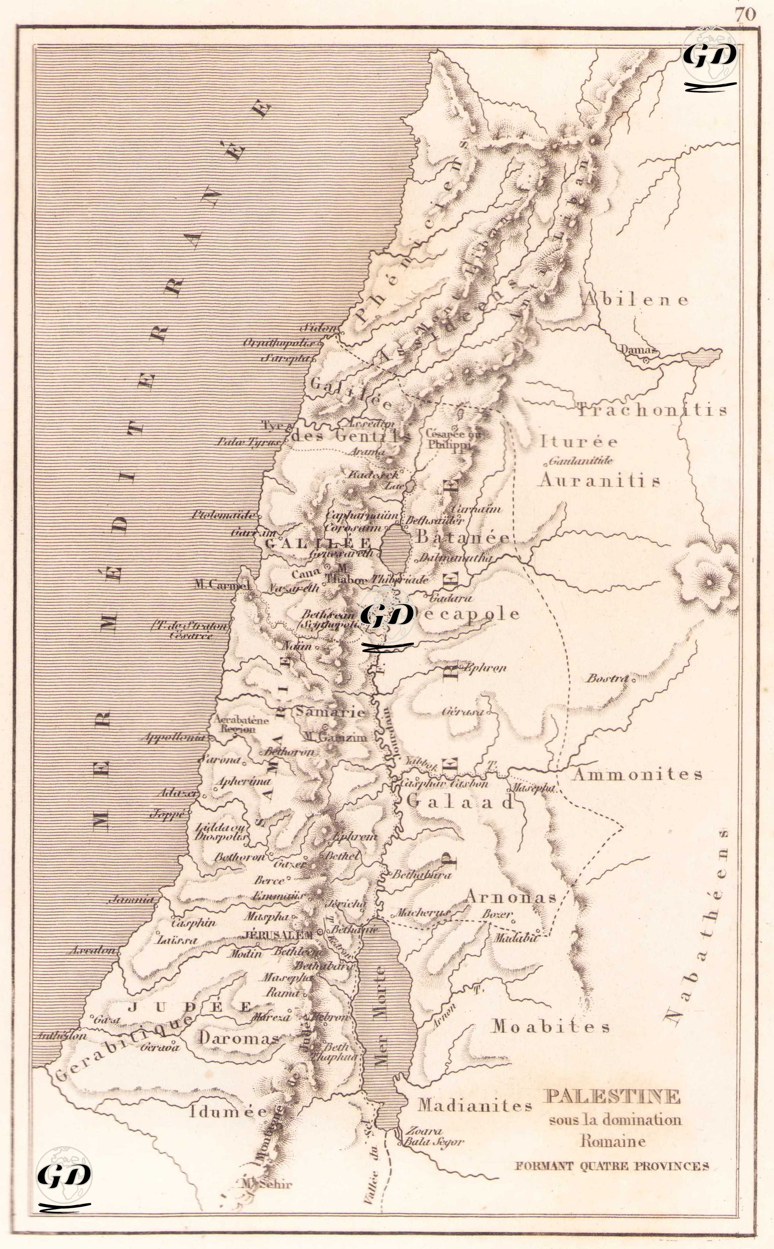
This map, entitled "Palestine sous la domination Romaine formant quatre provinces" (Palestine under Roman rule - four provinces), shows the territory of Palestine during the Roman Empire divided into four main regions: Judea, Samaria, Galilee and Pérée (East Bank / Transjordan). This engraving, prepared in French, depicts the geographic and administrative structure of the Holy Land under Roman rule in ancient times. The map clearly shows the Mediterranean Sea (Mer Méditerranée) to the west and the Jordan and the Dead Sea (Mer Morte) to the east, with cities and districts labeled in detail. Important cities include Jerusalem, Nazareth, Bethlehem, Jericho, Capharnaum, Bethsaïda, Joppe, Tyr, Sidon and Damascus, which were both religious and political centers. In the eastern part, some independent or semi-independent regions directly related to the Roman Empire are also shown on the map: for example, the names of tribes or regions frequently mentioned in the Bible, such as Auranitis, Iturée, Trachonitis, Galaad, Arnona and Moabites. In addition, Decapole (Ten Cities) refers to the Hellenistic city union in the eastern border region of Rome, and in this context, the Roman-Hellenistic cultural influence of the region is also reflected. The map has been used in both theological and archaeological studies to visualize the administrative structure of the Biblical geography in the Roman period. Mountains, valleys and rivers are given in topographic relief, and the borders are distinguished by dotted lines.