GRAVÜR DÜNYASI
Digital Engraving Library
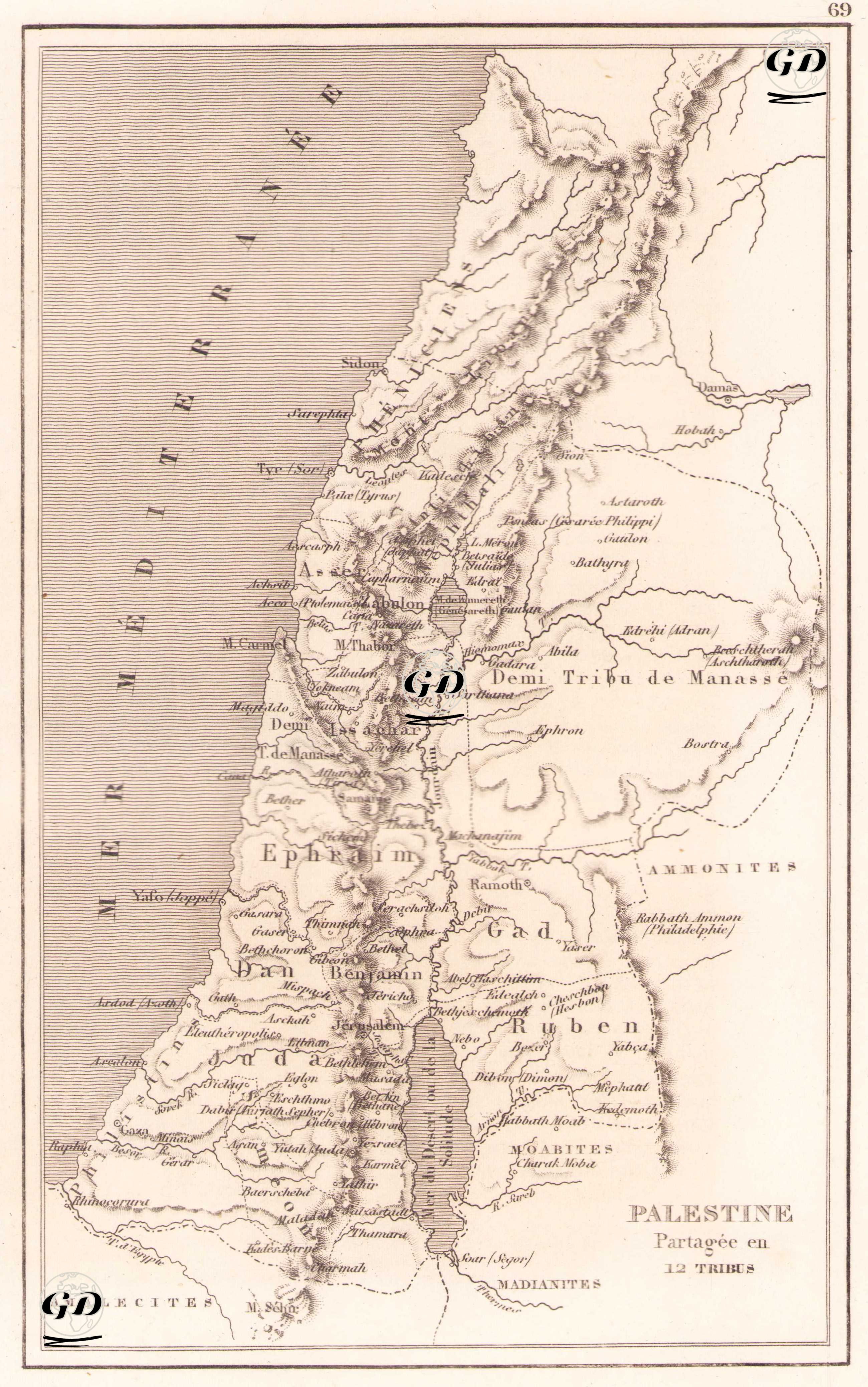
| Artist | Salomon Munk (1803-1867) |
| Date | 1845 |
| Technique | Copper Engraving |
| Category | Maps |
| Source | Palestine, Description Geographique, Historique et Archeologique par Salomon Munk - Firmin Didot Freres (Paris) |
This map is titled “Palestine Partagée en 12 Tribus” (Palestine Divided into 12 Tribes) and is a classic map of ancient Palestine based on biblical geography. The historical-geographical references are based on contemporary interpretations of the sacred texts. The map shows the Holy Land divided into 12 tribes of Israel (Dan, Benjamin, Ephraim, Manassé, Juda, Reuben, Gad, etc.). This French-language engraving provides detailed information on the settlement areas of the ancient Israelite tribes described in the Bible, both on the western and eastern sides. Important cities on the map include Jericho, Jérusalem, Nazareth, Bethlehem, Hebron, Jaffa, Gaza, and Tyre. In the west, the “Mer Méditerranée” (Mediterranean Sea) and in the east, tribal lands along the Jordan River can be observed. The “Mer Morte” (Dead Sea) is shown in detail and its surroundings are associated with the Reubenites, Moabites and Madianites. Similarly, in the northeast of the map, the lands of the eastern peoples mentioned in the Bible, such as the “Ammonites” and “Hobah” and “Damas”, are also located. Tribal boundaries are marked with dotted lines, and mountain ranges (e.g. Mount Carmel, M. Thabor) are indicated on the map with relief shading.