GRAVÜR DÜNYASI
Digital Engraving Library
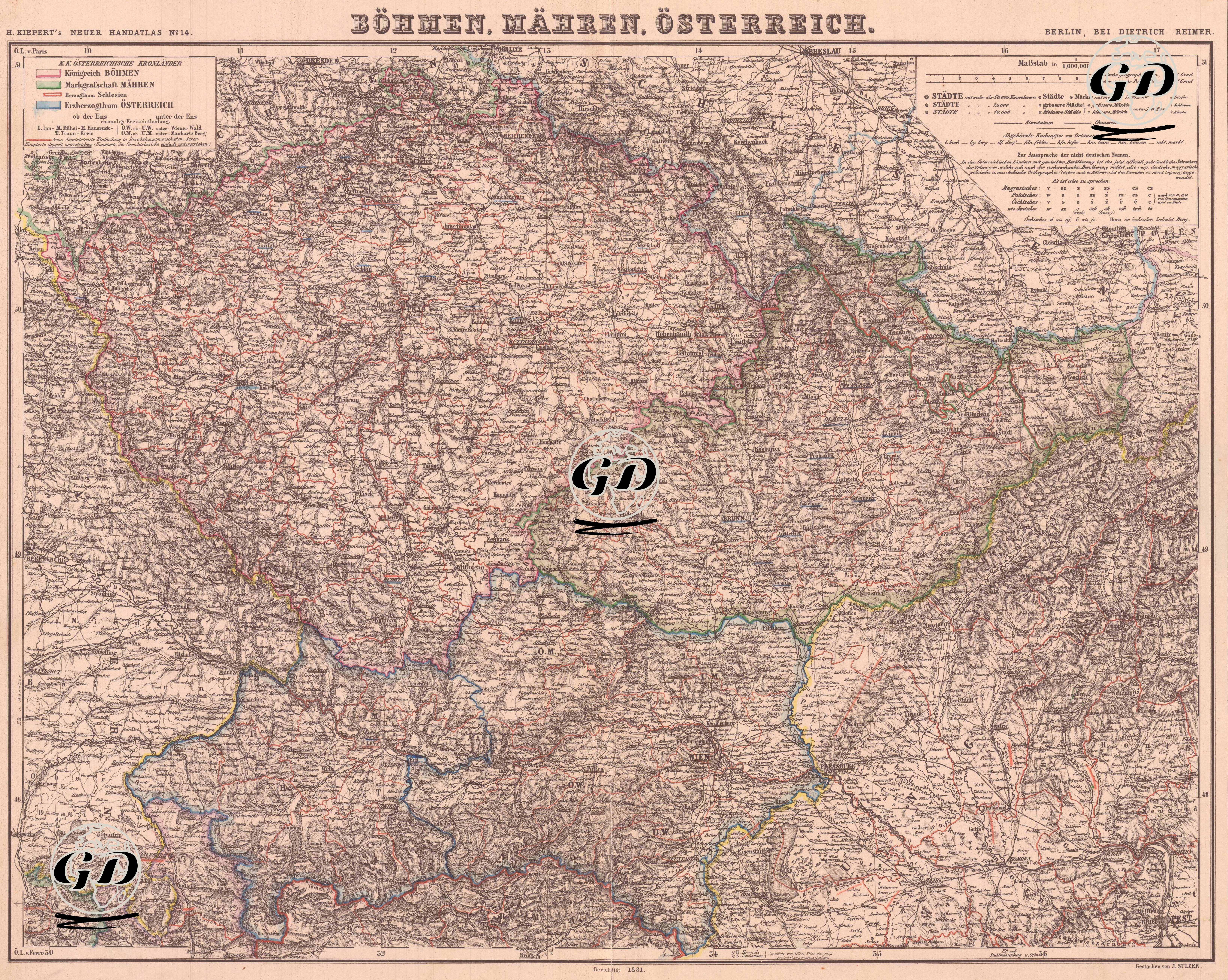
| Artist | Heinrich Kiepert (1818-1899) |
| Date | 1881 |
| Technique | Lithography-Colored |
| Category | Maps |
| Source | H. Keipert's Neuer Hand-Atlas No. 14, Verlag von Dietrich Reimer, Berlin |
This map is page 14 of Heinrich Kiepert's "Neuer Handatlas" and was published by the Dietrich Reimer publishing house in Berlin towards the end of the 19th century. Titled "Böhmen, Mähren, Österreich", this detailed cartographic work covers three important regions of the ): Royal Bohemia (Böhmen), the Moravian Markage (Mähren) and the regions corresponding to the western border of Austria (Österreich). The colored border drawings on the map are used to separate the administrative borders of these three historical regions, and the legend in the upper corner indicates which region these colors correspond to. The Bohemia region is an area covering the western and central parts of today's Czech Republic, including important centers such as Prague (Praha). Moravia is located in the east and is known for cities such as Brno. The southern part of the map also shows the northern borders of the Lower and Upper Austria regions.The map also provides detailed information on mountain ranges, river systems and transport routes; the Moldau (Vltava), Elbe (Labe) and March (Morava) rivers are particularly prominent on the map. Cities are marked with different symbols according to their size, and are ranked by population density and regional importance. Bohemia, with its particularly intense industrial and mining activities, was one of the most economically developed parts of the Habsburg Empire in the 19th century.