GRAVÜR DÜNYASI
Digital Engraving Library
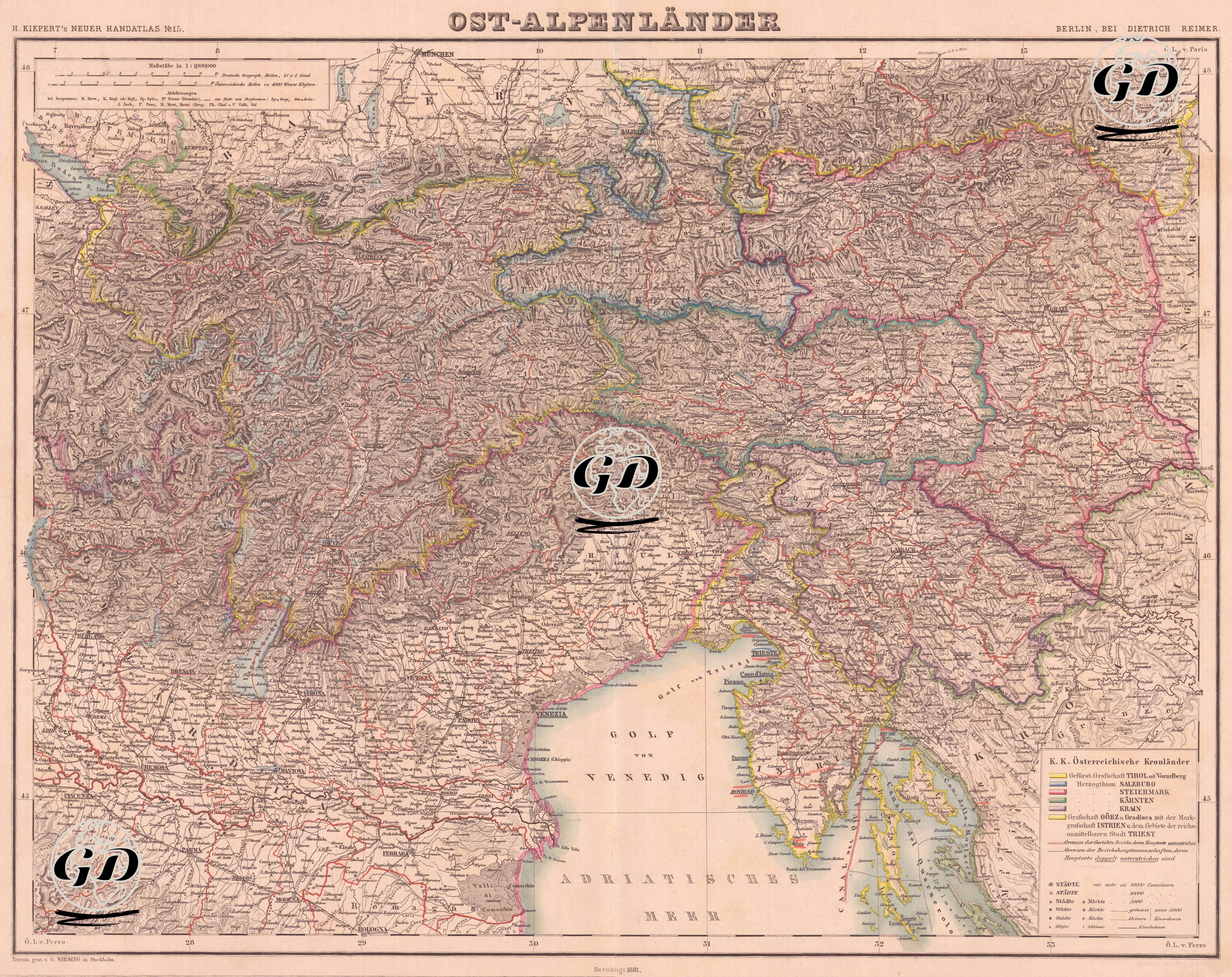
| Artist | Heinrich Kiepert (1818-1899) |
| Date | 1881 |
| Technique | Lithography-Colored |
| Category | Maps |
| Source | H. Keipert's Neuer Hand-Atlas No. 15, Verlag von Dietrich Reimer, Berlin |
This map is page number 15 of Heinrich Kiepert’s “Neuer Handatlas”, published by the Dietrich Reimer publishing house in Berlin in the second half of the 19th century, and is titled “Ost-Alpenländer” or “Eastern Alpine Regions”. The map depicts the eastern part of the Austro-Hungarian Empire, corresponding to the Alpine geography, in detail. When viewed according to today’s geography, the map covers southern Bavaria and most of Austria to the north, western Hungary to the east, all of Slovenia to the south, and northeastern Italy (especially the Gulf of Venice and the Friuli region). The northern shores of the Adriatic Sea, the Julian and Carnian Alps, important river systems (especially the Drau/Drava and Mur/Mura), and transportation lines are detailed. The colored legend in the lower right corner of the map classifies the royal provinces of the Austrian Empire and distinguishes these regions with color codes. Tyrol and Vorarlberg are shown in yellow, Styria in blue, Carinthia in red, Krain in purple, Salzburg in green and Görz-Gradiska and Ilyrien in other colours. The border lines on the map reflect both political-administrative distinctions and topographic details, while cities are classified with symbols according to their size. Centers such as Graz, Klagenfurt, Ljubljana (Laibach), Trieste, Innsbruck are among the prominent cities.