GRAVÜR DÜNYASI
Digital Engraving Library
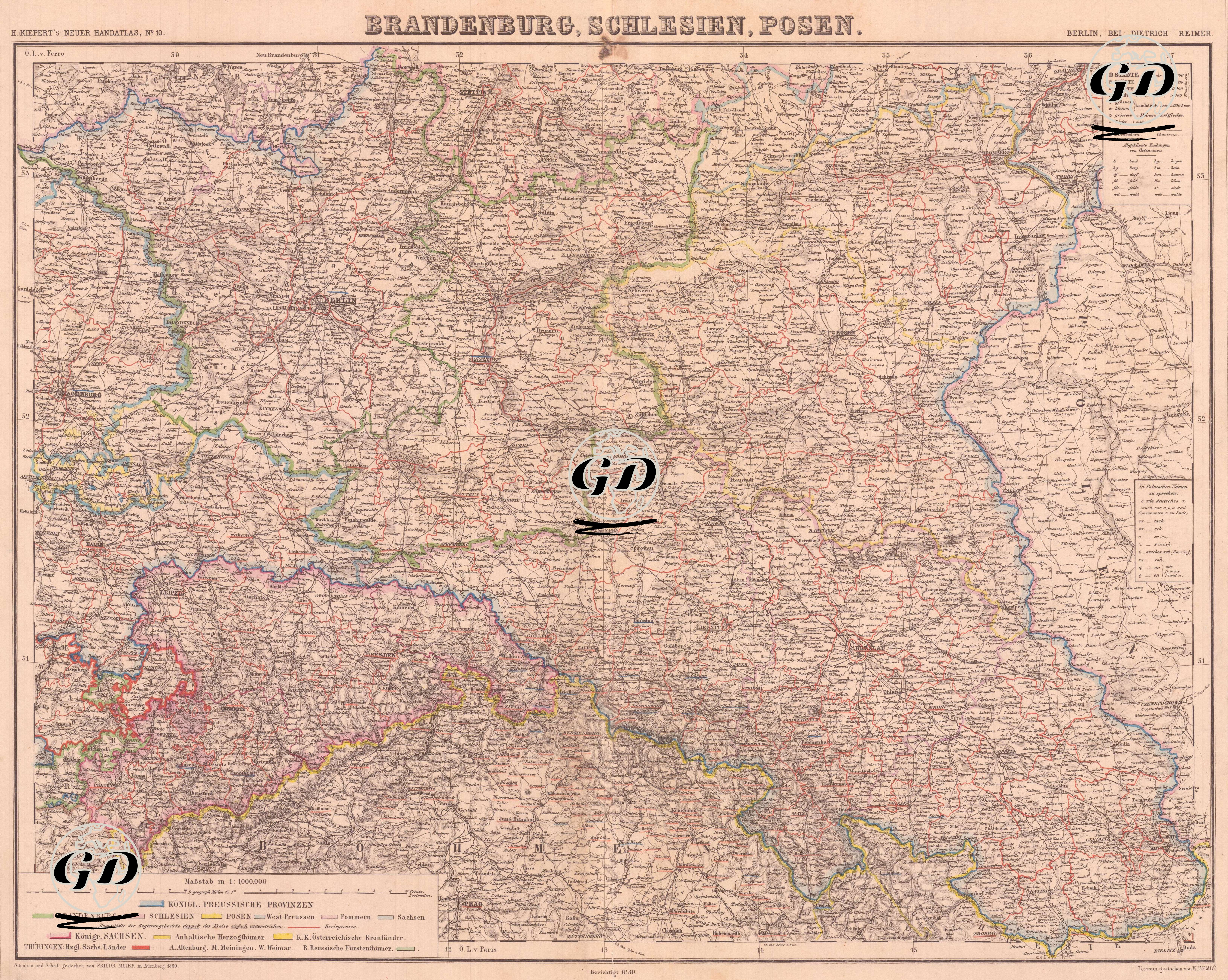
| Artist | Heinrich Kiepert (1818-1899) |
| Date | 1880 |
| Technique | Lithography-Colored |
| Category | Maps |
| Source | H. Keipert's Neuer Hand-Atlas No. 10, Verlag von Dietrich Reimer, Berlin |
This detailed map is a map of Germany covering the regions of "Brandenburg, Schlesien (Silesia) and Posen" published by the Dietrich Reimer publishing house in Berlin in the late 19th century. This work, map number 19 of the "Kiepert's Neuer Handatlas" series, shows in particular the eastern provinces of the Kingdom of Prussia in detail. Three main Prussian regions stand out on the map: Brandenburg: Located in the western part of the map, its capital was Berlin and it was the administrative center of Prussia. Schlesien (Silesia): The region in the southeast of the map, covering the southwest of today's Poland. It was an important economic center with rich coal and industrial resources. Posen: An ethnically complex region of the period, covering the area around Poznań in present-day Poland, where German and Polish were spoken together. The map separates the different provinces and duchies with colored border lines; important cities, rivers (especially the Oder and Spree), railways and roads are also shown in detail. While important cities such as Berlin, Breslau (today's Wrocław), Posen (Poznań) stand out, small states on the border of Thuringia and the eastern parts of the Kingdom of Saxony are also defined on the map. The symbol key (Erklärung) in the upper right corner explains information such as the size of cities, postal routes and railways. At the bottom are the colour codes used to distinguish between different state structures (Prussia, Saxony, Austrian imperial districts, etc.).