GRAVÜR DÜNYASI
Digital Engraving Library
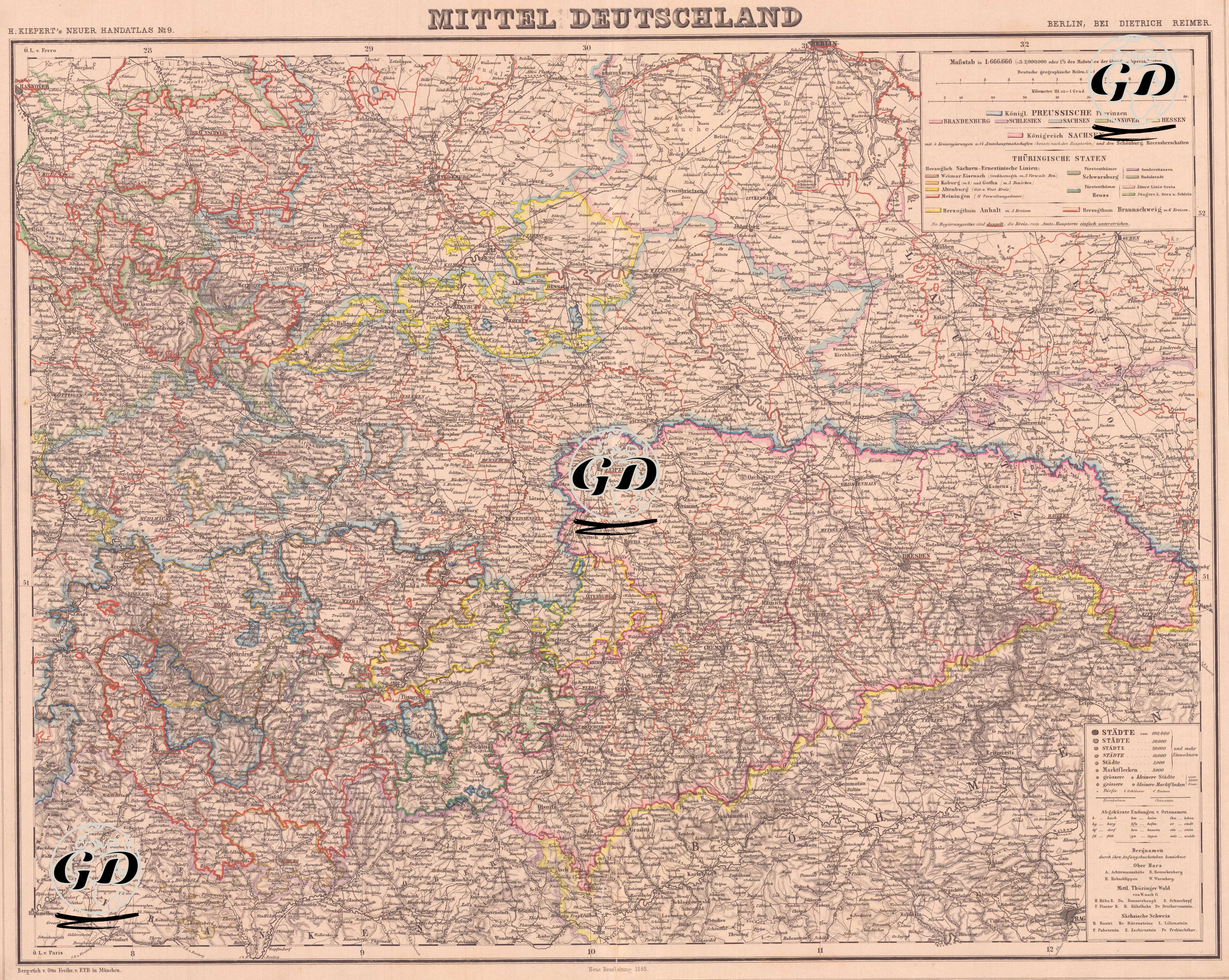
| Artist | Heinrich Kiepert (1818-1899) |
| Date | 1885 |
| Technique | Lithography-Colored |
| Category | Maps |
| Source | H. Keipert's Neuer Hand-Atlas No. 9, Verlag von Dietrich Reimer, Berlin |
This detailed map is the "Mittel Deutschland" or Central Germany map published by Dietrich Reimer in Berlin in the late 19th century. The map shows the political and administrative structures in Central Germany that took shape after the dissolution of the German Confederation and the establishment of the German Empire after 1866. The map distinguishes the states of the Kingdom of Prussia, the Kingdom of Saxony, the Duchies of Hesse, Thuringia, the northern regions of Bavaria, Anhalt, Reuss, Schwarzburg, Schaumburg-Lippe, and many smaller German states and dynasties with colored borders. Cities are shown with different symbols according to their size; the cultural and political centers of the period such as Leipzig, Dresden, Kassel, Erfurt, Weimar, Jena, Halle, and Coburg are highlighted. There is a color key (Legende) in the upper right corner of the map, and various political structures (kingdoms, duchies, grand duchies, principalities) are indicated with different colored borders. The map reflects in detail the complex feudal structure of Germany before its political unification in the late 19th century, and is an important document in understanding the process of German unification. In addition, the mountainous structure of the region, river systems (especially the Elbe, Main and Weser) and transportation routes are shown in topographical detail.