GRAVÜR DÜNYASI
Digital Engraving Library
| Date | 1895 |
| Technique | Chromolithograph |
| Category | Maps |
| Source | Meyers Konversations-Lexikon, 5. Auflage, Bibliographisches Institut, Leipzig |
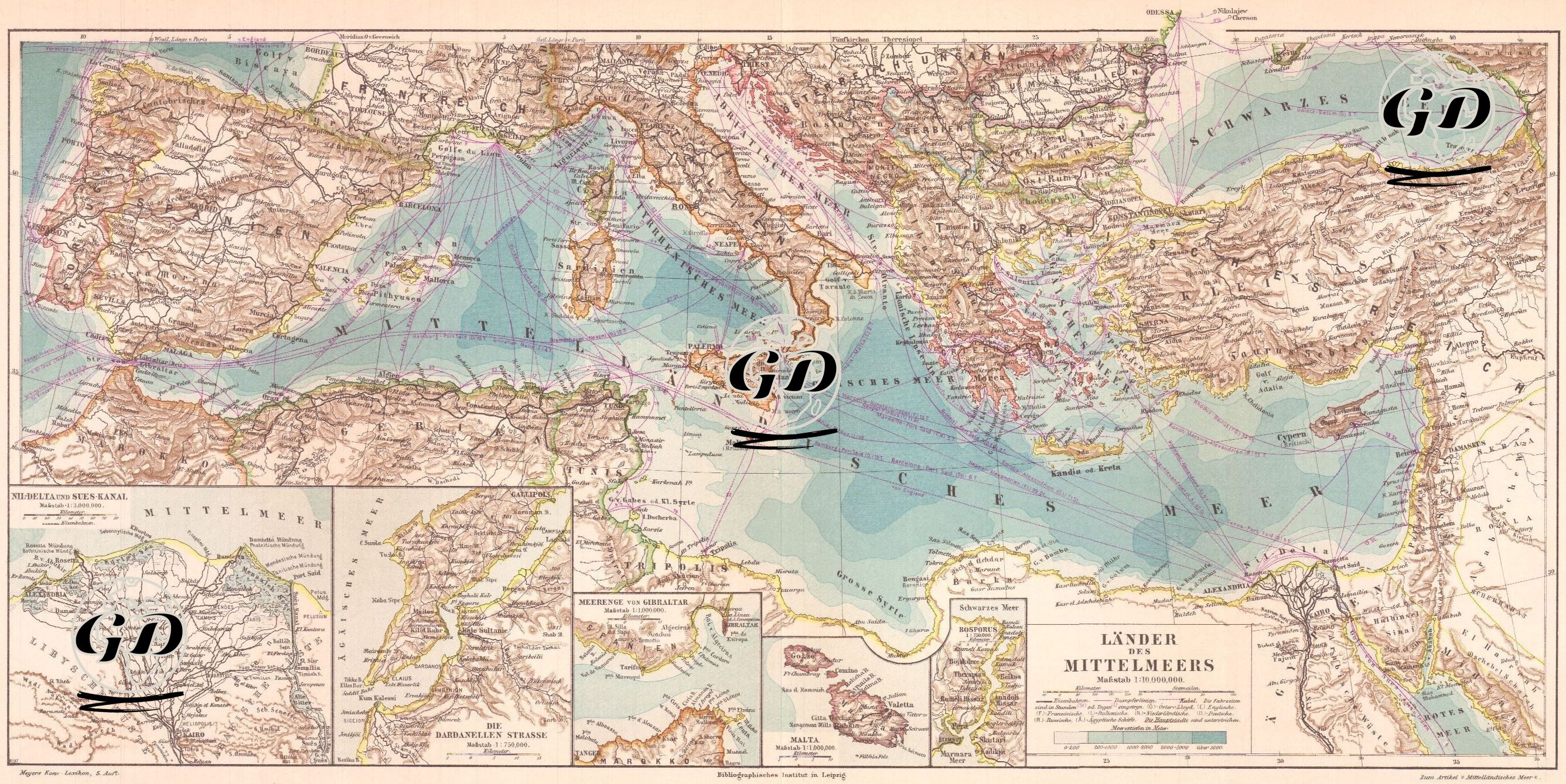
This colorful and detailed map is a 1:19,000,000 scale geopolitical map from a German source published at the end of the 19th century showing the Mediterranean countries and the strategic sea routes around them. The map shows in detail the steamship routes and trade routes connecting the various port cities of the Mediterranean. The colored lines clearly show the density and direction of maritime transportation. The regions that are critical to the maritime security of both the British Empire and the Ottoman Empire are shown in detail on small maps.